
Image: Wasatch Plateau

Size of this preview: 800 × 308 pixels. Other resolutions: 320 × 123 pixels | 1,146 × 441 pixels.
Original image (1,146 × 441 pixels, file size: 47 KB, MIME type: image/png)
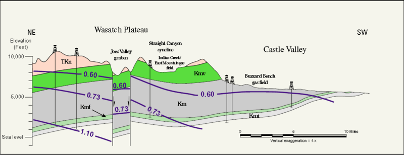
Description: Wasatch Plateau, where Kmt and Kmf are the Tununk and Ferron Sandstone members of the Mancos Shale, Km. Kmv is the Mesaverde Group and Tkn is the North Horn Formation
Title: Wasatch Plateau
Credit: The Uinta-Piceance Province - Introduction to a geologic assessment of undiscovered oil and gas resources, USGS Digital Data Series DDS-69-B
Author: USGS Uinta-Piceance Assessment Team
Usage Terms: Public domain
License: Public domain
Attribution Required?: No
Image usage
The following 2 pages link to this image:

All content from Kiddle encyclopedia articles (including the article images and facts) can be freely used under Attribution-ShareAlike license, unless stated otherwise.