
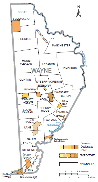
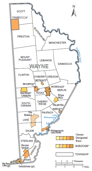
Image: Wayne County, Pennsylvania, Municipalities and CDPs
Size of this preview: 323 × 598 pixels. Other resolutions: 129 × 240 pixels | 345 × 639 pixels.
Original image (345 × 639 pixels, file size: 76 KB, MIME type: image/png)
Description: A map of Wayne County, Pennsylvania, showing the borders of the townships, boroughs, and census-designated places contained within it, edited from the original 2010 census map. Original image included Lackawanna, Susquehanna, and Wyoming Counties, and excluded the key (which came from page 2). The north arrow and the scale have been moved.
Title: Wayne County, Pennsylvania, Municipalities and CDPs
Credit: 2010 Census Geographic Areas Reference Maps for Pennsylvania
Author: United States Census Bureau
Usage Terms: Public domain
License: Public domain
Attribution Required?: No
Image usage
The following page links to this image:

All content from Kiddle encyclopedia articles (including the article images and facts) can be freely used under Attribution-ShareAlike license, unless stated otherwise.