
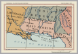
Image: West Florida Map 1767

Size of this PNG preview of this SVG file: 115 × 79 pixels. Other resolution: 320 × 220 pixels.
Original image (SVG file, nominally 115 × 79 pixels, file size: 539 KB)
Description: Cropped from the map 'The British Colonies in North America, 1763-1775' from the Historical Atlas by William Shepherd (1911) - available from the Perry-Castañeda Library Map Collection [1].
Title: West Florida Map 1767
Credit: Own work
Author: Rattyrattery
Usage Terms: Creative Commons Zero, Public Domain Dedication
License: CC0
License Link: http://creativecommons.org/publicdomain/zero/1.0/deed.en
Attribution Required?: No
Image usage
The following 6 pages link to this image:

All content from Kiddle encyclopedia articles (including the article images and facts) can be freely used under Attribution-ShareAlike license, unless stated otherwise.