
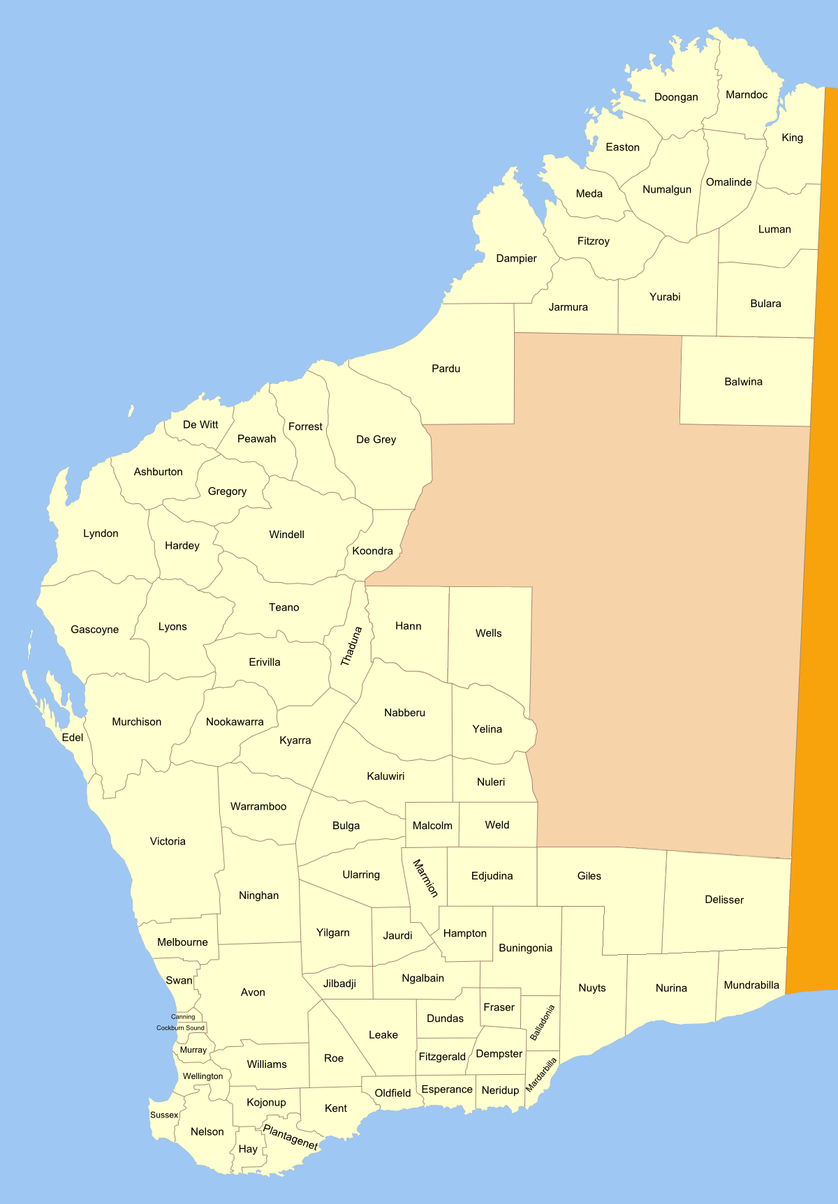
Image: Western Australia land districts
Size of this preview: 417 × 599 pixels. Other resolutions: 167 × 240 pixels | 1,200 × 1,725 pixels.
Original image (1,200 × 1,725 pixels, file size: 289 KB, MIME type: image/png)
Description: Map of land districts in Western Australia, as shown on old public domain 1909 map at the National Library. made from original svg See also: blank map for making locator maps
Title: Western Australia land districts
Credit: No machine-readable source provided. Own work assumed (based on copyright claims).
Author: No machine-readable author provided. Roke~commonswiki assumed (based on copyright claims).
Usage Terms: Creative Commons Attribution-Share Alike 3.0
License: CC-BY-SA-3.0
License Link: http://creativecommons.org/licenses/by-sa/3.0/
Attribution Required?: Yes
Image usage
The following 3 pages link to this image:

All content from Kiddle encyclopedia articles (including the article images and facts) can be freely used under Attribution-ShareAlike license, unless stated otherwise.