
Image: Wildfire spreads in Fort McMurray
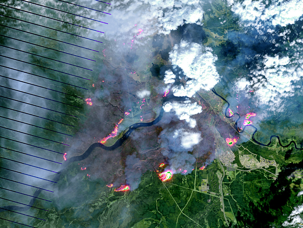
Description: On May 4, 2016, the the Enhanced Thematic Mapper Plus (ETM+) on the Landsat 7 satellite acquired this false-color image of the wildfire that burned through Fort McMurray in Alberta, Canada. The image combines shortwave infrared, near infrared, and green light (bands 5-4-2). Near- and short-wave infrared help penetrate clouds and smoke to reveal the hot spots associated with active fires, which appear red. Smoke appears white and burned areas appear brown.
Title: Wildfire spreads in Fort McMurray
Credit: Cropped from mcmurray_etm_2016125_swir_lrg.jpg on http://visibleearth.nasa.gov/view.php?id=87988
Author: NASA Earth Observatory image by Joshua Stevens, using Landsat data from the U.S. Geological Survey. Caption by Kathryn Hansen
Usage Terms: Public domain
License: Public domain
Attribution Required?: No
Image usage
The following page links to this image:
