2016 Fort McMurray wildfire facts for kids
Quick facts for kids 2016 Fort McMurray wildfireHorse River Fire |
|
|---|---|
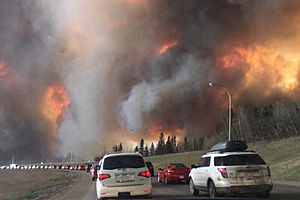
Fort McMurray residents evacuating along Highway 63 as the fire encroaches on the area
|
|
| Location | Wood Buffalo, Alberta Northern Saskatchewan Canada |
| Coordinates | 56°39′55″N 111°23′00″W / 56.66528°N 111.38333°W |
| Statistics | |
| Cost | $9.9 billion (direct and indirect costs) |
| Date(s) | August 2, 2017 Evacuation: May 3 – June 1, 2016 Provincial state of emergency: May 4 – July 1, 2016 |
| Burned area | 589,552 ha (1,456,810 acres) |
| Land use | Boreal forest, Residential, Oil Sands |
| Buildings destroyed | 3,244 |
| Deaths | 0 (direct) 2 (indirect) |
| Non-fatal injuries | 0 |
| Map | |
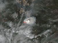
In May 2016, a huge wildfire started southwest of Fort McMurray, Alberta, Canada. On May 3, the fire quickly moved into the community. This forced the largest wildfire evacuation in Alberta's history, with over 88,000 people having to leave their homes.
Firefighters got help from the Canadian Armed Forces, the Royal Canadian Mounted Police, and other Canadian provinces. Many governments and groups like the Canadian Red Cross also helped people who had to leave their homes.
The wildfire destroyed about 2,400 homes and buildings in Fort McMurray. Another 2,000 people had to move because their homes were unsafe due to smoke and ash. The fire kept spreading across northern Alberta and even into Saskatchewan. It burned large forest areas and affected oil operations. With an estimated cost of C$9.9 billion, it became the most expensive disaster in Canadian history.
The fire burned about 590,000 hectares (1.46 million acres) before it was brought under control on July 5, 2016. It continued to smoulder (burn slowly) until it was fully put out on August 2, 2017. Experts believe the fire was started by humans in a remote area about 15 km (9 mi) from Fort McMurray, but the exact cause is still unknown.
Contents
How the Fire Started and Spread
What Caused the Fire?
A helicopter forestry crew first saw the fire on May 1, 2016, about 15 km (9 mi) from Fort McMurray. They reported it, and firefighters arrived quickly. The official cause of the fire is still not known, but it is thought to have been started by people.
Why the Fire Grew So Fast
When the fire started, northern Alberta had very hot and dry weather. Fort McMurray saw record-high temperatures. On May 3, the temperature reached 32.8°C (91°F), with very low humidity (only 12%). This made the air very dry.
The situation got worse on May 4. Temperatures were still high at 31.9°C (89°F), and strong winds blew up to 72 km/h (45 mph). A natural weather pattern called El Niño also caused a dry fall and winter, with very little snow. This snow melted quickly in the warm spring. All these conditions together created a "perfect storm" for a huge wildfire, helping it grow very fast.
Some people also discussed if climate change played a part in the fire's start and spread. While individual fires cannot be directly linked to climate change, scientists agree that climate change can lead to more intense wildfires overall.
The Fire Reaches Fort McMurray
As the fire moved closer to Fort McMurray, a local state of emergency was declared on May 1. Some areas were ordered to evacuate right away. By May 3, the mandatory evacuation order was expanded to all of Fort McMurray. By May 4, nearby communities like Anzac, Gregoire Lake Estates, and Fort McMurray First Nation also had to evacuate.
About 88,000 people were safely evacuated. Sadly, two people died in a car crash during the evacuation, one of whom was a firefighter's daughter. Even with the evacuation order, staff at the water treatment plant stayed behind to make sure firefighters had water.
On May 4, officials reported that the communities of Beacon Hill, Abasand, and Waterways had suffered "serious loss." The Government of Alberta declared a provincial state of emergency. About 1,600 buildings were destroyed, and 10,000 hectares (24,700 acres) of land had burned.
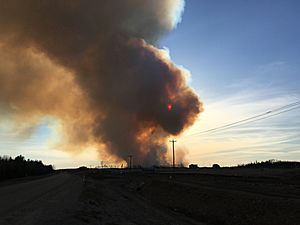
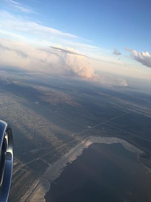
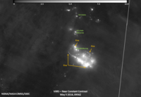
The fire crossed Highway 63, which is a main road, and threatened the international airport. The fire was so big and hot that it created its own weather, including lightning and special clouds called pyrocumulus clouds. This made the risk of more fires even higher.
The fire kept spreading south on May 5, burning about 85,000 hectares (210,000 acres). This forced more evacuations in communities that had already taken in thousands of people. The Royal Canadian Air Force and energy companies helped airlift about 8,000 people who had evacuated north to oil camps. Over 1,100 firefighters, 145 helicopters, and 22 air tankers worked to fight the fire.
On May 6, the Royal Canadian Mounted Police helped move 1,500 vehicles from oil camps north of Fort McMurray, south along Highway 63 to Edmonton. The fire continued to grow, reaching 100,000 hectares (247,000 acres) by May 6, and 200,000 hectares (494,000 acres) by May 7. As the fire moved northeast, the community of Fort McKay, which was hosting evacuees, also received an evacuation notice. Officials expected the fire to double in size and reach the Saskatchewan border.
Controlling and Putting Out the Fire
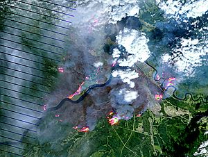
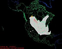
The wildfire kept spreading through remote forest areas in the following week. It reached oil sands work camps south of Fort MacKay, forcing about 8,000 workers to evacuate from 19 oil sites. One large lodge with 665 rooms was destroyed. The fire grew from 285,000 hectares (704,000 acres) on May 16 to 504,443 hectares (1.25 million acres) by May 21. It even spread into Saskatchewan.
Even though the fire moved away from Fort McMurray, two explosions and poor air quality kept residents from returning. By mid-June, rain and cooler temperatures helped firefighters contain the fire. On July 4, 2016, the fire was declared under control. However, it continued to smoulder deep in the moss and dirt throughout the winter.
Finally, on August 2, 2017, after no more hot spots were found, officials declared the wildfire fully extinguished.
Impacts of the Wildfire
| Name | # |
|---|---|
| Airport | 4 |
| Abasand | 1,168 |
| Anzac | 12 |
| Beacon Hill | 476 |
| Blacksand Lodge | 665 |
| Draper | 13 |
| Gregoire | 4 |
| Lower Townsite | 1 |
| Parsons Creek | 10 |
| Prairie Creek | 1 |
| Saprae Creek | 86 |
| Thickwood | 187 |
| Timberlea | 379 |
| Waterways | 238 |
| Total | 3,244 |
Damage to Communities and Buildings
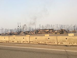
At first, it was thought that 1,600 buildings in Fort McMurray were destroyed. Firefighters worked hard to protect the downtown area and other homes. By May 9, this number was updated to 2,400 structures destroyed. However, about 85% to 90% of the community was not damaged. Later, two explosions in May damaged 10 buildings and destroyed three more.
The town's power system was also damaged. Most of Fort McMurray was put under a boil-water advisory because untreated water was used to help firefighters. This advisory was lifted on August 17, 2016.
The neighbourhoods of Waterways, Abasand, and Beacon Hill were hit the hardest. They were unsafe for people to return to because of contamination from arsenic and heavy metals in the ash. Residents could only visit their homes with supervision and relied on help from groups like Team Rubicon to sort through their belongings. By the end of October 2016, residents in these areas could finally move back home.
Effect on Oil Sands Operations
The wildfire caused oil sands companies north of Fort McMurray to stop production. Companies like Shell Canada, Suncor Energy, and Syncrude Canada had to shut down or reduce their operations. They focused on getting their employees and families to safety. Many companies also offered their work camps to house evacuees.
About one million barrels of oil production per day, which is a quarter of Canada's total oil output, was stopped in May 2016. This continued into June. This loss of oil production cost the Albertan economy about $70 million each day and contributed to higher global oil prices. Oil companies later restarted production, and the financial effects mostly ended by the fall of 2016.
Costs of the Disaster
Initial estimates for insurance payouts were as high as C$9 billion if the entire community had to be rebuilt. By July 7, 2016, the insured damage was estimated at $3.58 billion. This made the Fort McMurray wildfire the most expensive disaster in Canadian history. It cost more than the 1998 ice storms in Quebec ($1.9 billion) and the 2013 Alberta floods ($1.8 billion).
Returning Home and Rebuilding
On May 18, the Alberta government announced that residents could start returning to Fort McMurray between June 1 and 15, 2016. This would happen if certain conditions were met, such as the fire no longer being a threat and essential services being back up.
Residents were allowed to return to Fort McMurray in phases, based on which zone they lived in.
The neighbourhoods of Waterways, Abasand, and Beacon Hill were very badly burned. They were declared unsafe for people to live in because of contamination from arsenic and heavy metals in the ash. Residents in these 2,000 homes could only visit their properties with supervision. They relied on workers from the non-profit organization Team Rubicon to help them search through their belongings. Between August 31 and October 24, 2016, residents of 470 homes in these three areas were able to move back.
After the wildfire, the Regional Municipality of Wood Buffalo created a recovery plan. The total funding for recovery was estimated to be over $4.5 billion. This included money from federal, provincial, and local governments, the Canadian Red Cross, and insurance companies. By January 2018, most insurance claims had been processed.
Rebuilding the affected communities is still ongoing. As of May 2018, 20% of the destroyed homes had been rebuilt. The Regional Municipality of Wood Buffalo also updated its Wildfire Mitigation Strategy in January 2018. This plan looks at wildfire risks and suggests clearing vegetation, improving safety standards for new buildings, educating the public about fire threats, and updating emergency plans. They also encouraged people to rebuild homes that are more resistant to fire.
See also
 In Spanish: Incendio forestal de Fort McMurray para niños
 | George Robert Carruthers |
 | Patricia Bath |
 | Jan Ernst Matzeliger |
 | Alexander Miles |


