
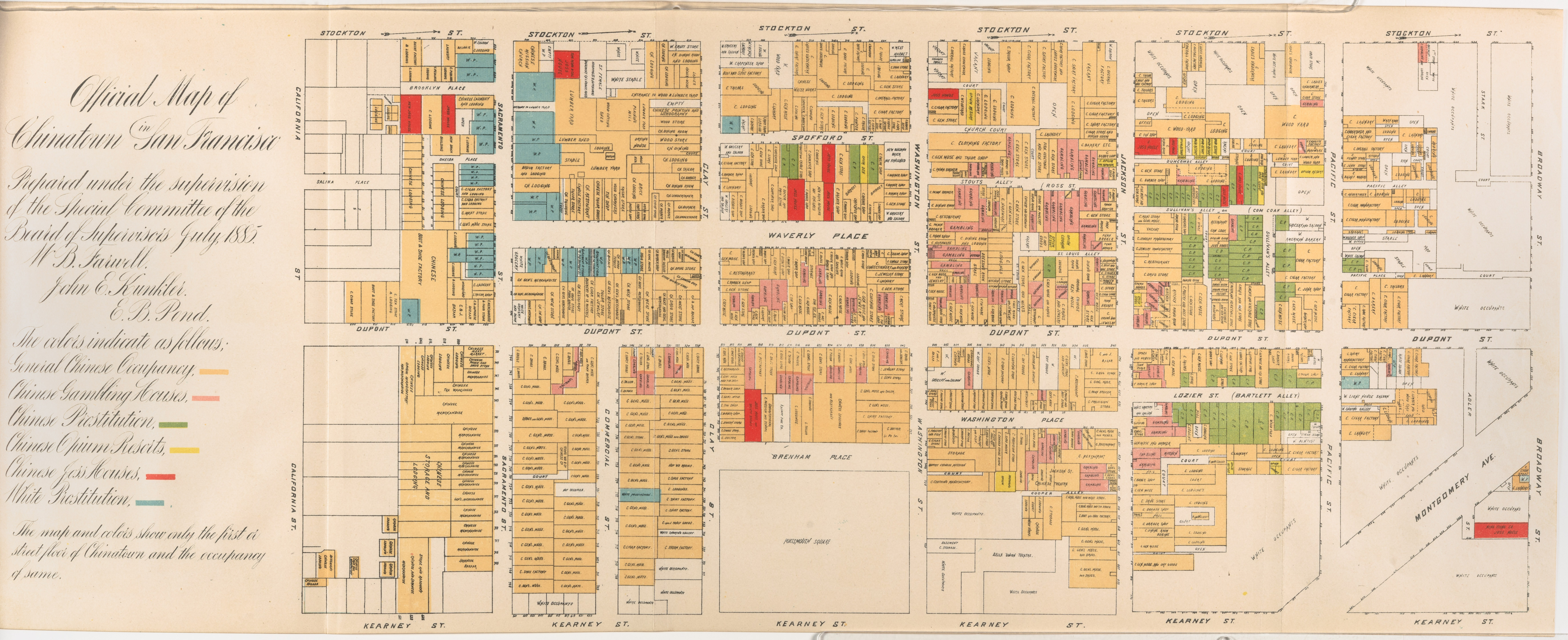
Image: Willard B. Farwell, Official Map of Chinatown 1885, Cornell CUL PJM 1093 01
Size of this preview: 800 × 326 pixels. Other resolutions: 320 × 131 pixels | 7,054 × 2,878 pixels.
Original image (7,054 × 2,878 pixels, file size: 3.58 MB, MIME type: image/jpeg)
Description: This map mirrors the bias against the Chinese in California. It was published as part of an official report of a Special Committee established by the San Francisco Board of Supervisors "on the Condition of the Chinese Quarter".
Title: Official Map of Chinatown Full TItle: Official map of Chinatown in San Francisco : prepared under the supervision of the special committee of the Board of Supervisors. July 1885.
Credit: Cornell University: Persuasive Cartography: The PJ Mode Collection
Author: Willard B. Farwell
Usage Terms: Public domain
License: Public domain
Attribution Required?: No
Image usage
The following page links to this image:

All content from Kiddle encyclopedia articles (including the article images and facts) can be freely used under Attribution-ShareAlike license, unless stated otherwise.