
Image: Yakima Fold Belt map
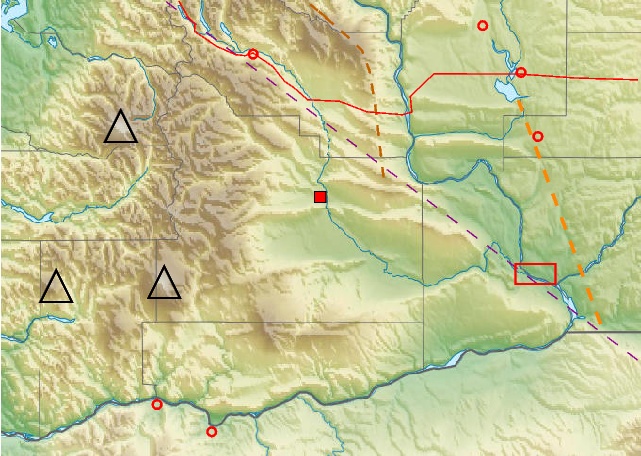
Description: Shaded-relief map showing ridges of the w:Yakima Fold Belt of south-central Washington, mostly between w:Interstate 90 (red line) and the Columbia River (bottom). Red square in center is the w:City of Yakima, red rectangle at lower right is the w:Tri-Cities, triangles are the w:Mount Rainier, w:Mount Saint Helens, and w:Mount Adams volcanoes of the Southern Washington Cascades. Yellow line marks the approximate location of the w:Olympic-Wallowa Lineament (OWL), crossing the Columbia River at the w:Wallula Gap (lower-right). Orange line is approximate location of edge of the North American craton.
Title: Yakima Fold Belt map
Credit: Own work. Base map excerpted from File:USA_Washington_relief_location_map.jpg.
Author: J. Johnson
Usage Terms: Creative Commons Attribution-Share Alike 3.0
License: CC BY-SA 3.0
License Link: https://creativecommons.org/licenses/by-sa/3.0
Attribution Required?: Yes
Image usage
The following page links to this image:
