
Image: Yellow River watercourse changes en
Size of this preview: 765 × 600 pixels. Other resolutions: 306 × 240 pixels | 1,087 × 852 pixels.
Original image (1,087 × 852 pixels, file size: 251 KB, MIME type: image/png)
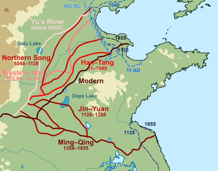
Description: An inaccurate map of historical courses of the Yellow River, ignoring major shifts during the Western Han, including decades flowing south of ShandongLegend: Modern Yellow River Ming-Qing course(1368-1855) Jin-Yuan course(1128-1368) Northern Song course(1048-1128) Eastern Han course(11-1048) Western Han course(602 BC-11 AD) Course of Yu the Great(before 602 BC) 1855 coastline 1128 coastline 1048 coastline 11 AD coastline 602 BC coastline
Author: Stevenliuyi
derivative work : Esiymbro
Usage Terms: Creative Commons Attribution-Share Alike 3.0
License: CC-BY-SA-3.0
License Link: http://creativecommons.org/licenses/by-sa/3.0/
Attribution Required?: Yes
Image usage
The following page links to this image:

All content from Kiddle encyclopedia articles (including the article images and facts) can be freely used under Attribution-ShareAlike license, unless stated otherwise.