
Image: Zimbabwe states and trade map
Size of this preview: 679 × 600 pixels. Other resolutions: 272 × 240 pixels | 1,217 × 1,075 pixels.
Original image (1,217 × 1,075 pixels, file size: 261 KB, MIME type: image/png)
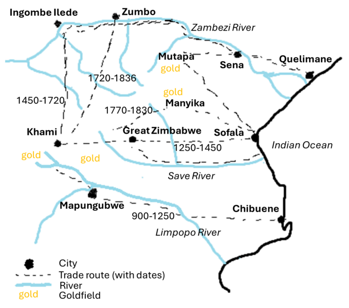
Description: A map of trade centres and routes in precolonial Zimbabwe. Using "Butua and the End of an Era" by Catrien Van Waarden (2012), page 50
Usage Terms: Public domain
Image usage
The following page links to this image:

All content from Kiddle encyclopedia articles (including the article images and facts) can be freely used under Attribution-ShareAlike license, unless stated otherwise.