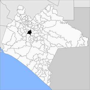
Ixtapa, Chiapas facts for kids
Quick facts for kids
Ixtapa Municipality
|
|
|---|---|

Municipality of Ixtapa in Chiapas
|
|
| Country | |
| State | Chiapas |
| Area | |
| • Total | 313 km2 (121 sq mi) |
| Population
(2010)
|
|
| • Total | 24,517 |
Ixtapa Municipality is a special area in the Mexican state of Chiapas. It is located in southern Mexico. A municipality is like a local government area, similar to a county or district. It helps manage the towns and villages within its borders.
About Ixtapa
Ixtapa Municipality covers an area of about 313 square kilometers. That's roughly the size of 31,300 football fields!
Population
In 2010, about 24,517 people lived in Ixtapa Municipality. This was an increase from 18,533 people in 2005. The number of people living there grew quite a bit in just five years.
Main Towns and Villages
The main town in the municipality is also called Ixtapa. In 2010, the town of Ixtapa had a population of 6,086 people.
Besides the main town, there are 82 other smaller communities. Many of these are rural, meaning they are in the countryside. Here are some of the largest villages:
- El Nopal (1,903 people in 2010)
- Cacate (1,225 people in 2010)
- Aztlán (Rancho Nuevo) (1,148 people in 2010)
- Concepción (1,133 people in 2010)
- El Zapotillo (1,058 people in 2010)
These villages are important parts of the Ixtapa Municipality.
See also
 In Spanish: Ixtapa (Chiapas) para niños


