Jordi Bolòs facts for kids
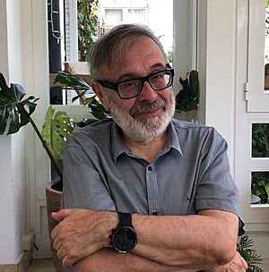
Jordi Bolòs i Masclans (born in Barcelona, 1955) is a Spanish historian and professor. He teaches Medieval History at the University of Lleida. The Middle Ages is a period in European history from about the 5th to the 15th century.
Professor Bolòs is an expert on what life was like in the region of Catalonia during this time. He studies how people lived in villages and cities, and how the land itself has changed over hundreds of years.
What Does He Study?
Jordi Bolòs focuses on a special field called landscape history. This means he looks at how the environment, farms, villages, and roads were created and changed during the Middle Ages. It's like being a detective who uses old maps, documents, and even archaeology to understand the past.
His main areas of research include:
- Rural History: Learning about life for people in the countryside, including farmers and villagers.
- Urban History: Studying the history of towns and cities, how they grew, and what jobs people had.
- The Medieval Landscape: Figuring out how the natural landscape of Catalonia was shaped by the people who lived there long ago.
Creating Historical Maps
One of the most important parts of his work is creating historical atlases. An atlas is a book of maps. His atlases show what different parts of Catalonia looked like during the Carolingian era (around the 8th to 10th centuries).
He has made detailed maps for several old territories known as counties, including:
- Besalú
- Empúries-Peralada
- Girona
- Osona
- Manresa
- Urgell
- Roussillon, Conflent, Vallespir and Fenouillèdes
These atlases help other students and historians see exactly where towns, castles, and borders were located in the Middle Ages.
See also
 In Spanish: Jordi Bolòs para niños
 | Kyle Baker |
 | Joseph Yoakum |
 | Laura Wheeler Waring |
 | Henry Ossawa Tanner |


