Kanasín facts for kids
Quick facts for kids
Kanasín
|
||
|---|---|---|
|
City
|
||

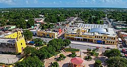
Main square of Kanasín.
|
||
|
||
| Country | ||
| State | ||
| Municipality | Kanasín Municipality | |
| City established | 1921 | |
| Elevation | 9 m (30 ft) | |
| Population
(2020)
|
||
| • Total | 139,753 | |
| • demonym | kanasinense | |
| Time zone | UTC-6 (Central Standard Time) | |
| • Summer (DST) | UTC-5 (Central Daylight Time) | |
| Postal Code |
97370
|
|
| Area code(s) | 999 | |
| INEGI Code | 041 | |
| Major Airport | Merida (Manuel Crescencio Rejón) International Airport | |
| IATA Code | MID | |
| ICAO Code | MMMD | |
| Municipalities of Yucatan | ||
Kanasín is a city in the Mexican state of Yucatán. Its name comes from a Maya word meaning "tense" or "strongly tightened." It is the main city of the Kanasín municipality.
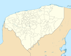
Kanasín is located in the northwestern part of Yucatán. It is part of the larger Mérida metropolitan area. In 2020, about 139,753 people lived there. This makes Kanasín the second largest city in Yucatán, after Mérida. It is also one of the biggest cities in southeastern Mexico.
Long ago, before Europeans arrived, the area of Kanasín was part of a Mayan chiefdom called Chakan. The city of Kanasín was started in the mid-1500s. This happened during the Spanish conquest when a system called encomienda was used. The city's name comes from a local plant with red flowers. Kanasín officially became a city in 2007. Today, it is an important area for industry and growth in the state.
Contents
History of Kanasín
Before the Spanish arrived, we don't know exactly which Mayan group controlled this area. After the Spanish conquest, the land became part of the encomienda system. This system meant that Spanish settlers were given control over groups of native people and their land.
One of the first people to oversee this system in Kanasín was Francisco Sosa. He was in charge of 209 native people. Later, Josefa Díaz Bolio took over, caring for 211 people. Then, Sister María Josefa was in charge of 155 people.
In 1821, Yucatán declared its independence from Spain. A few years later, in 1825, Kanasín was officially made the main town of its own municipality.
How Kanasín is Governed
Kanasín is the main city of its municipality, which is like a county. The city has a leader called a municipal president. This president is chosen by the people and serves for three years.
The city also has a town council with nine members. These members help run the city. They work on things like policing, public works, health, education, and parks.
The Municipal Council manages the city's money. They decide how money is spent and make reports about it. They also help set standards for schools each year.
Police Commissioners help keep the city safe and orderly. They make sure rules are followed and help carry out decisions made by the council.
Neighborhoods and Subdivisions
Kanasín has a street layout that mostly looks like a grid. It is made up of many different neighborhoods and subdivisions.
- Neighborhoods
- Andrés Quintana Roo
- Cecilio Chi
- Colibrí
- Croc
- Cuauhtémoc
- El Cerrito
- Flor de Mayo
- Francisco Villa Oriente
- Kanasín Centro
- Leona Vicario
- Mulchechén
- Mulchechén II
- Pedregales del Oriente
- Reparto las Granjas
- San Antonio Kaua III
- San Camilo
- San Haroldo San José Tzal
- Santa Isabel
- Xelpac
- Subdivisions
- Arboleda Kanasín
- Arecas
- Cielo Alto
- Condesa
- Coyoles
- Despertare
- El Encanto Kanasín
- Fontana I
- Girasoles
- Héctor Victoria
- Jardines de Kanasín
- Jardines de Mulchechén
- Jardines de San Pedro Noh Pat
- La Ceiba
- La Joya
- La Piedra
- Las Flores
- Las Haciendas
- Las Palmas Yucatán
- Las Palmeras
- Las Perlas
- Los Encinos
- Los Pinos de Mulchechén
- Los Robles
- Los Robles III
- Los Tulipanes
- Pablo Moreno
- Palmas San Pedro
- Pedregales de Kanasín
- Pedregales de Kanasín II
- Privada del Sol
- Puerta del Sol
- Puerta Esmeralda
- Residencial
- Rinconada Kanasín
- San Ignacio
- San José Kanasín
- Santa Ana
- Santa Cecilia
- Valle Azul
- Valle Oriente
- Valle Oriente de San Pedro Noh Pat
- Villa Bonita
- Villa Mercedes
- Villas del Oriente
- Villas Turquesa
- Vivah
Population Growth
The chart above shows how Kanasín's population has grown over the years. You can see a big increase in people living there, especially after 1980. This growth shows how Kanasín has become a more important city in Yucatán.
Local Festivals and Celebrations
Kanasín celebrates several special events throughout the year. These festivals are a great way to experience the local culture and traditions.
- 8 December: This day is a celebration to honor the Immaculate Conception.
- 29 January to 2 February: This is the Feast of the Virgin de la Candelaria. It's a time for special events and gatherings.
- March: A popular carnival takes place in March. Carnivals are usually filled with music, parades, and fun activities.
Places to Visit
If you visit Kanasín, there are a few interesting places to see. These sites offer a glimpse into the city's history and heritage.
- The Church of San José: This historic church was built in the seventeenth century. It is an example of old architecture.
- Hacienda San Ildefonso Teya: A hacienda is a large estate or plantation. This one is a historical site that you can visit.
See also
 In Spanish: Kanasín para niños
 | Claudette Colvin |
 | Myrlie Evers-Williams |
 | Alberta Odell Jones |


