La Peña, Panama facts for kids
Quick facts for kids
La Peña
|
|
|---|---|
|
Corregimiento
|
|
| Country | |
| Province | Veraguas |
| District | Santiago |
| Area | |
| • Land | 117.6 km2 (45.4 sq mi) |
| Population
(2010)
|
|
| • Total | 3,990 |
| • Density | 33.9/km2 (88/sq mi) |
| Population density calculated based on land area. | |
| Time zone | UTC−5 (EST) |
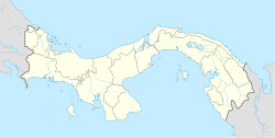
La Peña is a special kind of area in Panama. It's called a corregimiento, which is like a local government area or a district. La Peña is found in the Santiago District, which is part of the Veraguas Province.
What is La Peña?
La Peña is a corregimiento in Panama. Think of it as a specific part of a larger district, with its own local administration. It's a way to organize different towns and communities within a province.
Where is La Peña Located?
La Peña is located in the country of Panama. Specifically, it's in the Veraguas Province, which is one of Panama's ten provinces. Within Veraguas, La Peña is part of the Santiago District. This district is named after its main city, Santiago de Veraguas.
How Many People Live in La Peña?
The number of people living in La Peña has changed over the years.
- In 1990, about 7,005 people lived there.
- By 2000, the population was around 3,746 people.
- In 2010, the population was 3,990 people.
This shows that the number of residents can go up and down over time.
See also
 In Spanish: La Peña (Veraguas) para niños
 | John T. Biggers |
 | Thomas Blackshear |
 | Mark Bradford |
 | Beverly Buchanan |


