Lake D'Arbonne facts for kids
Quick facts for kids Lake D’Arbonne |
|
|---|---|
| Location | Union Parish, near Farmerville, Louisiana |
| Coordinates | 32°45′41″N 92°25′26″W / 32.76139°N 92.42389°W |
| Type | reservoir |
| Basin countries | United States |
| Surface area | 15,250 acres (62 km2) |
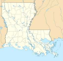
Lake D’Arbonne is a large, man-made lake in northern Louisiana. It is located near the town of Farmerville in Union Parish. This lake is a popular spot for fishing and outdoor fun.
Lake D’Arbonne is actually a type of lake called a reservoir. This means it was created by building a dam across a river or stream to hold water. The lake covers about 15,250 acres (62 km2) of land.
Contents
How Lake D’Arbonne Was Made
The idea for Lake D’Arbonne started in 1957. Work began soon after to create this big lake.
A large concrete dam was built to hold back the water. This dam is 2,450 feet long and 54 feet tall. The Louisiana Department of Public Works finished building the dam in 1961. By 1963, the lake was full of water and ready to enjoy.
Fun at the Lake
Lake D’Arbonne is a great place for outdoor activities. It is especially known for fishing.
You can also visit Lake D’Arbonne State Park. This park is a special area maintained by the state. It offers places for camping and other fun outdoor activities right on the lake.
People Who Helped Create the Lake
Many people worked hard to make Lake D’Arbonne a reality. They helped get the project approved and built.
Some of the key people included:
- B. R. Patton, who was a State Senator.
- T. T. Fields, who was a State Representative.
- Alvin Green, a local landowner from Bernice.
- Fred Preaus, a businessman from Farmerville. He also served as the state highway director for Governor Robert F. Kennon.
The James Peyton Smith Bridge
There is a bridge over Lake D'Arbonne in Farmerville. It is part of Louisiana State Highway 33. This bridge is named after James Peyton Smith.
James Peyton Smith was a state representative. He represented Union and Morehouse parishes from 1964 to 1972.
 | Janet Taylor Pickett |
 | Synthia Saint James |
 | Howardena Pindell |
 | Faith Ringgold |


