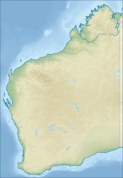
Lamboo Gunian Community facts for kids
Quick facts for kids Lamboo GunianWestern Australia |
|||||||||
|---|---|---|---|---|---|---|---|---|---|
| Postcode(s) | 6770 | ||||||||
| Elevation | 422 m (1,385 ft) | ||||||||
| Location | 20 km (12 mi) east of Halls Creek, Western Australia | ||||||||
| LGA(s) | Shire of Halls Creek | ||||||||
| State electorate(s) | Kimberley | ||||||||
| Federal Division(s) | Durack | ||||||||
|
|||||||||
Lamboo Gunian, also known as Koongie Park, is a small Aboriginal community in Western Australia. It is located about 20 kilometres (12 miles) east of Halls Creek. This area is part of the Kimberley region, within the Shire of Halls Creek.
Traditional Land Rights
The Lamboo Gunian community is located on land that is part of a registered native title claim. This claim, called Koongie Elvire (WAD6157/98), means that the traditional Aboriginal owners have special rights and interests over this land. It recognises their long connection to the area.
How the Community is Run
The community is managed by a group called the Koongie Elvira Aboriginal Corporation. This group used to be known as the Lamboo Gunian Aboriginal Corporation. It was officially set up on 2 June 1980 under a law that helps Aboriginal groups manage their own affairs. This corporation helps make important decisions for the community.
Planning for the Future
Lamboo Gunian has a special plan called Layout Plan No.2. This plan helps guide how the community is built and organised. It makes sure that new houses, roads, and other facilities are developed in a good way. The community approved this plan on 17 December 2002. The Western Australian Planning Commission, a government body, also approved it on 9 September 2003. You can find details about this plan on the Planning Western Australia website.


