Leoville, Saskatchewan facts for kids
Quick facts for kids
Leoville
|
|
|---|---|
|
Village
|
|
| Village of Leoville | |
| Country | Canada |
| Province | Saskatchewan |
| Region | Central |
| Census division | 16 |
| Rural municipality | Spiritwood No. 496 |
| Post office founded | 1930 |
| Government | |
| • Type | Municipal |
| Area | |
| • Total | 1.11 km2 (0.43 sq mi) |
| Population
(2016)
|
|
| • Total | 375 |
| • Density | 339.2/km2 (879/sq mi) |
| Time zone | UTC-6 (CST) |
| Postal code |
S0J 1N0
|
| Area code(s) | 306 |
| Highways | |
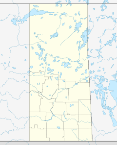
Leoville is a small village in the Canadian province of Saskatchewan. In 2016, about 375 people lived there. It is located within the Rural Municipality of Spiritwood No. 496 and Census Division No. 16. A census division is like a region used for counting people.
Leoville is found along Highway 24. Another road, Highway 946, starts in the village and goes north. Leoville is also important because it is home to the main office for the Pelican Lake First Nation government.
Leoville's History
Leoville officially became a village on June 26, 1944. This means it gained its own local government at that time.
How Many People Live Here?
We can learn about Leoville's population from the Statistics Canada census. A census is like a big count of all the people living in a country.
|
|||||||||||||||||||||||||||||||||
In the 2021 Census, 364 people lived in Leoville. They lived in about 151 homes. This was a small change from its 2016 population of 375 people.
Leoville covers a land area of about 1.14 square kilometers. This means that in 2021, there were about 319 people living in each square kilometer. This is called population density.
In the 2016 Census, Leoville had 375 people. They lived in about 146 homes. This was a small increase from its 2011 population of 366. The village had a population density of about 339 people per square kilometer in 2016.
 | Isaac Myers |
 | D. Hamilton Jackson |
 | A. Philip Randolph |


