List of Pennsylvania state historical markers in Clarion County facts for kids
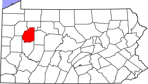
This is a list of the Pennsylvania state historical markers in Clarion County.
This is intended to be a complete list of the official state historical markers placed in Clarion County, Pennsylvania by the Pennsylvania Historical and Museum Commission (PHMC). The locations of the historical markers, as well as the latitude and longitude coordinates as provided by the PHMC's database, are included below when available. There are 7 historical markers located in Clarion County.
Historical markers
| Marker title | Image | Date dedicated | Location | Marker type | Topics |
|---|---|---|---|---|---|
| Brady's Bend |  |
November 28, 1946 | PA 68 at Brady's Bend Park Lookout, Brady's Bend 40°59′17″N 79°34′59″W / 40.98807°N 79.58303°W |
Roadside | American Revolution, Military, Native American |
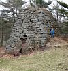
| Buchanan Furnace |  |
April 3, 1950 | PA 58, north of PA 368, Callensburg 41°07′38″N 79°33′01″W / 41.12722°N 79.5504°W |
Roadside | Business & Industry, Coal, Furnaces, Iron |
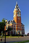
| Clarion County |  |
April 26, 1982 | Courthouse, Main Street (US 322) at 5th Avenue, Clarion 41°12′54″N 79°23′10″W / 41.21508°N 79.38612°W |
City | Business & Industry, Coal, Government & Politics, Government & Politics 19th Century, Iron |
| Fishbasket Old Town |  |
July 12, 1997 | At cemetery, Brookville Street (PA 28) near Park Road, Fairmount City 41°00′45″N 79°17′40″W / 41.012637°N 79.29455°W |
Roadside | Cities & Towns, Early Settlement, Native American, Paths & Trails |
| Foxburg Golf Course |  |
June 1, 1955 | At golf course, St Petersburg Road (PA 58), Foxburg 41°08′47″N 79°40′47″W / 41.14648°N 79.67977°W |
Roadside | Sports |
| Helen Furnace |  |
March 31, 1950 | Miola Road & White Oak Drive, 7 miles northeast of Clarion 41°17′15″N 79°19′07″W / 41.28748°N 79.31855°W |
Roadside | Business & Industry, Coal, Furnaces, Iron |
| Rural Electrification |  |
July 11, 1987 | PA 368 near Terwilliger Road, 1 mile east of Parker 41°06′04″N 79°39′54″W / 41.10102°N 79.66488°W |
Roadside | Business & Industry, Electricity |

All content from Kiddle encyclopedia articles (including the article images and facts) can be freely used under Attribution-ShareAlike license, unless stated otherwise. Cite this article:
List of Pennsylvania state historical markers in Clarion County Facts for Kids. Kiddle Encyclopedia.

