
List of Pennsylvania state historical markers in Washington County facts for kids

Welcome to Washington County, Pennsylvania! Did you know this area is full of amazing history? All over the county, you can find special signs called Pennsylvania state historical markers. These markers are like outdoor history books. They tell us about important people, places, and events that happened right here.
The Pennsylvania Historical and Museum Commission (PHMC) puts up these markers. They help everyone learn about the past. Washington County has 53 of these cool historical markers. Let's explore some of the most interesting ones!
Important People from Washington County
Washington County has been home to many famous and influential people. Historical markers celebrate their lives and what they achieved.
Inventors and Scientists
- Edward Acheson was a brilliant inventor. He created carborundum, a super hard material used for grinding and polishing. He also made artificial graphite, which is used in pencils and batteries. His marker is in Washington, where he lived.
- William Holmes McGuffey was an educator who created the famous McGuffey Readers. These textbooks taught millions of American children how to read and learn in the 1800s. You can find his marker near McGuffey High School in Claysville.
- Ralston Thresher marks an important invention in farming. The thresher was a machine that helped farmers separate grain from stalks much faster than by hand. This invention changed how farms worked.
Sports Stars and Entertainers
- Delvin G. Miller was a legendary figure in horse racing. He was known for training and driving harness horses. His marker is at The Meadows Racetrack and Casino, a famous local racetrack.
- John K. Tener had an amazing life! He was a professional baseball player, playing for the Chicago White Stockings. After his baseball career, he became the Governor of Pennsylvania. His marker is in Charleroi.
- Jay Livingston was a very talented songwriter. He wrote many famous songs for movies and TV shows. Some of his most well-known songs include "Buttons and Bows" and "Que Sera, Sera." His marker is in McDonald.
Leaders and Writers
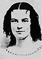
- Rebecca Harding Davis was an important writer. She wrote stories that showed the tough lives of factory workers in the 1800s. She was one of the first American writers to focus on realistic stories about everyday people. Her marker is near Washington & Jefferson College.
- Joseph A. "Jock" Yablonski was a coal miner and a union leader. He worked to improve conditions for miners. His marker in California, Pennsylvania, tells his story.
Cool Places and Events in Washington County
Many markers tell us about significant places or moments in history.
Early Settlements and Forts
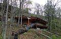
- Meadowcroft Rockshelter is an incredible archaeological site. It shows that people lived in this area more than 16,000 years ago! It's one of the oldest known human settlements in North America. The marker is in Avella.
- Doddridge's Fort and Rice's Fort were important forts built by early settlers to protect themselves during conflicts. These markers remind us of the challenges faced by pioneers.
- The Mounds in Monongahela are ancient earthworks. They were built by Native American people long before European settlers arrived. They show the rich history of the land's first inhabitants.
The Whiskey Rebellion
- The Whiskey Rebellion was a big event in early American history. Farmers in Western Pennsylvania were upset about a tax on whiskey. They rebelled against the government. Markers like the one for the David Bradford House in Washington tell the story of this important protest. The Mingo Creek Church marker also relates to this event, as it was a meeting place for some of the rebels.
- Whiskey Point in Monongahela is another marker related to the rebellion. It highlights a spot where events of the Whiskey Rebellion took place.
Transportation and Industry
- The "S" Bridge in Claysville is a unique bridge on the historic National Road. This road was one of the first major highways in the United States, connecting the East Coast to the Midwest. The "S" shape helped wagons cross a stream.
- The National Road itself has a marker. It was a huge project that helped people and goods travel across the country.
- The California Boatyards marker tells about a time when boats were built right here in California, Pennsylvania. This was important for transporting goods on the Monongahela River.
- The Gantz Oil Well and The McGugin Gas Well markers celebrate the discovery of oil and natural gas in Washington County. This industry brought many changes and jobs to the area.
- Cement City in Donora was a unique neighborhood built with concrete houses. It was an interesting experiment in housing for workers in the early 1900s.
Environmental History
- The 1948 Donora Smog marker remembers a serious air pollution event that happened in Donora. This event was a major turning point that led to new laws to protect our air quality.
Washington and Jefferson College

The markers for Washington and Jefferson College celebrate a very old and respected school in Washington. This college has been educating students for a long time and has played a big part in the history of the area.
Images for kids
-
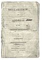
The "Declaration and Address" marker in Washington.
-
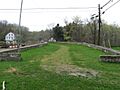
The "S" Bridge near Claysville.
-

A placeholder image.
-
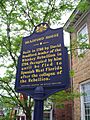
The David Bradford House marker.
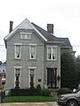
-
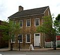
The David Bradford House.
-
The California Boatyards marker.
-
The Capt. Philo McGiffin marker.
-
The Edward Acheson marker.
-
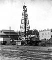
The Gantz Oil Well marker.
-
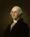
The George Washington marker.
-
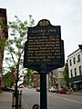
The Globe Inn marker.
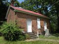
-
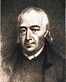
The Hill Church and John McMillan markers.
-
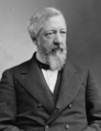
The James G. Blaine marker.
-
The John K. Tener marker.
-
The LeMoyne Crematory marker.
-
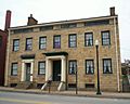
The LeMoyne House marker.
-
The Meadowcroft Rockshelter marker.
-
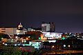
The Monongahela marker.
-
The National Road marker.
-
The Rebecca Harding Davis marker.
-
A Washington, Pennsylvania marker.
-
Another Washington, Pennsylvania marker.
-
A Washington, Pennsylvania marker.
-
A Washington, Pennsylvania marker.
-
The William Holmes McGuffey marker.
_1809.jpg)


