List of lakes of Hot Spring County, Arkansas facts for kids
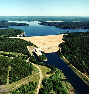
Hot Spring County, Arkansas, is home to several important bodies of water. While it doesn't have many natural lakes, it has at least 9 named reservoirs. These are man-made lakes that are very important for the people and wildlife in the area. They provide water, help create electricity, and offer fun places for outdoor activities like fishing and boating.
Contents
Understanding Lakes and Reservoirs
A lake is usually a natural body of water, often formed by glaciers, volcanoes, or rivers. A reservoir is a man-made lake. People create reservoirs by building a large dam across a river or stream. This dam holds back the water, forming a large pool.
Why are Reservoirs Important?
Reservoirs serve many important purposes:
- Drinking Water: They store water for cities and towns to drink.
- Electricity: The water released from dams can spin turbines to create clean electricity.
- Flood Control: They can hold back extra water during heavy rains, preventing floods downstream.
- Recreation: Many reservoirs are popular places for fishing, boating, swimming, and camping.
- Wildlife: They provide homes for many different kinds of fish, birds, and other animals.
Reservoirs of Hot Spring County
Even though the United States Geological Survey says there are no natural named lakes in Hot Spring County, there are many important reservoirs. These man-made lakes are vital to the region. Here are some of the main reservoirs you can find:
- Clearwater Lake, 34°28′27″N 092°47′50″W / 34.47417°N 92.79722°W, located at an elevation of 525 feet (160 m).
- Crouchwood Lake, 34°28′00″N 092°54′55″W / 34.46667°N 92.91528°W, found at an elevation of 423 feet (129 m).
- DeGray Lake, 34°15′07″N 093°11′57″W / 34.25194°N 93.19917°W, with an elevation of 400 feet (120 m). DeGray Lake is known for its clear waters and recreational activities.
- Jones Lake, 34°29′00″N 092°46′01″W / 34.48333°N 92.76694°W, sitting at an elevation of 449 feet (137 m).
- Kinzey Lake, 34°28′54″N 092°48′37″W / 34.48167°N 92.81028°W, located at an elevation of 614 feet (187 m).
- Lake Bobbie, 34°23′33″N 093°10′16″W / 34.39250°N 93.17111°W, found at an elevation of 591 feet (180 m).
- Lake Catherine, 34°25′36″N 092°53′13″W / 34.42667°N 92.88694°W, with an elevation of 266 feet (81 m). This lake is also a popular spot for recreation.
- Lower Lake, 34°29′10″N 092°46′12″W / 34.48611°N 92.77000°W, sitting at an elevation of 486 feet (148 m).
- Lucinda Lake, 34°29′09″N 092°48′33″W / 34.48583°N 92.80917°W, located at an elevation of 531 feet (162 m).
These reservoirs are important natural resources for Hot Spring County, supporting both the environment and the local community.
See also
 | Chris Smalls |
 | Fred Hampton |
 | Ralph Abernathy |


