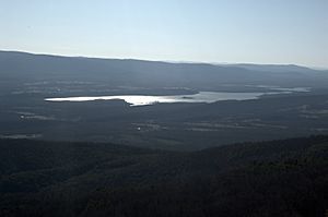
List of lakes of Yell County, Arkansas facts for kids
Yell County, Arkansas, is a place filled with natural beauty, and a big part of that beauty comes from its many bodies of water. There are at least 26 named lakes and reservoirs here! These watery spots are important for wildlife, recreation, and sometimes even for providing drinking water.
But what's the difference between a lake and a reservoir? A lake is usually a natural body of water, often formed by glaciers, rivers, or other natural processes. A reservoir, on the other hand, is a man-made lake. It's created when a dam is built across a river or stream to hold back water. People build reservoirs for many reasons, like storing water for cities, controlling floods, or generating electricity.
Contents
Exploring Yell County's Waterways
Natural Lakes of Yell County
Yell County is home to several natural lakes. These lakes are often peaceful places, perfect for fishing, boating, or just enjoying nature. Each lake has its own unique features and is a great spot to explore the outdoors.
- Buckman Lake, located at 35°04′33″N 093°28′14″W / 35.07583°N 93.47056°W, sits at an elevation of 338 feet (103 m).
- Cowger Lake, found at 35°03′09″N 093°24′36″W / 35.05250°N 93.41000°W, is about 325 feet (99 m) above sea level.
- Gibson Lake, with coordinates 35°07′48″N 093°07′34″W / 35.13000°N 93.12611°W, has an elevation of 295 feet (90 m).
- Horseshoe Lake, located at 35°03′38″N 093°27′04″W / 35.06056°N 93.45111°W, is 325 feet (99 m) high.
- Keeland Lake, found at 35°02′48″N 093°12′15″W / 35.04667°N 93.20417°W, sits at 292 feet (89 m).
- Luther Lake, with coordinates 35°07′51″N 093°05′28″W / 35.13083°N 93.09111°W, is 285 feet (87 m) above sea level.
- Mason Lake, located at 35°03′56″N 093°27′23″W / 35.06556°N 93.45639°W, has an elevation of 325 feet (99 m).
- Open Slough, found at 35°08′50″N 093°07′15″W / 35.14722°N 93.12083°W, is 302 feet (92 m) high.
- Peeler Lake, with coordinates 35°04′09″N 093°19′51″W / 35.06917°N 93.33083°W, sits at 312 feet (95 m).
- Peter George Lake, located at 35°06′14″N 093°18′14″W / 35.10389°N 93.30389°W, is 322 feet (98 m) above sea level.
- Rose Lake, found at 35°03′45″N 093°05′12″W / 35.06250°N 93.08667°W, has an elevation of 299 feet (91 m).
- Surrounded Ridges Lake, with coordinates 35°05′20″N 093°18′21″W / 35.08889°N 93.30583°W, is 308 feet (94 m) high.
Man-Made Reservoirs
Reservoirs are like giant bathtubs built by people to store water. They are very important for communities, providing water for homes, farms, and sometimes even creating electricity. They also offer great places for fishing, boating, and other water sports.
- Bailey Branch Lake, located at 35°02′12″N 093°26′57″W / 35.03667°N 93.44917°W, sits at an elevation of 344 feet (105 m).
- Blue Mountain Lake, found at 35°05′59″N 093°42′02″W / 35.09972°N 93.70056°W, is about 384 feet (117 m) above sea level. This is one of the larger and more well-known reservoirs in the area.
- Bogs Lake, with coordinates 35°08′01″N 093°17′47″W / 35.13361°N 93.29639°W, has an elevation of 338 feet (103 m).
- Cedar-Piney Lake, located at 35°06′50″N 093°29′11″W / 35.11389°N 93.48639°W, is 387 feet (118 m) high.
- Chambers Lake, found at 35°02′37″N 093°27′49″W / 35.04361°N 93.46361°W, sits at 427 feet (130 m).
- Harris Fish Farm Reservoir, with coordinates 35°06′07″N 093°21′22″W / 35.10194°N 93.35611°W, is 351 feet (107 m) above sea level.
- Kingfisher Lake, located at 35°05′44″N 093°06′20″W / 35.09556°N 93.10556°W, has an elevation of 315 feet (96 m).
- Lake Ola, found at 35°01′54″N 092°14′01″W / 35.03167°N 92.23361°W, is 361 feet (110 m) high.
- Lake Ola-dale, with coordinates 35°01′48″N 093°14′10″W / 35.03000°N 93.23611°W, sits at 390 feet (120 m).
- Mockingbird Hill Lake, located at 35°06′27″N 093°13′05″W / 35.10750°N 93.21806°W, is 354 feet (108 m) above sea level.
- Nimrod Lake, found at 34°57′03″N 093°14′37″W / 34.95083°N 93.24361°W, has an elevation of 341 feet (104 m).
- Pullen Pond, with coordinates 35°05′12″N 093°08′06″W / 35.08667°N 93.13500°W, is 302 feet (92 m) high.
- Schoonover Lake, located at 35°05′15″N 093°12′12″W / 35.08750°N 93.20333°W, sits at 348 feet (106 m).
- Spring Lake, found at 35°09′14″N 093°25′39″W / 35.15389°N 93.42750°W, is 512 feet (156 m) high, making it one of the higher elevation bodies of water listed.
See also
 | Calvin Brent |
 | Walter T. Bailey |
 | Martha Cassell Thompson |
 | Alberta Jeannette Cassell |


