List of listed buildings in Aberdeen/4 facts for kids
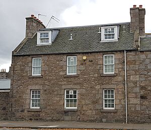
This is a list of listed buildings in Aberdeen, Scotland.
List
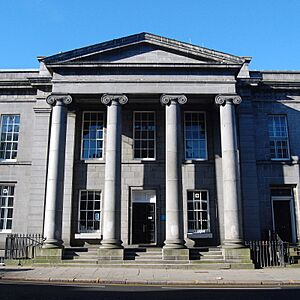
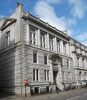
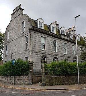
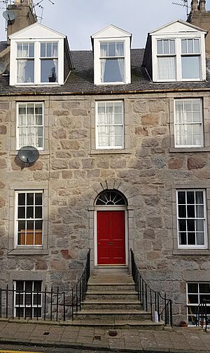
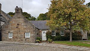
Name | Location | Date Listed | Grid Ref. | Geo-coordinates | Notes | LB Number | Image |
---|---|---|---|---|---|---|---|
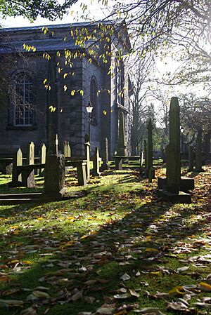
Nigg Kirk Road, Nigg Parish Church (C. Of S.) Including Graveyard, Gatepiers And Boundary Walls | 57°07′09″N 2°05′24″W / 57.11923°N 2.090082°W | Category B | 19945 | ||||
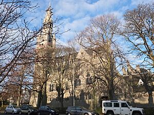
Queen's Cross At Fountainhall Road And Queen's Gardens, Rubislaw Parish Church And Church Hall | 57°08′36″N 2°07′39″W / 57.143407°N 2.12747°W | Category B | 19947 | ||||
St. Machar's Cathedral, Churchyard, Chanonry | 57°10′12″N 2°06′08″W / 57.169867°N 2.102178°W | Category B | 19958 | ||||
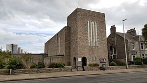
St. Mary's Church (C. Of S.) King Street | 57°09′51″N 2°05′47″W / 57.164213°N 2.096425°W | Category B | 19963 | ||||
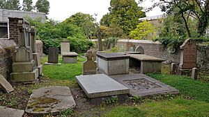
Union Street, 9 Back Wynd, Schoolhill And Correction Wynd, St Nicholas Churchyard, Including Boundary Walls And Gatepiers | 57°08′47″N 2°05′58″W / 57.146505°N 2.09937°W | Category A | 19967 | ||||
Allenvale Road, Allenvale Cemetery, Including Lodge And James Saint Monument | 57°07′51″N 2°06′38″W / 57.130703°N 2.110462°W | Category B | 46473 | ||||
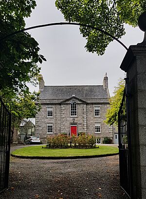
1 Fonthill Terrace, Whinhill House, Including Gates, Gatepiers And Boundary Walls | 57°08′08″N 2°06′29″W / 57.135502°N 2.108047°W | Category B | 46476 | ||||
60 And 62 Albury Road, Including Boundary Walls | 57°08′17″N 2°06′34″W / 57.137972°N 2.109426°W | Category C(S) | 46770 | ||||
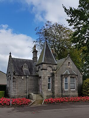
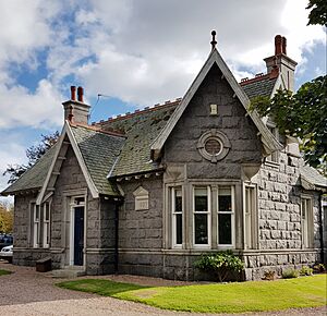
Duthie Park, East Lodge, Gates, Gatepiers And Boundary Walls | 57°07′56″N 2°06′08″W / 57.132345°N 2.102223°W | Category B | 46779 | ||||
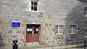
North Esplanade West, Proserv (Ns) Ltd., Former Caretakers House, Aberdeen Mineral Water Co | 57°08′20″N 2°05′42″W / 57.139007°N 2.095005°W | Category C(S) | 46795 | ||||
6-8 (Even Numbers) Polmuir Road, Including Boundary Walls And Railings | 57°08′10″N 2°06′17″W / 57.13608°N 2.104728°W | Category C(S) | 46798 | ||||
1, 3 And 3A Beechgrove Terrace And 2 Westfield Road, Including Boundary Walls | 57°08′57″N 2°07′25″W / 57.149142°N 2.123557°W | Category C(S) | 47452 | ||||
44 And 46 Fountainhall Road At Desswood Place, Including Boundary Walls | 57°08′43″N 2°07′40″W / 57.145257°N 2.127857°W | Category C(S) | 47479 | ||||
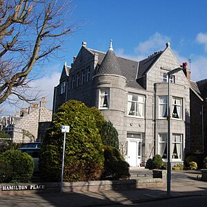
20 Hamilton Place, Including Boundary Walls | 57°08′54″N 2°07′26″W / 57.148414°N 2.124°W | Category C(S) | 47488 | ||||
Skene Street And Esslemont Avenue, Aberdeen Grammar School, Lodge, Bridge Over Denburn, Gates, Gatepiers, Boundary Walls And Railings | 57°08′46″N 2°06′51″W / 57.146142°N 2.114259°W | Category B | 47494 | ||||
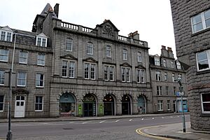
514-520 (Even Numbers) Union Street | 57°08′35″N 2°06′45″W / 57.143071°N 2.112382°W | Category C(S) | 47498 | ||||
40 Albyn Place, Including Gatepiers And Boundary Walls | 57°08′34″N 2°07′31″W / 57.142754°N 2.125254°W | Category B | 47915 | ||||
Holburn Street At Alford Lane, Holburn Central Parish Church, Including Church Hall, March Stone (Forming Quoin On W Gable) And Boundary Walls | 57°08′32″N 2°06′45″W / 57.142317°N 2.112529°W | Category B | 47927 | ||||
28-38 (Even Numbers) Holburn Street And 4-14 (Even Numbers) Union Grove, Skene House, Including Boundary Wall And Inset Niche | 57°08′32″N 2°06′46″W / 57.142092°N 2.11271°W | Category B | 47929 | ||||
338 King Street, Merkland South Building (Former King Street Public School) Including Gatepiers, Gates And Railings | 57°09′18″N 2°05′39″W / 57.15498°N 2.09407°W | Category C(S) | 48284 | ||||
Newlands Avenue And South Anderson Drive, Newlands, Including Boundary Walls | 57°07′49″N 2°07′42″W / 57.130363°N 2.128251°W | Category C(S) | 48518 | ||||
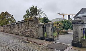
'satrosphere', 179 Constitution Street, Former Tramway Depot | 57°09′12″N 2°05′05″W / 57.153262°N 2.084744°W | Category B | 49309 | ||||
60 Frederick Street, Warehouse | 57°09′00″N 2°05′30″W / 57.150077°N 2.091661°W | Category B | 50945 | ||||
107-131 (Odd Nos) Union Street | 57°08′47″N 2°05′56″W / 57.146343°N 2.09889°W | Category C(S) | 50958 | ||||
Greyhope Road, Capstan Jetty | 57°08′28″N 2°04′05″W / 57.141136°N 2.06806°W | Category C(S) | 51752 | ||||
Spital, 15 And 17 Spital | 57°09′27″N 2°06′00″W / 57.157491°N 2.099896°W | Category B | 51757 | ||||
Justice Mill Lane, Former Regent Cinema | 57°08′30″N 2°06′41″W / 57.141653°N 2.111386°W | Category C(S) | 45603 | ||||
1 And 3 Rubislaw Den South At Spademill Road, Including Boundary Walls | 57°08′33″N 2°08′04″W / 57.142591°N 2.134523°W | Category C(S) | 20788 | ||||
27 And 27A Rubislaw Den South, Including Boundary Walls | 57°08′33″N 2°08′14″W / 57.142373°N 2.137315°W | Category C(S) | 20791 | ||||
33 And 35 Rubislaw Den South, Including Gatepiers And Boundary Walls | 57°08′32″N 2°08′16″W / 57.1423°N 2.137893°W | Category C(S) | 20793 | ||||
30 Rubislaw Den South, Including Gatepiers And Boundary Walls | 57°08′34″N 2°08′19″W / 57.142829°N 2.138622°W | Category B | 20806 | ||||
54 Rubislaw Den South, Including Ancillary Structure, Gatepiers And Boundary Walls | 57°08′33″N 2°08′32″W / 57.142565°N 2.142257°W | Category C(S) | 20814 | ||||
58 And 58A Rubislaw Den South, Ingleside, Including Gatepiers And Boundary Walls | 57°08′33″N 2°08′34″W / 57.14251°N 2.142901°W | Category B | 20816 | ||||
33 Forest Road At Desswood Place, Including Gatepiers And Boundary Walls | 57°08′40″N 2°08′03″W / 57.144316°N 2.134265°W | Category C(S) | 20696 | ||||
44, 44A And 46 Forest Road, Including Gatepiers And Boundary Walls | 57°08′42″N 2°08′09″W / 57.144979°N 2.135854°W | Category C(S) | 20705 | ||||
19 Queen's Road, Albyn School For Girls, Including Ancillary Structure, Gatepiers And Boundary Walls | 57°08′30″N 2°07′53″W / 57.141786°N 2.131447°W | Category B | 20717 | ||||
33 Queen's Road, Including Gatepiers And Boundary Walls | 57°08′28″N 2°08′02″W / 57.141235°N 2.133957°W | Category B | 20723 | ||||
2 And 4 Queen's Road, Including Gatepiers And Boundary Walls | 57°08′34″N 2°07′46″W / 57.142875°N 2.129352°W | Category C(S) | 20733 | ||||
11 Rubislaw Den North, Braco Lodge, Including Boundary Walls | 57°08′40″N 2°08′17″W / 57.144429°N 2.137934°W | Category C(S) | 20763 | ||||
24 Rubislaw Den North, Including Gatepiers And Boundary Walls | 57°08′42″N 2°08′18″W / 57.144905°N 2.138266°W | Category C(S) | 20775 | ||||
6 Queen's Gate And 2-12 (Even Numbers) And 12A Forest Road, At Queen's Road, Including Railings And Boundary Walls | 57°08′32″N 2°08′01″W / 57.142341°N 2.13368°W | Category C(S) | 20635 | ||||
230 George Street And 34 John Street | 57°09′05″N 2°06′09″W / 57.151308°N 2.10259°W | Category B | 20649 | ||||
Hazlehead Park, K6 Telephone Kiosk | 57°08′24″N 2°10′26″W / 57.140117°N 2.173972°W | Category B | 20670 | ||||
Gilcomston South Church Union Street/Summer Street | 57°08′39″N 2°06′32″W / 57.14408°N 2.108832°W | Category B | 20676 | ||||
244 Market Street And 1 North Esplanade West, Riverside House, Former Tramshed | 57°08′27″N 2°05′27″W / 57.140924°N 2.09073°W | Category B | 20678 | ||||
25 Polmuir Road, Clifton Villa, Including Boundary Walls | 57°08′04″N 2°06′11″W / 57.134429°N 2.103005°W | Category C(S) | 20615 | ||||
Hamilton Place, Whitehill Bowling Green Wall, Including Piers, Railings And Gates | 57°08′51″N 2°07′37″W / 57.147441°N 2.127005°W | Category B | 20627 | ||||
98 Hamilton Place At Fountainhall Road, Including Gatepiers And Boundary Walls | 57°08′50″N 2°07′46″W / 57.147214°N 2.129367°W | Category A | 20629 | ||||
37 And 39 Westburn Road, Including Gatepiers And Boundary Walls | 57°09′11″N 2°06′52″W / 57.152996°N 2.114346°W | Category C(S) | 20597 | ||||
Wrights' And Coopers' Place (House 4; Old Number 7) | 57°09′59″N 2°06′06″W / 57.166328°N 2.101722°W | Category B | 20602 | ||||
Union Street, 261-263 | 57°08′39″N 2°06′21″W / 57.144254°N 2.105891°W | Category C(S) | 20538 | ||||
431 Union Street Including 429, 433, 441, 443 Union Street, Former Capitol Cinema | 57°08′35″N 2°06′36″W / 57.14319°N 2.10997°W | Category B | 20547 | ||||
Union Street, 156 | 57°08′44″N 2°06′14″W / 57.145477°N 2.103912°W | Category C(S) | 20562 | ||||
Union Terrace, 19 Savings Bank And 1 Diamond Place | 57°08′48″N 2°06′15″W / 57.146528°N 2.104295°W | Category B | 20577 | ||||
20 And 22 Upperkirkgate | 57°08′56″N 2°05′54″W / 57.148922°N 2.098369°W | Category C(S) | 20580 | ||||
42 Upperkirkgate | 57°08′55″N 2°05′56″W / 57.148706°N 2.098897°W | Category C(S) | 20582 | ||||
St. Machar Drive, 60 Cluny's Port, Old Aberdeen | 57°10′01″N 2°06′11″W / 57.167082°N 2.103129°W | Category B | 20478 | ||||
St. Machar Drive, 70 Old Aberdeen | 57°10′01″N 2°06′06″W / 57.167083°N 2.101559°W | Category B | 20480 | ||||
61 Schoolhill, Former James Dun's House | 57°08′52″N 2°06′04″W / 57.147707°N 2.101125°W | Category B | 20483 | ||||
48 And 50 Shiprow (Including Former House Of Provost Ross) | 57°08′48″N 2°05′41″W / 57.146688°N 2.094776°W | Category A | 20484 | ||||
Skene Terrace, 44 | 57°08′50″N 2°06′27″W / 57.147342°N 2.107603°W | Category B | 20504 | ||||
Skene Terrace, 48, 50 | 57°08′50″N 2°06′29″W / 57.147207°N 2.108015°W | Category B | 20506 | ||||
95, 97 And 99 Union Street | 57°08′47″N 2°05′54″W / 57.146425°N 2.098395°W | Category C(S) | 20524 | ||||
76 Forest Road At King's Gate (Formerly 55 King's Gate), Including Gates, Gatepiers And Boundary Walls | 57°08′48″N 2°08′12″W / 57.146613°N 2.136703°W | Category B | 20416 | ||||
Mackenzie Place, 8 High Street, Old Aberdeen | 57°09′55″N 2°06′10″W / 57.165312°N 2.102744°W | Category B | 20417 | ||||
Mackie Place, 4, 5 | 57°08′51″N 2°06′47″W / 57.147418°N 2.113073°W | Category B | 20419 | ||||
Marine Terrace, Boundary Walls And Railings To Communal Garden, Including Former Public Lavatory | 57°08′19″N 2°06′05″W / 57.13867°N 2.101266°W | Category B | 20422 | ||||
11-15 (Odd Nos) Marischal Street | 57°08′51″N 2°05′35″W / 57.147606°N 2.092994°W | Category B | 20424 | ||||
56 Marischal Street | 57°08′48″N 2°05′31″W / 57.146546°N 2.092°W | Category C(S) | 20442 | ||||
39 And 40 Regent Quay | 57°08′48″N 2°05′27″W / 57.146547°N 2.090793°W | Category C(S) | 20462 | ||||
73, 74 And 75 Regent Quay | 57°08′48″N 2°05′17″W / 57.146774°N 2.087968°W | Category C(S) | 20467 | ||||
Golden Square, 17, 18 | 57°08′45″N 2°06′21″W / 57.145808°N 2.105912°W | Category B | 20328 | ||||
Grant's Place, 1-3 Old Aberdeen | 57°09′58″N 2°06′07″W / 57.166211°N 2.10187°W | Category B | 20330 | ||||
64, 64A, 66, 66A And 66B Hamilton Place, Including Gatepiers And Boundary Walls | 57°08′52″N 2°07′37″W / 57.147764°N 2.126956°W | Category A | 20335 | ||||
68, 68A And 70 Hamilton Place, Including Gatepiers And Boundary Walls | 57°08′52″N 2°07′38″W / 57.147683°N 2.127303°W | Category A | 20336 | ||||
82, 82A And 84 Hamilton Place, Including Gatepiers And Boundary Walls | 57°08′51″N 2°07′42″W / 57.147431°N 2.128393°W | Category A | 20340 | ||||
High Street, 17, 19 (West Side) Old Aberdeen | 57°09′53″N 2°06′08″W / 57.164756°N 2.102296°W | Category B | 20348 | ||||
High Street, 33, (West Side) Old Aberdeen | 57°09′55″N 2°06′09″W / 57.165205°N 2.102479°W | Category B | 20353 | ||||
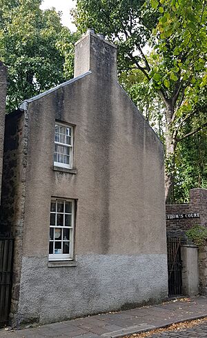
High Street, 67, (West Side) And Thom's Court, Old Aberdeen | 57°09′57″N 2°06′08″W / 57.165807°N 2.102349°W | Category C(S) | 20359 | ||||
High Street, 81, Garden Walls And Gate Pillars | 57°09′58″N 2°06′08″W / 57.166148°N 2.10235°W | Category B | 20361 | ||||
High Street, 38-48 (Even Nos) (East Side) Row Part Of Block E Of Taylor Building, King's College, Old Aberdeen | 57°09′55″N 2°06′07″W / 57.165187°N 2.101884°W | Category B | 20368 | ||||
High Street, 106 (East Side) Old Aberdeen | 57°10′01″N 2°06′07″W / 57.166876°N 2.102054°W | Category B | 20377 | ||||
249 Holburn Street | 57°08′13″N 2°06′52″W / 57.136934°N 2.114396°W | Category C(S) | 20379 | ||||
2-6 (Even Nos) King Street And 7 And 8 Castle Street | 57°08′55″N 2°05′35″W / 57.148486°N 2.093194°W | Category B | 20394 | ||||
12 And 14 King Street | 57°08′55″N 2°05′36″W / 57.148585°N 2.093195°W | Category C(S) | 20395 | ||||
Don Street, (N.W. Side) Braeside Cottage And Ivy Cottage | 57°10′40″N 2°06′00″W / 57.177639°N 2.099967°W | Category B | 20303 | ||||
Douglas Place, 6 Old Aberdeen | 57°09′54″N 2°06′10″W / 57.165079°N 2.102694°W | Category B | 20309 | ||||
261-265 (Odd) George Street | 57°09′06″N 2°06′12″W / 57.15155°N 2.103367°W | Category B | 20317 | ||||
1-5 (Odd Nos) George Street | 57°08′54″N 2°05′58″W / 57.148319°N 2.099441°W | Category B | 20318 | ||||
George Street, 393 Aberdeen Savings Bank | 57°09′12″N 2°06′20″W / 57.153354°N 2.105554°W | Category B | 20319 | ||||
George Street, 593-595 | 57°09′22″N 2°06′32″W / 57.156199°N 2.108802°W | Category C(S) | 20321 | ||||
College Bounds, 51 And 51 And 1/2 (West Side) Powis Lodge Old Aberdeen | 57°09′50″N 2°06′09″W / 57.163929°N 2.102459°W | Category B | 20220 | ||||
College Bounds, 20, 22 (East Side) Old Aberdeen | 57°09′44″N 2°06′05″W / 57.162259°N 2.101446°W | Category B | 20227 | ||||
Crown Street, 27, 29 Britannic House | 57°08′39″N 2°06′10″W / 57.144238°N 2.102653°W | Category B | 20241 | ||||
Crown Street, 84, 86, 86 And A Half | 57°08′36″N 2°06′09″W / 57.143367°N 2.102419°W | Category B | 20250 | ||||
Dee Place, 13 | 57°08′29″N 2°06′09″W / 57.141508°N 2.102546°W | Category B | 20255 | ||||
Dee Street, 69, 71 | 57°08′33″N 2°06′10″W / 57.142379°N 2.102796°W | Category B | 20263 | ||||
Dee Street, 46 | 57°08′36″N 2°06′14″W / 57.14324°N 2.103757°W | Category C(S) | 20266 | ||||
Don Street, 27, 29 (West Side) Old Aberdeen | 57°10′04″N 2°06′06″W / 57.167829°N 2.101594°W | Category C(S) | 20278 | ||||
Don Street, 45 (West Side) Old Aberdeen | 57°10′06″N 2°06′03″W / 57.168413°N 2.100934°W | Category B | 20280 | ||||
Don Street, 49 (The Close) Old Aberdeen | 57°10′06″N 2°06′02″W / 57.168306°N 2.100504°W | Category B | 20281 | ||||
Don Street, 65, 67 (West Side) Old Aberdeen | 57°10′07″N 2°05′59″W / 57.168657°N 2.099711°W | Category B | 20284 | ||||
Don Street, 75, 77 (West Side) Old Aberdeen | 57°10′08″N 2°05′57″W / 57.168909°N 2.099166°W | Category C(S) | 20286 | ||||
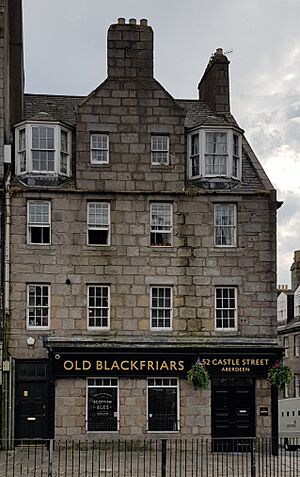
51 And 52 Castle Street And 1 And 3 Marischal Street | 57°08′52″N 2°05′35″W / 57.147785°N 2.093176°W | Category B | 20173 | ||||
Chanonry (West Side) And St Machar Drive, Botany Boundary Wall And Gate Pillars | 57°10′04″N 2°06′10″W / 57.167891°N 2.102801°W | Category B | 20177 | ||||
Chanonry, 11 (West Side) Old Aberdeen | 57°10′09″N 2°06′15″W / 57.169264°N 2.104095°W | Category B | 20188 | ||||
Chanonry, 18 Boundary Wall Only | 57°10′09″N 2°06′03″W / 57.169302°N 2.100804°W | Category B | 20199 | ||||
Clark's Lane, 3 Old Aberdeen | 57°10′07″N 2°05′55″W / 57.168711°N 2.09862°W | Category B | 20205 | ||||
22 And 23 Albyn Place, Albyn Hospital, Including Boundary Walls | 57°08′34″N 2°07′07″W / 57.142643°N 2.118561°W | Category B | 20118 | ||||
1-3 (Odd Nos) Bath Street, Royal Hotel | 57°08′41″N 2°06′08″W / 57.144733°N 2.102125°W | Category C(S) | 20124 | ||||
30 Beechgrove Terrace, Mile End House, Including Gatepiers And Boundary Walls | 57°08′57″N 2°07′38″W / 57.149049°N 2.127126°W | Category C(S) | 20126 | ||||
49 And 51 Belmont Street, The Belmont Picturehouse (Former Trades Council Hall) | 57°08′50″N 2°06′09″W / 57.147212°N 2.102396°W | Category C(S) | 20132 | ||||
11A-19 Bon Accord Street (Former Livery Stables And Offices), 21-29 Langstane Place And 2-16 Gordon Street | 57°08′38″N 2°06′21″W / 57.143796°N 2.105808°W | Category B | 20139 | ||||
Bon Accord Street, 60, 62 | 57°08′31″N 2°06′18″W / 57.141856°N 2.105075°W | Category C(S) | 20148 | ||||
2 Alford Place, Alford Place Church (Former Christ's College Library), Including Wall And Railings | 57°08′35″N 2°06′45″W / 57.143035°N 2.112547°W | Category B | 20087 | ||||
Powis House, (Powis Community Centre) 11 Powis Circle | 57°09′51″N 2°06′35″W / 57.164202°N 2.109751°W | Category B | 20104 | ||||
35 Regent Quay, Custom House | 57°08′47″N 2°05′28″W / 57.14652°N 2.091074°W | Category A | 19982 | ||||
27,29,31 King Street, Including Railings | 57°08′56″N 2°05′38″W / 57.148773°N 2.093823°W | Category A | 19983 | ||||
Fire Station (North Eastern Fire Brigade Area Headquarters), King Street | 57°09′12″N 2°05′39″W / 57.153354°N 2.094298°W | Category B | 19985 | ||||
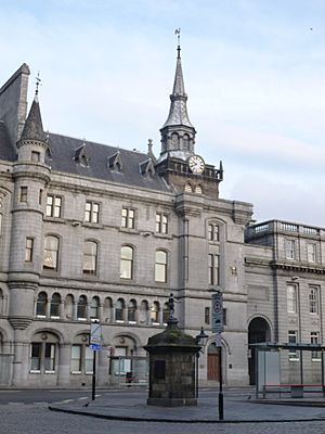
Castle Street And 2 Broad Street, Town House, Including Municipal Offices, Court Houses And Tolbooth | 57°08′53″N 2°05′41″W / 57.148071°N 2.094681°W | Category A | 19990 | ||||
Telephone Exchange 27-35 (Odd Nos) Bon Accord Street | 57°08′36″N 2°06′18″W / 57.143401°N 2.104931°W | Category B | 19997 | ||||
Queen's Cross, Queen Victoria Statue | 57°08′35″N 2°07′37″W / 57.143084°N 2.12694°W | Category B | 20011 | ||||
115-117 (Odd Numbers) Great Western Road, March Stone Number 4 | 57°08′19″N 2°07′06″W / 57.138494°N 2.118234°W | Category C(S) | 20017 | ||||
March Stone No. 7, At No. 3 Craigton Road | 57°07′54″N 2°08′17″W / 57.131583°N 2.138035°W | Category B | 20020 | ||||
March Stone No. 47 On North Side Of The Road Leading To Farm Of Westerton Of Auchmill And At The Bend North Of Marchburn Infant School | 57°10′14″N 2°10′00″W / 57.170562°N 2.166673°W | Category B | 20027 | ||||
55 Powis Terrace, March Stone No 57 | 57°09′36″N 2°06′51″W / 57.159886°N 2.114087°W | Category C(S) | 20037 | ||||
March Stone No. 58, In Front Garden Wall Of 21 Elmbank Terrace | 57°09′29″N 2°06′29″W / 57.158032°N 2.107964°W | Category B | 20038 | ||||
March Stone No. 64, On South Side Of School Road At Junction With Golf Road | 57°09′59″N 2°05′14″W / 57.166258°N 2.087254°W | Category B | 20044 | ||||
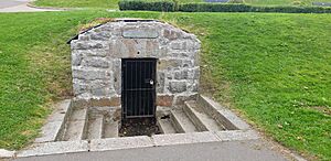
24 Albyn Place, St John's Well | 57°08′52″N 2°06′32″W / 57.147692°N 2.10876°W | Category C(S) | 20054 | ||||
Snow Churchyard College Bounds | 57°09′46″N 2°06′09″W / 57.162797°N 2.102506°W | Category B | 20064 | ||||
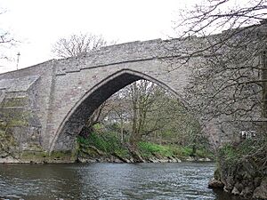
Brig O' Balgownie Over River Don | 57°10′38″N 2°05′55″W / 57.177245°N 2.098742°W | Category A | 20067 | ||||
Duthie Park, Fountainhall Cistern House | 57°07′43″N 2°06′15″W / 57.128724°N 2.104096°W | Category C(S) | 20080 | ||||
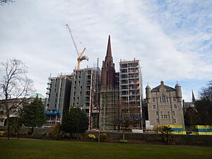
Carden Place And Albyn Place, Queen's Cross Church (Church Of Scotland), Including Gatepiers And Boundary Walls | 57°08′36″N 2°07′30″W / 57.143284°N 2.124958°W | Category A | 19948 | ||||
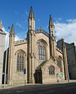
King Street, St Andrew's Cathedral (Episcopal) | 57°08′57″N 2°05′35″W / 57.149088°N 2.092981°W | Category A | 19953 | ||||
15 Back Wynd (Former West St Nicholas Church Parish Rooms) | 57°08′51″N 2°06′02″W / 57.147474°N 2.100497°W | Category C(S) | 19968 | ||||
20 Union Terrace | 57°08′48″N 2°06′16″W / 57.146725°N 2.104576°W | Category B | 19979 | ||||
5 York Street, Cam House, (Former Nursery School), Including Boundary Wall And Railings | 57°08′47″N 2°04′45″W / 57.146348°N 2.079258°W | Category C(S) | 46278 | ||||
17 Fonthill Road, Eastbank, Including Gatepiers And Boundary Walls | 57°08′13″N 2°06′29″W / 57.136859°N 2.108183°W | Category C(S) | 46475 | ||||
2-14 (Even Numbers) Fonthill Terrace, Including Gatepiers And Boundary Walls | 57°08′09″N 2°06′28″W / 57.135799°N 2.107751°W | Category B | 46477 | ||||
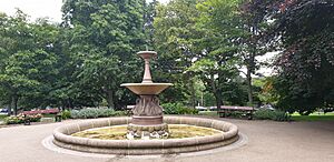
Duthie Park, Fountain | 57°07′47″N 2°06′04″W / 57.129849°N 2.101126°W | Category B | 46781 | ||||
32-36 (Even Numbers) Ferryhill Place, Including Gatepiers And Boundary Walls | 57°08′14″N 2°06′14″W / 57.137204°N 2.103955°W | Category B | 46788 | ||||
64 Fonthill Road And 73-75 (Odd Numbers) Albury Road | 57°08′14″N 2°06′34″W / 57.137316°N 2.109341°W | Category C(S) | 46790 | ||||
6 Berryden Road | 57°09′13″N 2°06′43″W / 57.153582°N 2.111918°W | Category C(S) | 46983 | ||||
82 Beechgrove Terrace, Ernan Lodge, Including Boundary Walls | 57°08′53″N 2°07′48″W / 57.148031°N 2.129949°W | Category C(S) | 46992 | ||||
Mid Stocket Road, Raeden Nursery Walled Garden | 57°09′02″N 2°08′35″W / 57.150667°N 2.143031°W | Category C(S) | 46995 | ||||
172-176 (Inclusive Numbers) And 178 Skene Street At Thistle Lane, Including Boundary Walls | 57°08′45″N 2°06′49″W / 57.145891°N 2.113696°W | Category C(S) | 47496 | ||||
21 Albyn Place, Albyn Hospital, Including Boundary Walls | 57°08′34″N 2°07′06″W / 57.142724°N 2.11828°W | Category C(S) | 47912 | ||||
67 King's Gate, Including Boundary Walls | 57°08′47″N 2°08′22″W / 57.146305°N 2.139445°W | Category C(S) | 47930 | ||||
Broomhill Road At Gray Street, Broomhill Primary School, Including Gates, Gatepiers, Boundary Walls, Railings And Lodge (88 Gray Street) | 57°07′55″N 2°07′27″W / 57.132047°N 2.124061°W | Category C(S) | 48513 | ||||
Union Grove At Holburn Street, 1-18 (Inclusive Numbers) Union Grove Court, Including Gatepiers And Boundary Walls | 57°08′30″N 2°06′48″W / 57.141579°N 2.113468°W | Category C(S) | 48523 |
Key
The scheme for classifying buildings in Scotland is:
- Category A: "buildings of national or international importance, either architectural or historic; or fine, little-altered examples of some particular period, style or building type."
- Category B: "buildings of regional or more than local importance; or major examples of some particular period, style or building type, which may have been altered."
- Category C: "buildings of local importance; lesser examples of any period, style, or building type, as originally constructed or moderately altered; and simple traditional buildings which group well with other listed buildings."
In March 2016 there were 47,288 listed buildings in Scotland. Of these, 8% were Category A, and 50% were Category B, with the remaining 42% being Category C.
See also
- List of listed buildings in Aberdeen
All content from Kiddle encyclopedia articles (including the article images and facts) can be freely used under Attribution-ShareAlike license, unless stated otherwise. Cite this article:
List of listed buildings in Aberdeen/4 Facts for Kids. Kiddle Encyclopedia.