List of national monuments in Munster facts for kids
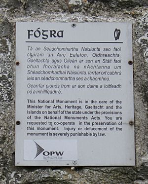
The Irish state has officially approved the following list of national monuments of Ireland. In Ireland, a structure or site may be deemed to be a "national monument", and therefore worthy of state protection, if it is of national importance. If the land adjoining the monument is essential to protect it, this land may also be protected.
Contents
National Monuments in Munster
Clare - Cork - Kerry - Limerick - Tipperary - Waterford |
This list is initially sorted by county. If the list is sorted under another heading, the county links above will take you to the first item from the county in the sorted list
NM# | Monument name | Description | Image | Townland | County | Location |
---|---|---|---|---|---|---|
11 | Corcomroe Abbey | Abbey (Cistercian) | Abbey West | 53°07′37″N 9°03′14″W / 53.126911°N 9.054013°W | ||
648 | Ballyallaban ringfort | Ringforts | Ballyallaban | 53°05′24″N 9°09′31″W / 53.09005°N 9.158578°W | ||
574 | Tau Cross (Cross Inneenboy) | Cross | Ballycashen, Roughan | 52°58′40″N 9°06′53″W / 52.977822°N 9.114703°W | ||
484 | Ballyhickey Wedge Tomb | Wedge Tomb | Ballyhickey | 52°50′04″N 8°51′20″W / 52.834306°N 8.855493°W | ||
591 | Brian Boru's Fort | Ringfort | Ballyvally | 52°49′08″N 8°27′06″W / 52.818908°N 8.451578°W | ||
478 | Bunratty Castle | Castle | Bunratty East | 52°41′48″N 8°48′42″W / 52.696667°N 8.811667°W | ||
466 | Caheraphuca Wedge Tomb | Wedge Tomb | Caheraphuca | 52°56′05″N 8°54′18″W / 52.934612°N 8.904909°W | ||
354 | Cahermacnaghten | Cashel | Cahermacnaghten | 53°02′45″N 9°11′54″W / 53.045964°N 9.198353°W | ||
195 | Canon Island Abbey | Abbey (Augustinian) | Canon Island | 52°40′44″N 9°02′13″W / 52.678981°N 9.036906°W | ||
197 | Clare Abbey | Abbey (Augustinian) | Clarecastle | 52°49′44″N 8°58′08″W / 52.828964°N 8.968881°W | ||
583 | Dromore Castle | Castle | Dromore (Ruan) | 52°55′31″N 8°57′46″W / 52.925269°N 8.962639°W | ||
204 | Drumcliff | Church & Round Tower | Drumcliff | 52°52′04″N 8°59′51″W / 52.8679°N 8.997506°W | ||
170 | Ennis Friary | Friary (Franciscan) | Ennis | 52°50′45″N 8°58′53″W / 52.845972°N 8.981381°W | ||
509 | Gleninagh Castle | Castle | Gleninagh North | 53°08′16″N 9°12′21″W / 53.137656°N 9.205919°W | ||
14 | Inchicronan Abbey | Abbey (Augustinian) | Inchicronan | 52°55′05″N 8°54′24″W / 52.917964°N 8.906675°W | ||
5 | Inishcaltra (Inis Cealtra) | Early Medieval Ecclesiastical Site | Mountshannon | 52°54′53″N 8°27′01″W / 52.914764°N 8.450144°W | ||
7 | Kilfenora | Church | Kilcarragh | 52°59′23″N 9°13′23″W / 52.9896°N 9.2231°W | ||
9 | Kilfenora Abbey | Friary (Franciscan) | Kilfenora | 52°59′27″N 9°13′05″W / 52.990959°N 9.218177°W | ||
8 | Kilfenora | Cathedral & Crosses | Kilfenora | 52°59′26″N 9°13′01″W / 52.9906°N 9.217003°W | ||
279 | St. Molua's Church | Church | Killaloe | 52°48′25″N 8°26′40″W / 52.806993°N 8.444308°W | ||
448 | Leamaneh Castle | Castle | Leamaneah North | 52°59′15″N 9°08′23″W / 52.987636°N 9.139847°W | ||
16 | Dysert O'Dea | Church, Round Tower & Cross | Mollaneen | 52°54′33″N 9°04′06″W / 52.909169°N 9.068394°W | ||
649 | Mooghaun | Hillfort | Mooghaun | 52°46′59″N 8°52′43″W / 52.78315°N 8.87869°W | ||
176 | Killone Abbey | Abbey (Augustinian) | Ennis | 52°48′22″N 9°00′15″W / 52.806228°N 9.004189°W | ||
12 | Oughtmama | Three Churches | Oughtmama | 53°07′01″N 9°02′19″W / 53.116857°N 9.038548°W | ||
17 | Ruan Church | Church | Portlecka | 52°55′41″N 8°59′24″W / 52.928125°N 8.989933°W | ||
632 | Poulnabrone | Portal Tomb | Poulnabrone | 53°02′55″N 9°08′24″W / 53.048696°N 9.140025°W | ||
15 | Quin Abbey | Friary (Franciscan) | Quin | 52°49′09″N 8°51′47″W / 52.8192°N 8.862956°W | ||
427 | Carrigaholt Castle | Castle | Carrigaholt | 52°36′00″N 9°41′58″W / 52.599947°N 9.699425°W | ||
10 | Scattery Island (Inis Cathaigh) | Early Medieval Ecclesiastical Site | Kilrush | 52°36′42″N 9°31′10″W / 52.611583°N 9.519336°W | ||
6 | St. Flannan's Cathedral | Church | Killaloe | 52°48′23″N 8°26′21″W / 52.8065°N 8.43925°W | ||
270 | Slievenaglasha Wedge Tomb | Wedge Tomb | Slievenaglasha | 53°01′02″N 9°03′06″W / 53.017331°N 9.051686°W | ||
13 | Temple Cronan | Church | Termon | 53°02′46″N 9°03′40″W / 53.046164°N 9.061109°W | ||
224 | Magh Adhair | Inauguration Site | Toonagh | 52°50′28″N 8°49′44″W / 52.841228°N 8.828881°W | ||
270 | Tullycommon Wedge Tomb | Wedge Tomb | Tullycommon | 53°01′32″N 9°03′31″W / 53.025496°N 9.058521°W | ||
270 | Cashlaungarr | Cashel | Tullycommon | 53°00′48″N 9°04′47″W / 53.013266°N 9.079670°W | ||
270 | Cahercommaun | Cashel | Carran | 53°00′52″N 9°04′14″W / 53.014575°N 9.070519°W | ||
645 | Altar Wedge Tomb | Wedge Tomb | Altar | 51°30′49″N 9°38′38″W / 51.51373°N 9.64398°W | ||
314 | Ardskeagh Church | Church | Ardskeagh (Fermoy barony) | 52°19′55″N 8°37′41″W / 52.331832°N 8.627986°W | ||
301 | Ballybeg | Dovecote | Ballybeg East | 52°13′13″N 8°40′11″W / 52.22023°N 8.66984°W | ||
301 | Ballybeg | Tower | Ballybeg West | 52°13′12″N 8°40′07″W / 52.21989°N 8.66851°W | ||
301 | Ballybeg Abbey | Friary (Augustinian) | Buttevant | 52°13′10″N 8°40′11″W / 52.21941°N 8.66976°W | ||
22 | Templekieran, Clear Island | Church & Cross inscribed pillar | Ballyieragh North | 51°26′27″N 9°30′22″W / 51.44070°N 9.50602°W | ||
425 | Ballinacarriga Castle | Castle | Dunmanway | 51°42′20″N 9°01′54″W / 51.70561°N 9.03175°W | ||
641 | Barryscourt Castle | Castle | Carrigtwohill | 51°54′17″N 8°15′34″W / 51.90462°N 8.25937°W | ||
594 | Blossomfort | Ringfort | Blossomfort | 52°09′41″N 8°45′15″W / 52.161504°N 8.754160°W | ||
558 | Glanworth | Medieval tower | Boherash | 52°11′21″N 8°21′20″W / 52.189069°N 8.355511°W | ||
558 | Glanworth Castle | Castle | Glanworth | 52°11′17″N 8°21′17″W / 52.18817°N 8.3547°W | ||
558 | Rock Abbey, Glanworth | Friary (Franciscan) | Boherash | 52°11′21″N 8°21′22″W / 52.18911°N 8.35625°W | ||
450 | Breeny More Stone Circle | Stone Circle & boulder burials | Breeny More | 51°44′32″N 9°22′30″W / 51.742145°N 9.375097°W | ||
202 | Buttevant Abbey | Friary (Franciscan) | Buttevant | 52°13′52″N 8°40′09″W / 52.23124°N 8.66909°W | ||
233 | Cahervagliar | Ringfort | Cappeen West | 51°47′35″N 8°59′49″W / 51.79310°N 8.99694°W | ||
660 | Carrigagulla | Stone Circle | Ballinagree | 52°00′01″N 8°54′59″W / 52.000410°N 8.916359°W | ||
255 | Carrigaphooca Castle | Castle | Carrigaphooca | 51°54′31″N 9°01′42″W / 51.90855°N 9.02847°W | ||
255 | Carrigaphooca stone circle | Stone Circle | Carrigaphooca | 51°54′35″N 9°01′30″W / 51.909610°N 9.024975°W | ||
656 | Castledonovan Castle | Castle | Castledonovan | 51°41′32″N 9°16′57″W / 51.69211°N 9.28259°W | ||
281 | Mallow Castle | Castle | Castlelands | 52°08′02″N 8°38′22″W / 52.13389°N 8.63945°W | ||
536 | Clodagh Standing Stones | Standing Stones - Pair | Clodagh, County Cork | 51°41′53″N 9°13′27″W / 51.69804°N 9.22428°W | ||
240 | Conna Castle | Castle | Conna | 52°05′40″N 8°06′06″W / 52.09454°N 8.10170°W | ||
592 | Carn Tierna | Hillfort & Cairn | Coolcarron (Fermoy) | 52°06′54″N 8°16′58″W / 52.114982°N 8.282754°W | ||
565 | Coolcoulaghta Standing Stones | Standing Stones - Pair | Coolcoulaghta | 51°35′48″N 9°32′36″W / 51.59669°N 9.54334°W | ||
395 | Coole Upper Churches | Two Churches | Coole Upper | 52°06′31″N 8°12′12″W / 52.10873°N 8.20338°W | ||
600 | Derryarkane Stone Circle | Stone Circle & Standing Stone | Derryarkane | 51°43′43″N 9°22′19″W / 51.72859°N 9.37206°W | ||
296 | Drishane Castle | Castle | Drishane More | 52°04′31″N 9°02′55″W / 52.07515°N 9.04849°W | ||
339 | Dromaneen Castle | Castle | Dromaneen | 52°07′35″N 8°43′50″W / 52.12636°N 8.73066°W | ||
381 | Drombeg | Circle, Hut Site & Fulacht Fiadh | Glandore | 51°33′52″N 9°05′13″W / 51.56455°N 9.08702°W | ||
169 | Sherkin Abbey | Friary (Franciscan) | Sherkin Island | 51°28′34″N 9°24′01″W / 51.47613°N 9.40022°W | ||
374 | Farranahineeny Stone Row | Stone Row | Farranahineeny | 51°47′42″N 9°08′20″W / 51.79494°N 9.13888°W | ||
284 | Knockdrum Stone Fort | Cashel | Farrandau | 51°31′36″N 9°11′37″W / 51.52653°N 9.19368°W | ||
426 | Ballycrovane Ogham Stone | Ogham Stone | Faunkill and the Woods | 51°42′47″N 9°56′41″W / 51.71315°N 9.94460°W | ||
535 | Charles Fort | Star-Shaped-Fort | Summer Cove | 51°41′47″N 8°29′56″W / 51.6965°N 8.499°W | ||
552 | Greenhill Ogham Stones | Ogham Stones | Greenhill | 52°04′40″N 8°36′25″W / 52.07782°N 8.60684°W | ||
502 | Island Wedge Tomb | Wedge Tomb | Island (Rahan) | 52°04′04″N 8°34′47″W / 52.067690°N 8.579607°W | ||
490 | Kilbolane Castle | Castle | Milford | 52°20′20″N 8°51′04″W / 52.339°N 8.851°W | ||
182 | Kilcrea Abbey | Friary (Franciscan) | Ovens | 51°51′54″N 8°42′41″W / 51.86498°N 8.71128°W | ||
316 | Kileenemer Church | Church | Killeenemer | 52°12′56″N 8°19′43″W / 52.21546°N 8.32850°W | ||
436 | Kilnaruane Carved Pillar Stone | Shaft of High Cross | Kilnaruane | 51°40′17″N 9°28′05″W / 51.67132°N 9.46799°W | ||
420 | Knocknakilla | Stone Circle | Macroom and Millstreet | 52°00′22″N 9°01′25″W / 52.00618°N 9.02355°W | ||
318 | Labbacallee wedge tomb | Wedge Tomb | Labbacallee | 52°10′27″N 8°20′04″W / 52.1741817°N 8.3345418°W | ||
18 | Labbamolaga Church | Church & Grave slabs | Labbamolaga Middle | 52°18′39″N 8°20′51″W / 52.31080°N 8.34761°W | ||
333 | Liscarroll Castle | Castle | Liscarroll | 52°15′40″N 8°48′12″W / 52.26108°N 8.80338°W | ||
571 | Lissacresig Stone Circle | Stone Circle | Lissacresig | 51°55′32″N 9°03′43″W / 51.92566°N 9.06189°W | ||
571 | Lissacresig Ringfort | Ringfort | Lissacresig | 51°55′28″N 9°03′21″W / 51.924359°N 9.055811°W | ||
Maughanasilly Stone Row | Stone Row | Maughanasilly | 51°46′14″N 9°23′11″W / 51.7706°N 9.3865°W | |||
411 | Castlelyons Friary | Friary (Carmelite) | Mohera | 52°05′21″N 8°14′01″W / 52.08918°N 8.23366°W | ||
525 | James Fort | Star-Shaped-Fort & Blockhouse | Castlepark | 51°41′55″N 8°30′44″W / 51.69856°N 8.51223°W | ||
517 | Kanturk Castle | Castle | Kanturk | 52°09′53″N 8°54′10″W / 52.16486°N 8.90277°W | ||
580 | Skeagh Cairn | Ring barrow & Cairn | Skeagh (Abbeystrowry) | 51°34′29″N 9°20′18″W / 51.574748°N 9.338447°W | ||
Mount Gabriel | Prehistoric copper mines | Mount Gabriel | 51°33′07″N 9°31′51″W / 51.551977°N 9.530854°W | |||
618 | Kinneigh Round Tower | Round Tower | Castletown-Kinneigh | 51°45′50″N 8°58′31″W / 51.76394°N 8.97539°W | ||
21 | Timoleague Abbey | Friary (Franciscan) | Timoleague | 51°38′35″N 8°45′49″W / 51.64302°N 8.76351°W | ||
360 | Desmond Castle or The French Prison, Kinsale | Tower House | Kinsale | 51°42′26″N 8°31′29″W / 51.70736°N 8.52484°W | ||
299 | Tullylease Church | Church & Grave Slabs | Tullylease | 52°19′00″N 8°56′23″W / 52.31669°N 8.93965°W | ||
634 | Michael Collins birth place | Site with historic associations | Woodfield (Kilkerranmore) | 51°37′00″N 8°58′50″W / 51.616551°N 8.980496°W | ||
286 | North Abbey, Youghal | Friary (Dominican) | Youghal | 51°57′27″N 7°51′16″W / 51.95744°N 7.85454°W | ||
56 | Annagh Church | Church | Annagh | 52°14′54″N 9°45′17″W / 52.248452°N 9.754696°W | ||
430 | Ardcanaght Stones | Ogham Stones | Ardcanaght | 52°10′10″N 9°43′35″W / 52.169473°N 9.726435°W | ||
54 | Ardfert Cathedral | Cathedral & 2 Churches | Ardfert | 52°19′44″N 9°46′54″W / 52.328801°N 9.781773°W | ||
358 | Ardfert Abbey | Friary (Franciscan) | Ardfert | 52°19′49″N 9°46′26″W / 52.330294°N 9.773911°W | ||
221.01 | Arraglen Ogham Stone | Ogham Stone | Arraglen (Corkaguiney Barony) | 52°15′28″N 10°14′55″W / 52.2578184°N 10.2484763°W | ||
355 | Gallaunmore | Standing stone | Ballineetig | 52°08′21″N 10°13′22″W / 52.139254°N 10.222848°W | ||
221.1416 | Ballinknockane | Burial ground & possible church | Ballinknockane (Kilquane civil parish) | 52°14′00″N 10°17′53″W / 52.233438°N 10.298012°W | ||
221.1416 | Ballinknockane | Hut sites | Ballinknockane (Kilquane civil parish) | 52°14′03″N 10°17′30″W / 52.234288°N 10.291654°W | ||
221.1416 | Ballinknockane | Hut site & souterrain | Ballinknockane (Kilquane civil parish) | 52°14′12″N 10°17′37″W / 52.236584°N 10.293559°W | ||
168 | Ballinskelligs Abbey | Priory (Augustinian) | Ballinskelligs | 51°48′55″N 10°16′18″W / 51.815318°N 10.271774°W | ||
64 | Ballintaggart Ogham Stones | Ogham Stones | Ballintaggart | 52°07′40″N 10°14′35″W / 52.127783°N 10.243178°W | ||
221 | Ballybowler North Ogham Stone | Ogham Stone | Ballybowler North | 52°10′36″N 10°13′21″W / 52.176767°N 10.222615°W | ||
364 | Ballymalis Castle | Castle | Ballymalis | 52°05′05″N 9°41′33″W / 52.084602°N 9.692596°W | ||
62 | Teampall Geal (St. Manchan's Oratory) | Early Medieval Ecclesiastical Site & ogham stone | Ballymorereagh | 52°09′16″N 10°19′53″W / 52.154517°N 10.331273°W | ||
221.0712 | Cathair na BhFionnúrach | Stone fort, huts & souterrain | Ballynavenooragh | 52°13′34″N 10°17′53″W / 52.226192°N 10.297974°W | ||
221.0712 | Ballynavenooragh | Stone fort & hut | Ballynavenooragh | 52°13′38″N 10°17′48″W / 52.227350°N 10.296693°W | ||
221.2425 | Cathair na gCat | Cashel & Ogham Stone | Ballywiheen | 52°09′22″N 10°24′27″W / 52.156188°N 10.407492°W | ||
221.2425 | Ballywiheen | Early Medieval Ecclesiastical Site | Ballywiheen | 52°09′32″N 10°24′25″W / 52.158809°N 10.406990°W | ||
380, 492 | Beenbane | Calluragh, hut sites, cross slab, enclosure, souterrain, cross, standing stones | Beenbane | 51°49′55″N 10°09′25″W / 51.831927°N 10.156948°W | ||
500 | Beginish house | Stone-built house | Beginish | 51°56′20″N 10°17′24″W / 51.938991°N 10.289963°W | ||
184 | Caherconree Fort | Promontory Fort (Inland) | Caherconree | 52°11′51″N 9°51′47″W / 52.197367°N 9.863012°W | ||
221.4748 | Caherdorgan North Cashel | Cashel | Caherdorgan North | 52°10′45″N 10°20′22″W / 52.179233°N 10.339492°W | ||
221.4748 | The Chancellor's House | Building - medieval | Caherdorgan North | 52°10′54″N 10°20′18″W / 52.181803°N 10.338227°W | ||
238 | Callanafersy (Lisgortnageragh) | Ringfort | Callanafersy West | 52°08′13″N 9°46′28″W / 52.136969°N 9.774545°W | ||
249 | Carrigafoyle Castle | Castle | Ballylongford | 52°34′12″N 9°29′39″W / 52.570048°N 9.494181°W | ||
59 | Church Island (Valentia Harbour) | Early Medieval Ecclesiastical Site | Beginish | 51°56′15″N 10°17′00″W / 51.937597°N 10.283343°W | ||
60 | Church Island (Lough Currane) | Early Medieval Ecclesiastical Site | Lough Currane | 51°50′07″N 10°07′49″W / 51.83516°N 10.1304°W | ||
228 | Cloghanecarhan | Ringfort & Ogham Stone | Cloghanecarhan | 51°53′18″N 10°11′02″W / 51.888380°N 10.183974°W | ||
385 | Dunloe Ogham Stones | Ogham Stones | Coolmagort | 52°03′36″N 9°38′05″W / 52.059967°N 9.634751°W | ||
346 | Darrynane Beg Ogham Stone | Ogham Stone | Derrynane | 51°45′51″N 10°07′19″W / 51.764121°N 10.121920°W | ||
221.45 | Doonmore | Promontory Fort | Doonsheane | 52°07′07″N 10°13′19″W / 52.118696°N 10.221967°W | ||
221.46 | Emlagh East Ogham Stone | Ogham Stone | Emlagh East (Dingle civil parish) | 52°07′54″N 10°13′00″W / 52.131659°N 10.216570°W | ||
391 | Emlagh East Cashel | Cashel | Emlagh East (Dingle civil parish) | 52°07′58″N 10°13′31″W / 52.132803°N 10.225341°W | ||
177 | Dunbeg Fort | Promontory Fort | Fahan | 52°06′12″N 10°24′31″W / 52.103408°N 10.408541°W | ||
65 | Gallarus Castle | Castle | Baile na nGall | 52°10′33″N 10°21′21″W / 52.175824°N 10.355942°W | ||
66 | Gallarus Oratory | Early Medieval Ecclesiastical Site | Baile na nGall | 52°10′22″N 10°20′58″W / 52.17271°N 10.34936°W | ||
64 | Garfinny | Cemetery | Garfinny | 52°08′53″N 10°14′03″W / 52.147965°N 10.234200°W | ||
612 | Garfinny Bridge | Bridge | Garfinny/Flemingstown | 52°08′59″N 10°13′38″W / 52.149802°N 10.227109°W | ||
156 | Cathair Sayer | Clochaun | Glanfahan | 52°06′00″N 10°26′17″W / 52.09992°N 10.43812°W | ||
156 | Cathair Martín | Clochaun | Glanfahan | 52°06′07″N 10°25′29″W / 52.101993°N 10.424610°W | ||
156 | Cathair Murphy | Clochaun | Glanfahan | 52°06′03″N 10°26′03″W / 52.10070°N 10.43427°W | ||
156 | Cathair Síleoid | Clochán | Glanfahan | |||
156 | Caher Conor | Cashel | Glanfahan | 52°06′06″N 10°25′17″W / 52.101705°N 10.421369°W | ||
221.33 | Glin North | Clochán & stone fort | Glin North | 52°10′52″N 10°16′53″W / 52.181148°N 10.281366°W | ||
221.34 | Glin North | Cashel | Glin North | 52°10′49″N 10°17′09″W / 52.180344°N 10.285700°W | ||
63 | Rinn an Chaisleáin | Church site | Great Blasket Island | 52°06′19″N 10°30′40″W / 52.105299°N 10.511022°W | ||
61 | Skellig Michael | Early Medieval Ecclesiastical Site | Great Skellig | 51°46′20″N 10°32′19″W / 51.772187°N 10.538701°W | ||
67 | Illauntannig | Early Medieval Ecclesiastical Site | Illauntannig | 52°19′34″N 10°01′12″W / 52.326209°N 10.019893°W | ||
63 | Inishtooskert | Early Medieval Ecclesiastical Site | Inishtooskert | 52°04′55″N 10°34′05″W / 52.082043°N 10.568069°W | ||
63 | Inishvickillane | Early Medieval Ecclesiastical Site | Inishvickillane | 52°02′39″N 10°36′31″W / 52.044036°N 10.608539°W | ||
183 | Innisfallen Abbey | Church, Oratory & Abbey (Benedictine) | Innisfallen Island | 52°02′48″N 9°33′15″W / 52.046577°N 9.554222°W | ||
329 | Kilcoolaght East ogham stones | Ogham Stones | Kilcoolaght East | 52°04′26″N 9°44′46″W / 52.073977°N 9.745985°W | ||
593 | Killelton Church | Church | Killelton | 52°13′41″N 9°52′26″W / 52.228188°N 9.873757°W | ||
65 | Kilmalkedar | Early Medieval Ecclesiastical Site | Kilmalkedar | 52°11′06″N 10°20′11″W / 52.184913°N 10.336476°W | ||
221.22 | Keelers' Stone | Bullaun Stone | Kilmalkedar | 52°11′08″N 10°20′18″W / 52.185523°N 10.338254°W | ||
221.23 | St. Brendan's Oratory | Church | Kilmalkedar | 52°11′05″N 10°20′11″W / 52.184798°N 10.336304°W | ||
227 | Cahergall | Cashel | Kimego West | 51°57′21″N 10°15′28″W / 51.955903°N 10.257801°W | ||
414 | Leacanabuaile | Cashel | Kimego West | 51°57′30″N 10°15′43″W / 51.958234°N 10.261858°W | ||
258 | Lislaughtin Abbey | Friary (Franciscan) | Lislaughtin | 52°33′27″N 9°28′12″W / 52.557472°N 9.470057°W | ||
260 | Listowel Castle | Castle | Listowel | 52°26′40″N 9°29′13″W / 52.44444°N 9.48700°W | ||
611 | Loher Cashel | Cashel | Loher | 51°47′10″N 10°09′56″W / 51.78604°N 10.16558°W | ||
221.02 | Maumanorig | Early Medieval Ecclesiastical Site | Maumanorig | 52°08′38″N 10°21′31″W / 52.143812°N 10.358662°W | ||
311 | Muckross Abbey | Friary (Franciscan) | Killarney National Park | 52°01′34″N 9°29′42″W / 52.026206°N 9.494901°W | ||
53 | Aghadoe | Early Medieval Ecclesiastical Site | Parkavonear | 52°04′36″N 9°33′16″W / 52.076745°N 9.554511°W | ||
236 | Parkavonear Castle | Castle | Parkavonear | 52°04′33″N 9°33′18″W / 52.075938°N 9.555020°W | ||
10001 | Illaunloughan | Early Medieval Ecclesiastical Site | Portmagee | 51°53′12″N 10°22′25″W / 51.88657°N 10.37354°W | ||
221.21 | Rahinnane Castle | Castle, Ringfort and Souterrain | Rahinnane | 52°08′35″N 10°22′59″W / 52.143153°N 10.383186°W | ||
57 | Ratass Church | Church & Ogham Stone | Ratass | 52°16′01″N 9°40′55″W / 52.267011°N 9.681834°W | ||
55 | Rattoo | Early Medieval Ecclesiastical Site | Rattoo | 52°26′33″N 9°39′00″W / 52.442473°N 9.64999°W | ||
519 | Reask | Early Medieval Ecclesiastical Site | Reask | 52°10′03″N 10°23′16″W / 52.167374°N 10.387698°W | ||
221.35 | Reenconnell | Early Medieval Ecclesiastical Site | Reenconnell | 52°11′07″N 10°18′11″W / 52.185339°N 10.302927°W | ||
534 | Ross Castle | Castle | Ross Island | 52°02′28″N 9°31′53″W / 52.04124°N 9.53147°W | ||
221.27 | Dún an Óir (Fort del Oro) | Promontory Fort | Smerwick | 52°11′27″N 10°24′52″W / 52.190926°N 10.414348°W | ||
143 | Staigue | Cashel | Sneem | 51°48′18″N 10°00′56″W / 51.805033°N 10.015565°W | ||
303 | Tonaknock Cross | Cross | Tonaknock | 52°22′59″N 9°41′54″W / 52.383012°N 9.698287°W | ||
295 | Tullygarran ogham stones | Two Ogham Stones | Tullygarran | 52°16′33″N 9°38′33″W / 52.275833°N 9.642500°W | ||
212 | Kilmallock Abbey | Friary (Dominican) | Abbeyfarm | 52°24′09″N 8°34′30″W / 52.402439°N 8.574891°W | ||
622 | Desmond Castle | Castle | Adare | 52°34′10″N 8°46′56″W / 52.569503°N 8.782221°W | ||
201 | Askeaton Castle | Castle | Askeaton | 52°36′00″N 8°58′26″W / 52.600064°N 8.974024°W | ||
625 | Ballylanders fort | Ringfort | Ballylanders | 52°22′51″N 8°21′09″W / 52.380727°N 8.352398°W | ||
247 | Lough Gur | Enclosure | Bruff | 52°30′51″N 8°32′31″W / 52.514301°N 8.541850°W | ||
247 | Lough Gur Tomb | Megalithic Tomb unclassified | Lough Gur | 52°30′31″N 8°31′55″W / 52.508474°N 8.532034°W | ||
85 | Mungret Churches | Three Churches | Baunacloka, Dromdarrig | 52°38′04″N 8°40′32″W / 52.634306°N 8.675514°W | ||
194 | Hospital Church | Church (Knights Hospitallers) | Barrysfarm | 52°28′34″N 8°25′57″W / 52.476226°N 8.432532°W | ||
83 | Dísert Óengusa | Early Medieval Hermitage | Carrigeen (Croom) | 52°31′15″N 8°44′41″W / 52.520925°N 8.744785°W | ||
636, 582 | Desmond Hall and Castle | Medieval Castle Complex | Newcastlewest | 52°27′00″N 9°03′42″W / 52.450045°N 9.061538°W | ||
84 | Clonkeen Church | Church | Clonkeen (Barrington) | 52°38′38″N 8°27′36″W / 52.643905°N 8.459916°W | ||
345 | Killeen Cowpark | Church | Cowpark | 52°36′29″N 8°53′38″W / 52.607967°N 8.893779°W | ||
663 | Cush Earthworks | Earthworks | Cush | 52°22′52″N 8°26′34″W / 52.381111°N 8.442778°W | ||
315 | Duntryleague passage tomb | Passage Tomb | Deerpark (Duntryleague) | 52°24′23″N 8°19′21″W / 52.406472°N 8.322376°W | ||
555 | Rathard | Ringfort | Garryheakin | 52°31′03″N 8°18′24″W / 52.517617°N 8.306650°W | ||
341 | Killulta Church | Church | Glennameade | 52°37′45″N 8°50′10″W / 52.629075°N 8.836006°W | ||
268 | Glenquin Castle | Castle | Killeedy | 52°23′02″N 9°06′25″W / 52.383904°N 9.106815°W | ||
247 | Lough Gur Stone Circle | Stone Circle (potential) | Lough Gur | 52°30′55″N 8°32′29″W / 52.515322°N 8.541526°W | ||
247 | Lough Gur Standing Stone | Standing Stone | Lough Gur | 52°31′02″N 8°32′23″W / 52.5171023°N 8.5396117°W | ||
247 | Grange stone circle | Embanked Stone Circle | Grange | 52°30′51″N 8°32′30″W / 52.514295°N 8.541803°W | ||
247 | The Spectacles | House sites & field system | Lough Gur | 52°31′26″N 8°31′17″W / 52.52379°N 8.52136°W | ||
247 | Crock Island | Crannóg | Grange | 52°31′12″N 8°32′16″W / 52.520055°N 8.537676°W | ||
247 | Lough Gur Megalithic Structure | Megalithic Structure | Lough Gur | |||
680 | Kilmallock Medieval House | Medieval House | Abbeyfarm (Kilmallock) | 52°24′02″N 8°34′23″W / 52.400583°N 8.573171°W | ||
408 | Collegiate Church of SS Peter & Paul | Church | Killmallock | 52°24′04″N 8°34′29″W / 52.40102°N 8.574652°W | ||
173 | King John's Castle | Castle | Kilmallock | 52°24′05″N 8°34′36″W / 52.401443°N 8.576541°W | ||
538 | Kilmihill Ringfort | Ringfort | Kilmihil (Ballingarry) | 52°27′31″N 8°50′49″W / 52.45864°N 8.84694°W | ||
247 | Lough Gur Cemetery | Cairn | Lough Gur | 52°30′39″N 8°31′39″W / 52.510857°N 8.527633°W | ||
247 | Lough Gur Ringfort | Ringfort | Lough Gur | |||
576 | De Valera's Cottage | House with historic associations | Knockmore | 52°26′01″N 8°39′25″W / 52.433680°N 8.656964°W | ||
86 | Killaliathan Church (Killagholehane church, Our Lady of the Snows) | Church | Lacka Lower | 52°19′54″N 8°58′38″W / 52.331801°N 8.977225°W | ||
366 | Kilrush Church | Church | Limerick | 52°39′39″N 8°39′19″W / 52.660882°N 8.655214°W | ||
288 | King John's Castle | Castle | Limerick | 52°40′11″N 8°37′32″W / 52.669786°N 8.625458°W | ||
383 | Fanning's Castle | Castle | Limerick (Creagh Lane) | 52°40′02″N 8°37′19″W / 52.667352°N 8.621961°W | ||
247 | Lough Gur House | Prehistoric House Site | Lough Gur | |||
247 | Lough Gur Wedge Tomb | Wedge Tomb | Lough Gur | |||
247 | Knockadoon | Prehistoric Habitation | Lough Gur | |||
247 | Carraig Aille | Enclosure | Lough Gur | |||
247 | Lough Gur Cemetery Mound | Cemetery Mound | Lough Gur | |||
247 | Leagun | Standing Stone | Lough Gur | |||
185 | Askeaton Abbey | Friary (Franciscan) | Moig South | 52°36′14″N 8°58′31″W / 52.60398°N 8.975381°W | ||
171 | Monasteranenagh Abbey | Abbey (Cistercian) | Monaster South | 52°31′01″N 8°39′46″W / 52.516914°N 8.662689°W | ||
459 | Ardagh Fort | Ringfort | Reerasta South | 52°29′37″N 9°04′05″W / 52.493636°N 9.068108°W | ||
378 | Lackeen Castle | Castle | Abbeville | 53°05′18″N 8°04′26″W / 53.0884°N 8.0738°W | ||
124 | Ahenny High Crosses | High Crosses | Ahenny | 52°24′45″N 7°23′36″W / 52.41246°N 7.39339°W | ||
396 | St. Berrihert's Kyle | Crosses & Inscribed Slabs | Ardane | 52°24′37″N 8°04′38″W / 52.41021°N 8.07734°W | ||
604 | Ardcroney Burial Mound | Burial Mound (Cist) | Ardcroney | 52°56′17″N 8°09′26″W / 52.93818°N 8.15725°W | ||
573 | Ashleypark Burial Mound | Burial Moundy (Cist) | Ashleypark | 52°56′02″N 8°11′20″W / 52.933858°N 8.188848°W | ||
120 | Athassel Abbey | Priory (Augustinian) | Cashel | 52°28′46″N 7°59′01″W / 52.479444°N 7.983611°W | ||
581 | Ballycomisk Ringforts | Three Ringforts | Ballycomisk | 52°29′22″N 7°50′27″W / 52.489523°N 7.840805°W | ||
659 | Ballingarry Warhouse | House with historical associations | Farranrory Upper | 52°37′09″N 7°31′22″W / 52.619273°N 7.522898°W | ||
234 | Ballynahow Castle | Castle | Ballynahow | 52°41′35″N 7°52′41″W / 52.693070°N 7.878118°W | ||
123 | Ballynoran Church | Church | Ballynoran | 52°21′20″N 7°29′24″W / 52.355605°N 7.490105°W | ||
370 | Burncourt Castle | Castle or fortified house | Burncourt | 52°18′55″N 8°04′14″W / 52.31521°N 8.07049°W | ||
595 | Cahir Abbey | Priory (Augustinian) | Caherabbey Upper | 52°22′45″N 7°55′43″W / 52.379263°N 7.928563°W | ||
507 | Cahir Castle | Castle | Townparks | 52°22′28″N 7°55′38″W / 52.374571°N 7.927254°W | ||
577 | Cahir Castle Cottage | Cahir Castle Cottage | Townparks | 52°22′26″N 7°55′38″W / 52.374018°N 7.927183°W | ||
647 | Swiss Cottage | Cottage | Kilcommon Beg | 52°21′26″N 7°55′25″W / 52.35729°N 7.92355°W | ||
447 | Carrick-on-Suir Castle | Castle | Carrick-on-Suir | 52°20′42″N 7°24′25″W / 52.345084°N 7.406971°W | ||
537 | Rathanadav | Ringfort | Carron (St. Johnbaptist) | 52°28′32″N 7°53′16″W / 52.475425°N 7.887863°W | ||
550 | Carron fort | Ringfort | Carron (Tipperary town) | 52°29′37″N 8°10′48″W / 52.493514°N 8.179885°W | ||
127 | Hore Abbey | Abbey (Cistercian) | Cashel | 52°31′07″N 7°53′52″W / 52.5186°N 7.897893°W | ||
128 | Rock of Cashel | Ecclesiastical site | Cashel | 52°31′12″N 7°53′25″W / 52.51995°N 7.890288°W | ||
667 | Clonmel Main Guard | Courthouse | Burgagery-Lands West | 52°21′11″N 7°42′05″W / 52.35298°N 7.70139°W | ||
353 | Timoney Hills Standing Stones | Standing Stones | Cullaun, Timenyhills, Timoney | 52°54′01″N 7°43′12″W / 52.900309°N 7.720127°W | ||
533 | Derryvella | Early Medieval Ecclesiastical Site | Derryvella | 52°37′05″N 7°40′09″W / 52.617944°N 7.669056°W | ||
193 | St. Dominic's Abbey | Abbey (Dominican) | St. Dominick's Abbey | 52°31′05″N 7°53′16″W / 52.518066°N 7.887777°W | ||
122 | Donaghmore Church | Church | Donaghmore | 52°24′47″N 7°43′29″W / 52.412987°N 7.724840°W | ||
407 | Grallagh Castle | Castle & Bawn | Grallagh (Graystown) | 52°35′41″N 7°46′16″W / 52.594772°N 7.771243°W | ||
121 | Holy Cross Abbey | Abbey (Cistercian) (part of) | Holycross | 52°38′22″N 7°52′05″W / 52.63933°N 7.86813°W | ||
654 | Kilcash Church | Church & graveyard | Kilcash | 52°23′50″N 7°31′24″W / 52.397176°N 7.523361°W | ||
654 | Kilcash Castle | Castle | Kilcash | 52°23′50″N 7°31′16″W / 52.397326°N 7.521244°W | ||
218 | Kilcooly Abbey | Abbey (Cistercian) | Kilcoolyabbey | 52°40′15″N 7°34′16″W / 52.670731°N 7.571237°W | ||
584 | Knockgraffon | Motte & Bailey | Knockgraffon | 52°24′44″N 7°55′59″W / 52.412111°N 7.933144°W | ||
266 | Liathmore Churches | Two Churches | Leigh | 52°40′12″N 7°40′07″W / 52.66990°N 7.66866°W | ||
348 | Lismacrory Mounds | Mounds | Lismacrory | 53°02′16″N 8°01′54″W / 53.037717°N 8.031574°W | ||
524 | Longstone Rath | Standing Stone & prehistoric earthworks | Longstone | 52°30′22″N 8°17′52″W / 52.506051°N 8.297753°W | ||
673 | Lorrha Church | Church & two crosses | Lorrha | 53°05′30″N 8°07′13″W / 53.091572°N 8.120249°W | ||
357 | Lorrha Priory | Priory (Augustinian) | Lorrha | 53°05′31″N 8°07′17″W / 53.092012°N 8.121414°W | ||
361 | Lorrha Friary | Friary (Dominican) | Lorrha | 53°05′28″N 8°07′34″W / 53.091081°N 8.126113°W | ||
335 | Derrynaflan Church | Church & Early Medieval Ecclesiastical site | Lurgoe | 52°35′50″N 7°44′02″W / 52.597315°N 7.733829°W | ||
125 | Monaincha Church | Church & Cross | Monaincha | 52°56′47″N 7°44′53″W / 52.946321°N 7.74795°W | ||
292 | Moor Abbey | Friary (Franciscan) | Moorabbey | 52°24′09″N 8°16′42″W / 52.402466°N 8.278207°W | ||
513 | Nenagh Castle | Castle | Nenagh | 52°51′54″N 8°11′53″W / 52.865014°N 8.198154°W | ||
Roscrea Friary | Friary (Franciscan) | Roscrea | 52°57′09″N 7°47′59″W / 52.952579°N 7.799620°W | |||
451 | Portland Church | Church | Portland | 53°05′24″N 8°10′32″W / 53.090070°N 8.175483°W | ||
126 | Roscrea Church | Church, Round Tower, High Cross & Mill | Roscrea | 52°57′20″N 7°47′45″W / 52.955606°N 7.795717°W | ||
211 | Roscrea Castle | Castle | Roscrea | 52°57′19″N 7°47′53″W / 52.9553°N 7.7980°W | ||
548 | Shrough Passage Tomb | Passage Tomb | Shrough | 52°25′37″N 8°13′58″W / 52.426943°N 8.232823°W | ||
363 | Terryglass Castle | Castle | Terryglass | 53°03′34″N 8°12′43″W / 53.059364°N 8.211910°W | ||
332 | Toureen Peakaun | Church, Crosses & Slabs | Toureen | 52°24′32″N 7°59′36″W / 52.408754°N 7.993235°W | ||
131 | Ardmore Cathedral | Cathedral, Round Tower & Oratory | Ardocheasty | 51°56′56″N 7°43′34″W / 51.948782°N 7.72606°W | ||
384 | Ballynageeragh Portal Tomb | Portal Tomb | Ballynageeragh | 52°10′40″N 7°16′37″W / 52.177695°N 7.276892°W | ||
330 | Kiltera Ogham Stones | Ogham Stones | Dromore | 52°04′28″N 7°50′56″W / 52.074442°N 7.848787°W | ||
154 | Drumlohan Souterrain and Ogham Stones | Souterrain & Ogham Stones | Drumlohan | 52°09′48″N 7°27′55″W / 52.163319°N 7.465368°W | ||
569 | Dungarvan Castle | Castle | Dungarvan | 52°05′21″N 7°36′58″W / 52.089277°N 7.616229°W | ||
398 | Gaulstown Portal Tomb | Portal Tomb | Gaulstown | 52°12′21″N 7°12′38″W / 52.205853°N 7.210504°W | ||
421 | Knockeen Portal Tomb | Portal Tomb | Knockeen | 52°12′26″N 7°09′34″W / 52.2072°N 7.1595°W | ||
237 | Matthewstown Passage Tomb | Passage Tomb | Matthewstown | 52°10′33″N 7°13′38″W / 52.175879°N 7.227260°W | ||
132 | Mothel Abbey | Priory (Augustinian) | Mothel | 52°17′54″N 7°25′07″W / 52.298456°N 7.418558°W | ||
671 | Double Tower | Town Defences | Waterford | 52°15′23″N 7°06′43″W / 52.256421°N 7.111968°W | ||
661 | Reginald's Tower | Town Defences | Waterford | 52°15′38″N 7°06′19″W / 52.26048°N 7.10541°W | ||
205 | French Church, Waterford | Friary Church (Franciscan) | Waterford | 52°15′38″N 7°06′24″W / 52.260471°N 7.10662°W |
See also
All content from Kiddle encyclopedia articles (including the article images and facts) can be freely used under Attribution-ShareAlike license, unless stated otherwise. Cite this article:
List of national monuments in Munster Facts for Kids. Kiddle Encyclopedia.