
List of rivers of Wiltshire facts for kids
Wiltshire is a county in England, known for its beautiful countryside and ancient sites like Stonehenge. It's also home to many rivers and waterways. These rivers are super important! They provide homes for wildlife and are used by people for fun activities.
This article explores the main rivers that flow through Wiltshire. Some flow west towards the Bristol Channel, others east towards the North Sea, and some south towards the English Channel. Besides natural rivers, the Kennet and Avon Canal also crosses the county, connecting different waterways.
Contents
Wiltshire's Main Rivers
Wiltshire has three very important rivers. They are the River Avon (Bristol), the River Avon (Hampshire), and the River Thames. Let's learn more about them!
River Avon (Bristol)
The Bristol Avon is one of the two rivers named Avon in Wiltshire. It starts near a village called Acton Turville. From there, it flows through towns like Chippenham and Bath. Eventually, it reaches the city of Bristol. The river then joins the Severn Estuary, which leads to the Atlantic Ocean. This river is important for shipping and has a rich history.
River Avon (Hampshire)
The Hampshire Avon is the other River Avon in Wiltshire. It begins near Pewsey in Wiltshire. This river flows south through the famous city of Salisbury. It then continues into the county of Hampshire. Finally, it reaches the English Channel at Mudeford in Dorset. This river is well-known for its clear waters and is a great place for fishing.
River Thames
The River Thames is perhaps the most famous river in England! It enters Wiltshire near Ashton Keynes. While it doesn't flow through many big towns in Wiltshire, it's a very important part of the county's water system. The Thames continues its long journey through many counties. It eventually flows through London before reaching the North Sea.
Other Important Waterways
Besides the three main rivers, many other smaller rivers and streams flow through Wiltshire. They all play a part in the county's natural beauty and ecosystems.
The Kennet and Avon Canal
The Kennet and Avon Canal is not a natural river, but a man-made waterway. It was built a long time ago to connect the River Kennet in Reading with the River Avon in Bristol. This canal crosses Wiltshire, allowing boats to travel across the country. It's now a popular spot for walking, cycling, and boating.
Smaller Rivers and Brooks
Many smaller rivers and brooks also flow through Wiltshire. Each one has its own unique path and helps to shape the landscape. For example:
- The River Biss flows into the Bristol Avon.
- The River Kennet starts near Silbury Hill, a famous ancient site, and joins the River Thames.
- The River Nadder joins the Hampshire Avon in Salisbury.
- The River Wylye also joins the Nadder.
These smaller waterways are home to lots of different plants and animals. They are vital for the health of the environment in Wiltshire.
Images for kids
-
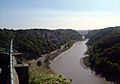
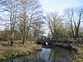
The Bristol Avon flowing through the Avon Gorge.
-
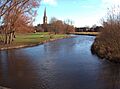
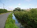
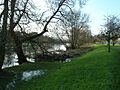
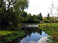
The Hampshire Avon at Salisbury.
-
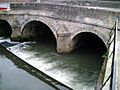
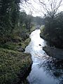
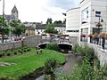
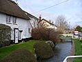
The River Biss in Trowbridge.
-
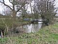
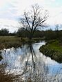
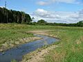
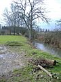
The River Blackwater.
-
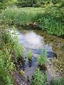
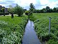
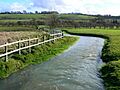
A chalkstream, like the River Bourne.
-
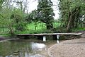
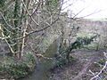
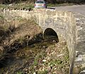
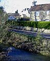
Broadmead Brook with a clapper bridge.
-
Brinkworth Brook.
-
The Bybrook River.
-
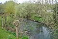
Bydemill Brook.
-
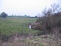
River Chalke and adjoining fish farm between Mead End, Bowerchalke and Broad Chalke.
-
Cocklemore Brook.
-
The River Cole.
-
Doncombe Brook.
-
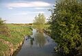
The River Dun near Hungerford.
-
The River Dun near Dunbridge.
-
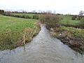
The River Ebble.
-
Gauze Brook.
-
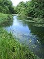
The River Kennet.
-
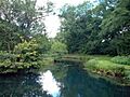
The River Key.
-
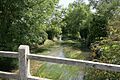
Lambrok Stream.
-
The River Marden.
-
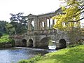
The River Nadder at Wilton House.
-
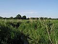
The Nine Mile River.
-
The River Og.
-
The River Ray.
-
Semington Brook.
-
The River Stour.
-
Summerham Brook.
-
Swill Brook.
-
The Tetbury Avon.
-
The River Till.
-
The River Wylye.


