Mattawana, Pennsylvania facts for kids
Quick facts for kids
Mattawana, Pennsylvania
|
|
|---|---|

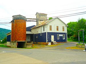
Feed mill
|
|
| Country | United States |
| State | Pennsylvania |
| County | Mifflin |
| Area | |
| • Total | 0.78 sq mi (2.03 km2) |
| • Land | 0.78 sq mi (2.02 km2) |
| • Water | 0.00 sq mi (0.00 km2) |
| Population
(2020)
|
|
| • Total | 193 |
| • Density | 247.12/sq mi (95.37/km2) |
| Time zone | UTC-5 (Eastern (EST)) |
| • Summer (DST) | UTC-4 (EDT) |
| FIPS code | 42-48072 |
Mattawana is a small community in Pennsylvania, United States. It's known as a census-designated place, which means it's an area identified by the government for gathering population information, but it doesn't have its own local government like a city or town. In 2020, about 193 people lived there.
About Mattawana
Mattawana is located in Bratton Township, which is part of Mifflin County. It sits on the east side of the Juniata River.
Where is Mattawana?
This community is found near where two main roads meet: U.S. Route 522 and Pennsylvania Route 103. If you cross the river from Mattawana, you'll find the borough of McVeytown.
What Does the Name Mean?
The name "Mattawana" comes from a Native American language. It is believed to mean either "river of shallows" or "place of fine furs." This suggests the area might have had shallow parts in the river or was a good spot for hunting animals with valuable fur long ago.
See also
 In Spanish: Mattawana para niños
 | William Lucy |
 | Charles Hayes |
 | Cleveland Robinson |

