Mayo River (Mexico) facts for kids
Quick facts for kids Mayo River |
|
|---|---|

Mayo River
|
|
|
Location of mouth
|
|
| Other name(s) | Rio Mayo en Mesa Colorada |
| Country | Mexico |
| State | Sonora |
| Physical characteristics | |
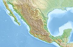
| River mouth | Gulf of California 26°43′48″N 109°47′32″W / 26.7301°N 109.7921°W |
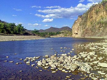
The Mayo River is an important river located in the Mexican state of Sonora. It flows through a beautiful region and plays a big role in the lives of people living nearby. This river helps with farming and provides electricity for many homes. The Mayo River eventually flows into the Gulf of California.
Contents
Where is the Mayo River?
The Mayo River is found in the northwestern part of Mexico. It runs through the state of Sonora, which is known for its warm climate. The river's path takes it through different landscapes. It supports the land it flows through.
The Adolfo Ruiz Cortines Dam
A very important structure on the Mayo River is the Adolfo Ruiz Cortines Dam. This dam is located about 30 kilometers (about 18 miles) east of the city of Navojoa. Navojoa is in the municipality of Álamos.
What does the dam do?
The Adolfo Ruiz Cortines Dam has two main jobs. First, it helps to generate electricity. This means it uses the power of the flowing water to create energy for homes and businesses. Second, it helps to irrigate farms in the Mayo Valley. Irrigation is when water is supplied to crops, helping them grow in dry areas. This makes farming possible and successful in the region.
Who was Adolfo Ruiz Cortines?
The dam is named after Adolfo Ruiz Cortines, who was a president of Mexico. A president is the leader of a country's government. He served as president from 1952 to 1958. Naming the dam after him honors his contributions to the country.
Why is the Mayo River Important?
The Mayo River is vital for the people and the environment in Sonora. It provides a steady source of water for agriculture. This allows farmers to grow many different crops. The electricity generated by the dam also powers homes and industries. This helps the economy of the region. The river also supports various plants and animals that live in and around its waters.
See also
 In Spanish: Río Mayo (México) para niños
- List of longest rivers of Mexico


