Munigua facts for kids
|
Municipium Flavium Muniguense
|
|

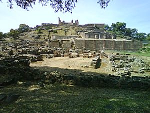
Eastern slope of the site with private and public buildings
|
|
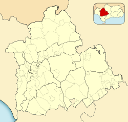
| Location | Villanueva del Río y Minas, Province of Seville, Spain |
|---|---|
| Coordinates | 37°42′47.3″N 5°44′26.17″W / 37.713139°N 5.7406028°W |
Munigua is the site of an ancient Roman city once called Municipium Flavium Muniguense. It is located about 8 kilometers from Villanueva del Río y Minas in the province of Seville, Spain. People lived here even before the Romans arrived. The city was most important between the 1st and 3rd centuries AD.
Today, you can still see many parts of this old city. It is protected as a Historical Artistic Monument because of its importance.
Contents
History of Munigua
Munigua was built in a place rich in copper and iron. Mining these metals was very important for the city's growth.
Early Settlements
The oldest pottery found at Munigua dates back to the 7th century BC. This pottery was made by the Punic people. Before the Romans, an Iberian settlement was located on top of the hill.
During the 1st century BC and early 1st century AD, mining was active in areas that later became the city's hot springs, forum, and some houses.
Roman Development
Many of the buildings you see today were built during the time of Emperor Augustus. However, most of the public and religious buildings were constructed later. This building boom happened in the late 1st century AD. At this time, Emperor Vespasian gave Munigua the special status of a municipium. This meant it had its own local government.
Around 70 AD, buildings near the top of the hill were taken down. This made space for the impressive Terrace Sanctuary. The city's public baths were updated when the Forum was built at the end of the 1st century.
City Life and Decline
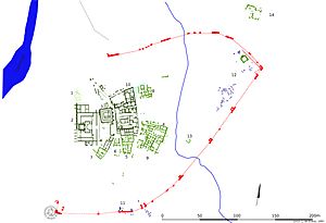
Several houses, like Houses 1, 5, and 6, were built between the late 1st and early 2nd centuries. These houses were near the baths street. House 2 was also built around this time. Houses 1, 2, and 6 likely belonged to important local families. This was because they were close to the city's main administrative and religious centers.
The city walls of Munigua were built in the late 2nd century AD. However, they were already falling apart by the 3rd century. The walls were never fully finished, and the western side remained open. Their design was unusual because they included some tombs from the nearby burial grounds.
At the end of the 3rd century, a powerful earthquake hit Munigua. This damaged houses, the Forum, and a two-story walkway. This event marked the beginning of the city's decline.
Many ancient Greco-Roman sculptures have been found here. Archaeologists have also discovered many pieces of Greek, Roman, Iberian, and Arab pottery.
Exploring the Archaeological Site
When you visit Munigua, you can see many fascinating remains of the ancient city.
Main Structures
Some of the most important parts of the site include:
- The city walls
- The Terrace Sanctuary, a special religious area
- The Temple of the Podium, a temple built on a raised platform
- The two-story Portico, a covered walkway
- The Temple of Mercury, dedicated to the Roman god Mercury
- The Forum, the city's main public square
- The thermal baths, where people went to wash and relax
- Several ancient houses
Ancient Mines
Recently, archaeologists found a large Roman copper mine at Munigua. This mine was built on top of an even older mine from around 2000 BC. The older mine was started by the Turdetani people. This huge mining system included tunnels that were connected and ventilated. It also had very deep shafts.
Images for kids
See also
 In Spanish: Munigua para niños
 | Sharif Bey |
 | Hale Woodruff |
 | Richmond Barthé |
 | Purvis Young |


