
National Parks of Ukraine facts for kids
National nature parks in Ukraine are special places where nature is protected. They are part of Ukraine's Nature-Preservation Fund. These parks cover a huge area, about 1,111,600 hectares (that's like 11,116 square kilometers!).
The biggest national park is Upper Pobozhia in Khmelnytskyi Oblast, which is over 100,000 hectares. The smallest is Derman-Ostroh National Nature Park, at less than 5,500 hectares. Most of these parks were created after the Soviet Union ended, especially in western Ukraine.
Contents
What Makes National Parks Special?
National nature parks are like giant outdoor classrooms and safe havens for plants and animals. They protect different types of landscapes, from tall mountains and deep forests to wide rivers and sandy beaches. These parks help keep nature healthy and offer amazing places for people to visit and learn.
Why Are They Important?
These parks are super important for many reasons:
- Protecting Wildlife: They provide safe homes for many animals, including rare birds, fish, and mammals.
- Saving Plants: They protect unique forests, flowers, and other plants that might not survive elsewhere.
- Clean Air and Water: Healthy natural areas help keep our air clean and our water pure.
- Learning and Fun: They offer places for people to hike, explore, and learn about nature. Many parks have trails and visitor centers.
- Studying Nature: Scientists can study how ecosystems work in these protected areas.
Discovering Ukraine's Amazing Parks
Ukraine has many different national nature parks, each with its own special features. Let's explore a few of them!
Carpathian National Nature Park

The Carpathian park was Ukraine's very first national park, created in 1980. It's also one of the largest! Located in Ivano-Frankivsk Oblast, this park protects the stunning Carpathian Mountains. Imagine tall peaks, green valleys, and ancient forests – it's a perfect place for adventure and enjoying mountain views.
Azov-Syvash National Nature Park

Down south, in Kherson Oblast, you'll find Azov-Syvash. This park is on Byriuchyi Island in the northwestern Azov Sea. It's a super important spot for birds! Over a million birds visit here every year during their long migrations. It's like a busy airport for birds, helping them rest and find food on their journey.
Dniester Canyon National Nature Park

In Ternopil Oblast, the Dniester Canyon follows Ukraine's largest canyon along the Dniester River. This park protects a beautiful area of forests and steppes. It's famous for its amazing rock formations and even has some of the longest caves in the world! It's a great place to see unique geology.
Dzharylhak National Nature Park

If you love beaches, then Dzharylhak in Kherson Oblast is for you! This park covers Dzharylhach Island, which is the biggest island in the Black Sea. It's known for its clean sandy beaches and natural springs. Parts of this island have been protected for nearly 100 years, showing how special it is.
Holy Mountains National Nature Park

In Eastern Ukraine, in Donetsk Oblast, is the Holy Mountains park. It's located along the chalk cliffs and riverbanks of the Donets River. This park is a mix of beautiful forests and important historical sites. It's a place where nature and history come together.
Shatsky National Natural Park

The Shatsky park in Volyn Oblast was created in 1983. Its goal is to protect and restore the natural beauty of the Volyn Polissia region. It's a wonderful place with many lakes and wetlands, perfect for enjoying peaceful nature.
Podilski Tovtry National Nature Park

One of the largest parks, Podilski Tovtry, is in Khmelnytskyi Oblast. It was established in 2015 and shows off the amazing natural landscape of the Podillia region. It's a vast area with diverse natural beauty.
Oleshky Sands National Nature Park

Did you know Ukraine has a desert? The Oleshky park in Kherson Oblast protects a unique sandy area. It's a fascinating place that feels very different from the usual forests and mountains, showing how diverse Ukraine's nature can be.
Images for kids
-
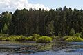
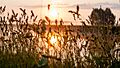
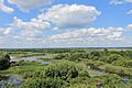
Morning beauty of the Southern Bug River in Buzk's Gard National Nature Park.
-
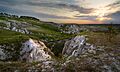
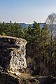
Dramatic cliffs at Charming Harbor National Nature Park.
-
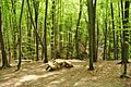
Children enjoying nature in Cheremosh National Nature Park.
-
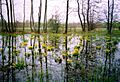
The peaceful surroundings of Derman-Ostroh National Nature Park.
-
Pine forest along the Desna River in Desna-Starogutsky National Nature Park.
-
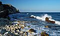
Sunrise over the chalk slopes in Dvorichanskyi National Nature Park.
-
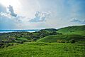
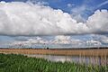
The vast Great Meadow National Nature Park.
-
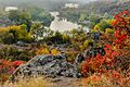
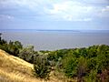
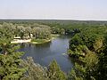
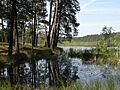
Left bank of Burshtyn Reservoir in Halych National Nature Park.
-
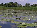
White lilies on the Vorskla River in Hetman National Nature Park.
-
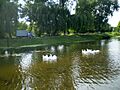
Orihuvat Pond in Holosiivskyi National Nature Park.
-
Homolsh Woods National Nature Park.
-
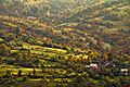
Autumn in Usteriky, Hutsulshchyna National Park.
-
A scenic view in Ichnya National Nature Park.
-
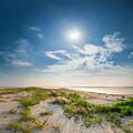
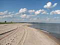
The Kinburn sandbar in Ivory Coast of Sviatoslav National Nature Park.
-
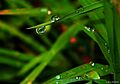
A morning dew drop in Karmelyukove Podillya.
-
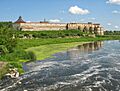
Khotyn Fortress within Khotyn National Nature Park.
-
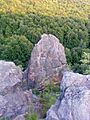
Maiden Rocks in Kremenets Mountains National Nature Park.
-
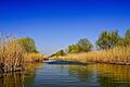
Labyrinths of the Dniester and Turunchuk rivers in Lower Dniester National Nature Park.
-
Holy Lake in Lower Polissia National Nature Park.
-

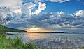
Sunrise in a field in Lower Sula National Nature Park.
-
Meotida National Nature Park, Kryva Kosa.
-
Mezynsky National Nature Park, Desna River at sunrise.
-
Olesko Pond in Northern Podillya National Nature Park.
-
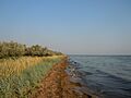
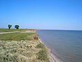
Coastline near Novopetrivka village in Pryazovskyi National Nature Park.
-
Frontline Nobel Lake in Prypiat-Stokhid National Nature Park.
-
Great Cliff, Uday floodplain in Pyryatyn National Nature Park.
-
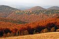
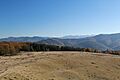
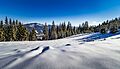
Autumn in Skole Beskids National Nature Park.
-
Sunrise over the swamp in Sloboda National Nature Park.
-
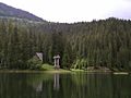
Lake Synevir in Synevir National Nature Park.
-
Synyohora National Nature Park.
-
Tsumanska Puscha National Nature Park.
-
Alibey Lagoon in Tuzly Lagoons National Nature Park.
-
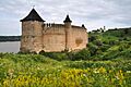
Medzyboz Castle, near Upper Pobuzhia National Nature Park.
-
Uzhanskyi National Nature Park.
-
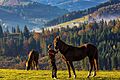
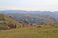
Mountain meadow near Dzembronia in Verkhovyna National Nature Park.
-
Vyzhnytsia National Nature Park.
-
White Lake National Nature Park.
-
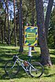
Path in the Yavoriv National Park.
-
Enchanted Valley in Zacharovany Krai National Nature Park.
-
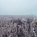
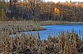
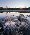
Frozen field in Zalissya National Nature Park.


See also
 In Spanish: Anexo:Parques naturales nacionales de Ucrania para niños
- Lists of Nature Reserves of Ukraine
- Nature park
- Categories of protected areas of Ukraine
