National Register of Historic Places listings in Allamakee County, Iowa facts for kids
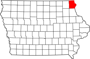
Welcome to Allamakee County, Iowa! This special place is home to many buildings, sites, and objects that are important to history. They are so important that they are listed on the National Register of Historic Places. This is like a special list kept by the United States government. When a place is on this list, it means it's worth protecting and learning about because of its history, architecture, or what it tells us about the past.
In Allamakee County, there are 22 different places on this list. Let's explore some of them!
Contents
Historic Buildings in Waukon
Waukon is a city in Allamakee County with several historic buildings.
Allamakee County Courthouses
Waukon has two courthouses that are on the historic list.
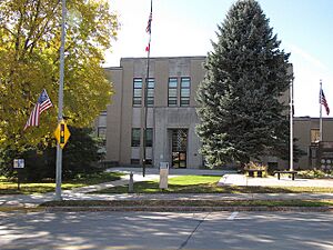
- The Allamakee County Court House at 110 Allamakee Street was added to the list in 2003. This is the newer courthouse.
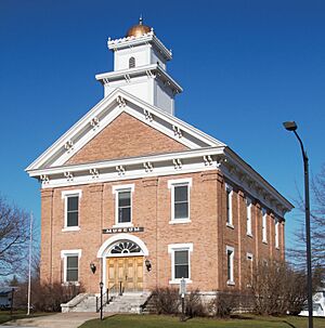
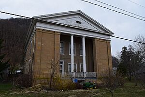
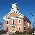
- The Old Allamakee County Courthouse at 107 Allamakee Street was listed in 1977. This older building now serves as the Allamakee County Historical Museum. It's cool to see how buildings change their purpose over time!
Otto J. Hager House
The Otto J. Hager House is a historic home located at 402 Allamakee Street in Waukon. It was added to the National Register in 1985. This house shows us what homes looked like in the past.
Ancient Mounds and Markers
Allamakee County is famous for its ancient earth mounds built by early Native American people.
Effigy Mounds National Monument
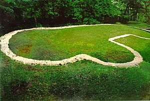
The Effigy Mounds National Monument is a very important historical site. It's located about 3 miles north of Marquette. This area has many ancient mounds shaped like animals, such as bears and birds. These mounds were built by Native Americans hundreds of years ago for burial or ceremonial purposes. It became a historic site in 1966 and is a great place to learn about early cultures.
Fish Farm Mound Group
The Fish Farm Mound Group is another collection of ancient mounds found in the Fish Farm Mounds State Preserve near New Albin. These mounds also tell us about the people who lived here long, long ago. It was listed in 1988.
Slinde Mound Group
The Slinde Mound Group is located in Hanover Township. Like the other mound groups, these are ancient earthworks that are important historical sites. It was added to the list in 1989.
Iron Post
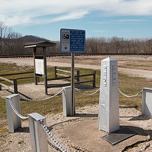
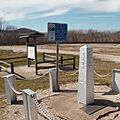
The Iron Post is a unique historical marker at the northern end of Main Street in New Albin. This iron post is not just any old marker; it legally defines the boundary line between the states of Minnesota and Iowa! It was listed in 1976.
Historic Sites in Lansing
Lansing, a town on the Mississippi River, has many historic places.
G. Kerndt and Brothers Buildings
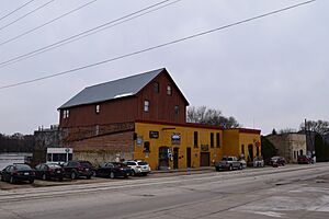
The G. Kerndt and Brothers Elevator and Warehouses, No. 11, No.12 and No. 13 are old buildings on Front Street in Lansing. They were important for storing goods, especially grain, that were shipped on the Mississippi River. They were listed in 1979.
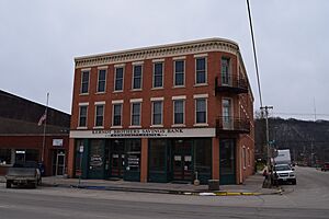
The G. Kerndt & Brothers Office Block is another building connected to the Kerndt family business, located at 4th and Main Street in Lansing. This was their main office. It was added to the list in 1982.
Lansing Fisheries Building
The Lansing Fisheries Building is located near the Mississippi River in southern Lansing. This building was important for the fishing industry in the area. It was listed in 1991.
Lansing Main Street Historic District
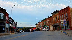
The Lansing Main Street Historic District includes a whole section of Main Street and nearby streets in Lansing. This means many buildings in this area are historically important together, showing what a busy town center looked like in the past. It became a historic district in 2014.
Lansing Stone School
The Lansing Stone School is an old school building at the corner of Center and Fifth Streets in Lansing. Imagine going to school in a building made of stone! It was listed in 1973.
Old Allamakee County Courthouse (Lansing)
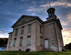
Lansing also has an Old Allamakee County Courthouse on Second Street. Before Waukon became the county seat, Lansing was important, and this building served as its courthouse. It was listed in 1983.
Historic Churches
Several churches in Allamakee County are recognized for their historical importance.
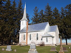
Old East Paint Creek Lutheran Church
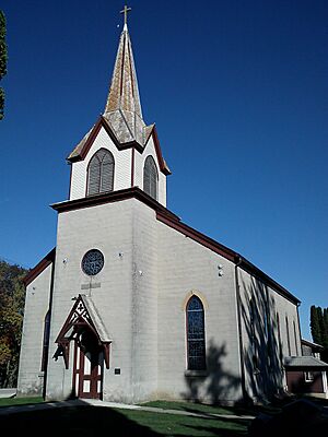
The Old East Paint Creek Lutheran Church is located north of Waterville. This beautiful old church tells the story of early settlers and their communities. It was listed in 1983.
Waterloo Ridge Lutheran Church Historic District
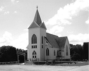
The Waterloo Ridge Menigheds Kirke og Kirkegard Historic District (also known as Waterloo Ridge Lutheran Church) is near Dorchester. This district includes the church and its cemetery, showing the history of the community that built it. It was listed in 2015.
West Paint Creek Synod Evangelical Lutheran Church and Cemetery
The West Paint Creek Synod Evangelical Lutheran Church and Cemetery is located at 1351 Elon Drive, near Waterville. This church and its cemetery are also important historical sites, showing the religious and community life of the past. It was added to the list in 2019.
Unique Barns and Bridges
Allamakee County also has some interesting structures like round barns and old bridges.
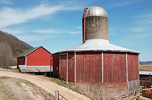
Fred W. Meier Round Barn
The Fred W. Meier Round Barn is a unique barn located off Iowa Highway 9, near Ludlow. Round barns were built for efficiency and strength. This one was listed in 1986.
Thomas Reburn Polygonal Barn
The Thomas Reburn Polygonal Barn is another unusual barn, located off Iowa Highway 26 near New Albin. A polygonal barn has many sides, almost like a circle. It was listed in 1986.
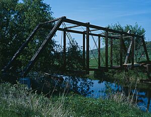
Red Bridge
The Red Bridge crosses the Yellow River on Fuel Hollow Road near Postville. Old bridges are important because they show how people traveled and built things in the past. This bridge was listed in 1998.
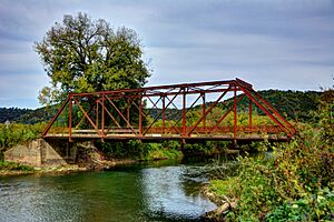
Upper Iowa River Bridge
The Upper Iowa River Bridge is on Mays Prairie Road and crosses the Upper Iowa River near Dorchester. This bridge, like the Red Bridge, is a historic example of engineering. It was listed in 1998.
Other Notable Sites
Turner Hall (Postville)
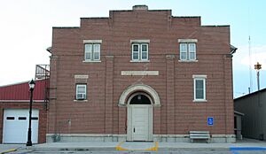
Turner Hall is located at 119 East Greene Street in Postville. Turner Halls were community centers, often for German-American groups, where people gathered for sports, social events, and cultural activities. This one was listed in 2000.
Yellow River State Forest Fire Tower
The Yellow River State Forest Fire Tower is located on Fire Tower Road within the Yellow River State Forest, near Harpers Ferry. Fire towers were crucial for spotting forest fires quickly to protect natural areas. This tower was listed in 2021.
Former Listings
Sometimes, a place that was once on the National Register of Historic Places might be removed from the list. This can happen if the building is changed too much, or if it's torn down.
Postville Public School
The Postville Public School at Ogden and Post Streets in Postville was listed in 1984 but was later removed from the list in 1987.
Images for kids


