National Register of Historic Places listings in Delaware County, Ohio facts for kids
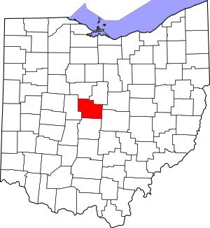
Delaware County in Ohio is home to many special places that are listed on the National Register of Historic Places. This is a list of buildings, sites, and areas that are important to history. They are recognized by the United States government for their historical or architectural value.
There are 58 different places in Delaware County that are on this list. These include old houses, schools, churches, bridges, and even ancient earthworks. One place was on the list but has since been removed. These historic spots help us learn about the past and protect important parts of our heritage for the future.
Contents
- Cool Historic Places in Delaware County
- Buildings at Ohio Wesleyan University
- Historic Homes and Taverns
- John Baker Tavern
- George Bieber House and Farm
- Center Inn
- John Cook Farm
- Samuel Cooper Farmhouse
- Crist Tavern Annex-Millworkers Boarding House
- Marcus Curtiss Inn
- John Detwiller Tavern and Farmstead
- Felkner-Anderson House
- Gooding House and Tavern
- Greenwood Farm
- High House
- Diadatus Keeler House
- Samuel Lewis Farmhouse
- Limestone Vale
- Forrest Meeker House and Farm
- Mill Worker Houses
- Edward E. Neff House
- Norman Dewey Perry House
- James Richey Farmhouse
- Samuel Sharp House
- Stephen Sharp House
- Sunbury Tavern
- Henry Van Deman House
- Warren Tavern Complex
- Other Important Structures and Sites
- Chambers Road Covered Bridge
- Delaware County Courthouse
- Delaware County Jail and Sheriff's Residence
- Delaware Public Library
- Highbank Park Works
- Highbanks Metropolitan Park Mounds I and II
- Historic Northwest District
- O'Shaughnessy Dam and Bridge
- St. Mary's Church and Rectory
- Sandusky Street Historic District
- Spruce Run Earthworks
- Stratford Methodist Episcopal Church
- Sunbury Town Hall
- Ufferman Site
- West Orange Road-Thomas Bridge
- Former Listing
- Images for kids
Cool Historic Places in Delaware County
Many interesting places in Delaware County are on the National Register. Let's explore a few of them!
Buildings at Ohio Wesleyan University
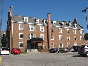
Ohio Wesleyan University in Delaware, Ohio, has several buildings listed on the National Register. These buildings are important parts of the university's history.
Austin Hall
Austin Hall was added to the list in 1985. It is located on the university campus at West Central Avenue and Elizabeth Street. This building is a great example of the university's early architecture.
Edwards Gymnasium
Also listed in 1985, Edwards Gymnasium is another key building at Ohio Wesleyan University. It includes the Pfeiffer Natatorium. This gym has been a central place for student activities for many years.
Elliott Hall, Sturges Library, and Merrick Hall
These three buildings were listed together in 1973. They are all found on the Ohio Wesleyan University campus. They represent important parts of the university's academic and social life over time.
Ohio Wesleyan University Student Observatory
This observatory, listed in 1985, is on West William Street. It shows the university's focus on science and learning. Students have used it to study the stars for decades.
Sanborn Hall
Sanborn Hall, located on the west campus, was also added in 1985. It is another historic building that contributes to the university's rich past.
Selby Field
Selby Field, listed in 1985, is the university's athletic field on Henry Street. It has hosted many sports events and gatherings over the years.
Slocum Hall
Slocum Hall, on the main campus along Sandusky Street, was listed in 1985. It is another example of the beautiful and historic buildings at Ohio Wesleyan.
Stuyvesant Hall
Stuyvesant Hall, on West William Street, joined the list in 1985. It is one of the many dormitories and academic buildings that make up the historic campus.
University Hall-Gray's Chapel
This impressive building, listed in 1985, is on the main campus along Sandusky Street. It combines University Hall with Gray's Chapel, serving as a central point for the university community.
Historic Homes and Taverns
Many old homes and taverns in Delaware County are recognized for their history. These buildings tell stories of early settlers and travelers.
John Baker Tavern
The John Baker Tavern, located at 4151 State Route 203 in Radnor Township, was listed in 2006. Taverns were important stops for travelers in the past, offering food and a place to rest.
George Bieber House and Farm
This house and farm, south of Delaware on Stratford Road, was listed in 1991. It is part of a group of buildings related to mills in the area.
Center Inn
The Center Inn, southeast of Sunbury on State Route 37, was listed in 1983. Inns like this were vital for people traveling long distances.
John Cook Farm
The John Cook Farm, east of Harlem, was added to the list in 1977. Old farms like this show us how people lived and worked in rural Ohio many years ago.
Samuel Cooper Farmhouse
This farmhouse, south of Radnor on Lawrence Road, was listed in 1993. It's another example of the historic farm life in the county.
Crist Tavern Annex-Millworkers Boarding House
Located south of Delaware on Olentangy River Road, this building was listed in 1994. It was likely a place where millworkers lived, showing the history of local industries.
Marcus Curtiss Inn
South of Galena on Sunbury Road, the Marcus Curtiss Inn was listed in 1976. It's a reminder of the old travel routes and hospitality of the past.
John Detwiller Tavern and Farmstead
West of Radnor on State Route 257, this tavern and farmstead was listed in 1993. It combines a place for travelers with a working farm.
Felkner-Anderson House
The Felkner-Anderson House, northwest of Ostrander, was listed in 1988. It's a historic home that has stood for many years.
Gooding House and Tavern
This house and tavern on Stagers Loop was listed in 2005. It gives us a glimpse into the past, when taverns were important community spots.
Greenwood Farm
North of Delaware, off U.S. Route 42, Greenwood Farm was listed in 1979. It's a significant historic farm in the area.
High House
The High House, north of Delaware on Panhandle Road, was listed in 1986. It's another example of the historic homes in Troy Township.
Diadatus Keeler House
Southeast of Galena on Red Bank Road, the Diadatus Keeler House was listed in 1979. This house has a unique history in Genoa Township.
Samuel Lewis Farmhouse
West of Radnor on Radnor Road, the Samuel Lewis Farmhouse was listed in 1993. It's a well-preserved example of a historic farm home.
Limestone Vale
South of Delaware on Olentangy River Road, Limestone Vale was listed in 1978. This property has a distinctive name and history.
Forrest Meeker House and Farm
South of Delaware on Stratford Road, this house and farm was listed in 1991. It's part of the "Mill-Related Buildings of Stratford Road" group.
Mill Worker Houses
Several houses on Stratford Road, south of Delaware, were listed in 1991 as "Mill Worker House No. 1," "No. 3," "No. 4," and "No. 5." These homes show where people who worked at local mills used to live.
Edward E. Neff House
The Edward E. Neff House, on North Franklin Street in Delaware, was listed in 1988. It's a notable historic home in the city.
Norman Dewey Perry House
South of Delaware on Stratford Road, the Norman Dewey Perry House was listed in 1991. It is another part of the mill-related historic buildings.
James Richey Farmhouse
This farmhouse, on South State Route 257, was listed in 1993. It's a historic farm building in Scioto Township.
Samuel Sharp House
West of Ashley on Horseshoe Road, the Samuel Sharp House was listed in 1982. It's an important historic home in Marlboro Township.
Stephen Sharp House
The Stephen Sharp House, on Africa Road in Westerville, was listed in 1982. It's a historic residence with a unique location.
Sunbury Tavern
The Sunbury Tavern, at the corner of State Route 37 and Galena Road, was listed in 1975. It served as a public house for many years.
Henry Van Deman House
The Henry Van Deman House, on Darlington Road in Delaware, was listed in 1984. It's a historic home with a specific architectural style.
Warren Tavern Complex
West of Delaware on U.S. Route 36, the Warren Tavern Complex was listed in 1983. This complex includes several buildings that were part of an old tavern.
Other Important Structures and Sites
Delaware County also has other types of historic places, like bridges, churches, and even ancient earthworks built by early peoples.
Chambers Road Covered Bridge
About 1.5 miles northeast of Olive Green, the Chambers Road Covered Bridge was listed in 1974. Covered bridges are rare and beautiful examples of old engineering.
Delaware County Courthouse
The Delaware County Courthouse, at North Sandusky Street and Central Avenue in Delaware, was listed in 1973. Courthouses are often grand buildings that represent local government and justice.
Delaware County Jail and Sheriff's Residence
This building, at 20 West Central Avenue in Delaware, was listed in 1990. It shows how law enforcement buildings looked in the past.
Delaware Public Library
The Delaware Public Library, at 101 North Sandusky Street, was listed in 1983. Libraries are important centers for learning and community.
Highbank Park Works
On a bluff above the Olentangy River, the Highbank Park Works was listed in 1974. These are ancient earthworks, which are structures built by early Native American cultures. They are very important archaeological sites.
Highbanks Metropolitan Park Mounds I and II
These mounds, on the eastern side of the Olentangy River, were listed in 1975. They are also ancient earthworks, showing the rich history of indigenous peoples in the area.
Historic Northwest District
This district in Delaware, roughly bounded by Pennsylvania Avenue, North Sandusky Street, and other streets, was listed in 1996. It includes many historic buildings that together form an important part of the city's character.
O'Shaughnessy Dam and Bridge
Located between State Routes 257 and 745, east of Shawnee Hills, this dam and bridge were listed in 1990. Dams are important for water management and power.
St. Mary's Church and Rectory
St. Mary's Church and Rectory, at 82 East William Street in Delaware, was listed in 1980. Churches often have beautiful architecture and are central to community life.
Sandusky Street Historic District
This district in Delaware, including parts of Sandusky, Winter, and William Streets, was listed in 1982. It's a collection of historic buildings that show the city's development.
Spruce Run Earthworks
Along Spruce Run south of Galena, these earthworks were listed in 1973. They are another example of the ancient structures found in Delaware County.
Stratford Methodist Episcopal Church
This church, at the junction of U.S. Route 23 and State Route 315, south of Delaware, was listed in 1991. It's a historic place of worship.
Sunbury Town Hall
The Sunbury Town Hall, on Town Square, was listed in 1975. Town halls are important for local government and community events.
Ufferman Site
North of Delaware, near Delaware Lake, the Ufferman Site was listed in 1974. This is an archaeological site, meaning it holds clues about past human activity.
West Orange Road-Thomas Bridge
East of State Route 315, northeast of Powell, this bridge was listed in 2002. It's a historic bridge that has served the community for many years.
Former Listing
Sometimes, a place is removed from the National Register of Historic Places. This usually happens if the building is destroyed or changes too much.
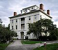
Monnett Hall
Monnett Hall, which was part of the Ohio Wesleyan University campus, was listed in 1975 but removed in 1980. It was located at Elizabeth and Winter Streets.
Images for kids


