National Register of Historic Places listings in Edmunds County, South Dakota facts for kids
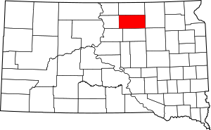
This is a list of the National Register of Historic Places listings in Edmunds County, South Dakota.
This is intended to be a complete list of the properties on the National Register of Historic Places in Edmunds County, South Dakota, United States. The locations of National Register properties and districts for which the latitude and longitude coordinates are included below, may be seen in a map.
There are 11 properties listed on the National Register in the county. Another 2 properties were once listed but have been removed.
Current listings
| Name on the Register | Image | Date listed | Location | City or town | Description | |
|---|---|---|---|---|---|---|
| 1 | Bank of Bowdle |
(#85000183) |
3026 Main St. 45°27′19″N 99°39′13″W / 45.455278°N 99.653611°W |
Bowdle | ||
| 2 | Marcus P. Beebe Library |
(#77001243) |
Main St. and 2nd Ave. 45°26′15″N 99°01′31″W / 45.4375°N 99.025278°W |
Ipswich | ||
| 3 | Marcus Beebe House |
(#76001733) |
4th St. and 5th Ave. 45°26′56″N 99°01′45″W / 45.448889°N 99.029167°W |
Ipswich | ||
| 4 | Bierman Barn |
(#96001230) |
14315 372nd Ave. 45°16′16″N 98°45′19″W / 45.271111°N 98.755278°W |
Mansfield | ||
| 5 | Edmunds County Courthouse |
(#00000997) |
2nd Ave. between 2nd and 3rd Sts. 45°26′45″N 99°01′32″W / 45.445833°N 99.025556°W |
Ipswich | ||
| 6 | John Eisenbeis House |
(#84003283) |
West of Highway 47 in the southern half of the southwestern quadrant of Section 17, T124N, R73W Coordinates missing |
Bowdle | ||
| 7 | Ipswich Baptist Church |
(#78002550) |
Main St. and 3rd Ave. 45°26′41″N 99°01′32″W / 45.444722°N 99.025556°W |
Ipswich | ||
| 8 | Ipswich State Bank |
(#78002551) |
1st Ave. and Main St. 45°26′12″N 99°01′30″W / 45.436667°N 99.025°W |
Ipswich | ||
| 9 | Parmley Land Office |
(#79002402) |
119 Main St. 45°26′43″N 99°01′41″W / 45.445143°N 99.027945°W |
Ipswich | ||
| 10 | J.W. Parmley House |
(#80003720) |
4th St. and 4th Ave. 45°26′38″N 99°01′48″W / 45.443889°N 99.03°W |
Ipswich | ||
| 11 | John Strouckel House |
(#84001268) |
Northeastern corner of the eastern half of Section 33, T122N, R72W, west of Loyalton Coordinates missing |
Loyalton |
Former listings
| Name on the Register | Image | Date listed | Date removed | Location | City or town | Summary | |
|---|---|---|---|---|---|---|---|
| 1 | Roscoe Community Hall |
(#84003284) |
|
202 Mitchell St. 45°27′00″N 99°20′15″W / 45.45°N 99.3375°W |
Roscoe | Demolished; |

All content from Kiddle encyclopedia articles (including the article images and facts) can be freely used under Attribution-ShareAlike license, unless stated otherwise. Cite this article:
National Register of Historic Places listings in Edmunds County, South Dakota Facts for Kids. Kiddle Encyclopedia.


