
National Register of Historic Places listings in Galveston County, Texas facts for kids

Galveston County, Texas, is full of amazing places that tell stories about the past! This list is all about the special buildings, areas, and even ships in Galveston County that are so important, they've been added to the National Register of Historic Places. Think of it like a Hall of Fame for historic spots across the United States. When a place is on this list, it means it's super important for history, architecture, or even what it means to a community. Let's explore some of these cool places!
Contents
What Makes a Place Historic?
When a building or area gets listed on the National Register of Historic Places, it means it's been recognized as a special part of history. These places help us understand how people lived, worked, and built things a long time ago. They might be old homes, churches, public buildings, or even parts of a city. Protecting these places helps us remember and learn from the past.
Famous Historic Spots in Galveston
Galveston Island and nearby areas in Galveston County have many incredible historic sites. Here are some of the most interesting ones:
Grand Buildings
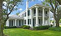
- Ashton Villa: This beautiful old mansion at 2328 Broadway in Galveston was built way back in 1859. It's one of the first grand homes in Galveston and has seen a lot of history, including the Civil War and the Great Storm of 1900. It's a great example of old Southern architecture.
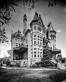
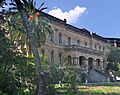
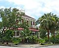
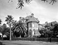
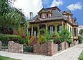
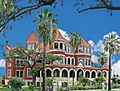
- Bishop's Palace: Located at 1402 Avenue J (Broadway), this stunning Victorian house is also known as Gresham's Castle. It was built between 1887 and 1892 and looks like something out of a fairy tale! It's famous for its unique design and fancy details.
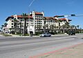
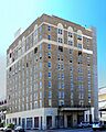
- Galvez Hotel: Standing proudly at 2024 Seawall Boulevard, the Galvez Hotel opened in 1911. It was built after the devastating 1900 storm to help Galveston rebuild and attract visitors. It's a beautiful landmark right on the beach.
- Grand Opera House: Found at 2012-2020 Avenue E, this historic theater opened in 1894. It's still a place where people can enjoy live shows and performances today. It's often called "The Grand 1894 Opera House."
- Rosenberg Library: Located at 2310 Sealy Street, the Rosenberg Library is one of the oldest public libraries in Texas. It first opened in 1904 and has been a center for learning and community ever since.
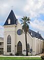
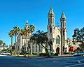
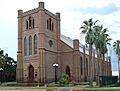
- St. Mary's Cathedral Basilica: This impressive church at 2011 Church Avenue was built in 1847. It's one of the oldest Catholic churches in Texas and has a very grand and historic feel.
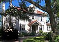
- Willis-Moody Mansion: You can find this mansion at 2618 Broadway. It was built in 1895 and was home to the powerful Moody family, who were very important in Galveston's history.
Important Ships
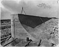
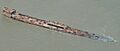
- SS ELISSA: This tall ship is docked at Pier 21 in Galveston. The Elissa is a real sailing ship built in 1877! It's one of the oldest ships still sailing today and offers a glimpse into what sea travel was like long ago.
- USS CAVALLA (submarine): Located at Seawolf Park, this submarine (SS-244) played a big role in World War II. You can visit it and learn about life underwater during wartime.
- USS STEWART: Also at Seawolf Park, the USS Stewart (DE-238) is a destroyer escort ship from World War II. It's another amazing example of naval history that you can explore.
- SS SELMA (steamship): This unique ship, built in 1919, is special because it's made of concrete! It's a rare example of ships built during World War I when steel was scarce.
Cool Outdoor Spots
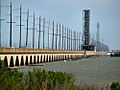
- Galveston Causeway: This long bridge connects Galveston Island to the mainland. It was built in 1912 and was a huge engineering feat for its time, making it easier for people to get to and from the island.
- Galveston Seawall: After the devastating 1900 hurricane, Galveston built this massive seawall along Seawall Boulevard to protect the city from future storms. It's a famous landmark and a symbol of Galveston's resilience.
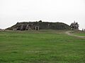
- Fort Travis: Located in Port Bolivar, this old fort was built to protect Galveston Bay. It played a role in both World War I and World War II.
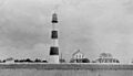
- Point Bolivar Lighthouse: Also in Port Bolivar, this lighthouse helped guide ships safely into Galveston Bay for many years. It's a tall, historic structure that once shone a light for sailors.
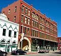
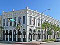
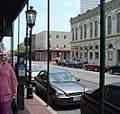
- The Strand Historic District: This area in downtown Galveston, roughly bounded by Avenue A and 20th Street, is filled with historic buildings that were once busy shops and businesses. It's a lively place today, still keeping its old charm.
Places We Lost
Sadly, some historic places in Galveston County have been removed from the National Register. This usually happens if they are destroyed or damaged beyond repair. For example, three places were lost during Hurricane Ike in 2008, a powerful storm that hit the coast.
- Balinese Room: This famous pier-based nightclub was a popular spot for entertainment in Galveston. It was destroyed by Hurricane Ike in 2008.
- The Breakers: Located in Caplen, this building was also lost to Hurricane Ike.
- Moser House: Another historic home in Caplen that was destroyed by Hurricane Ike.
- Ursuline Academy: This school in Galveston was badly damaged by Hurricane Carla in 1961 and later torn down in 1974.
Images for kids
-
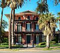
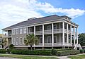
Ashton Villa
-
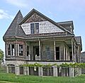
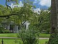
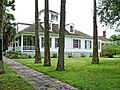
Henry Beissner House
-
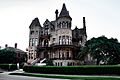
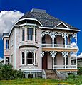
Bishop's Palace
-
Building at 1921-1921 1/2 Avenue D
-
Building at 1925-1927 Market Street
-
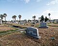
Cemetery Historic District
-
Galveston City Hall
-
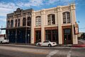
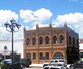
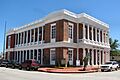
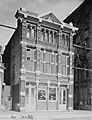
City National Bank
-
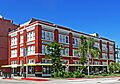
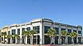
East End Historic District
-
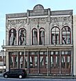
Eiband's
-

The ELISSA
-
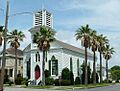
First Evangelical Lutheran Church
-
First Presbyterian Church
-
Fort Travis
-
Galveston Causeway
-
Galveston Orphans Home
-
Galveston Seawall
-
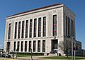
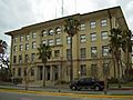
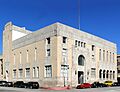
Galveston US Post Office, Custom House and Courthouse
-
Galvez Hotel
-
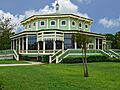
Garten Verein Pavilion
-
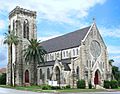
Grace Episcopal Church
-
Grand Opera House
-
John Hagemann House
-
House at 2017-2023 Avenue I
-
House at 2528 Postoffice St.
-
Sealy Hutchings House
-
Illies Building-Justine Apartments
-
Daniel Webster Kempner House
-
Jean Lafitte Hotel
-
Lasker Home for Homeless Children
-
Marschner Building
-
McKinney-McDonald House
-
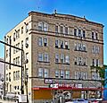
Melrose Apartment Building
-
Michel B. Menard House
-
Model Laundry
-
Old Galveston Customhouse
-
Pix Building
-
Point Bolivar Lighthouse
-
Powhatan House
-
Reedy Chapel-AME Church
-
Robinson Building
-

Rosenberg Library
-
Scottish Rite Cathedral
-
George Sealy House
-
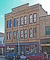
M. W. Shaw Building
-

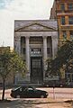
Ashbel Smith Building
-
SS SELMA (steamship)
-
St. Joseph's Church
-
St. Mary's Cathedral
-
Star Drug Store
-
Steffens-Drewa House Complex
-
The Strand Historic District
-
Sweeney-Royston House
-
Texas Heroes Monument
-
Trinity Protestant Episcopal Church
-
Trueheart-Adriance Building
-
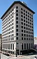
U.S. National Bank
-

USS CAVALLA (submarine)
-
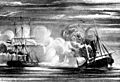
USS HATTERAS (41GV68)
-
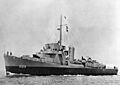
USS STEWART
-
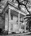
Samuel May Williams House
-
Willis-Moody Mansion
-
Balinese Room (former listing)


.jpg)

.jpg)
.jpg)


.jpg)


.jpg)


_underway_c1944.jpg)


