National Register of Historic Places listings in Iberville Parish, Louisiana facts for kids
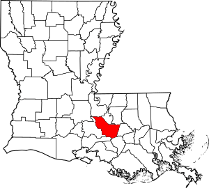
Iberville Parish in Louisiana is home to many amazing places that tell stories from the past! These special spots are listed on the National Register of Historic Places. This list helps protect buildings, sites, and objects that are important to American history. Think of it like a special hall of fame for historic places!
There are 24 different properties and areas in Iberville Parish that have earned a spot on this important list. Each one has a unique story about how people lived, worked, and built communities long ago. Let's explore some of these cool places!
Contents
What is the National Register of Historic Places?
The National Register of Historic Places is an official list kept by the United States government. It includes buildings, districts, objects, and sites that are important in American history, architecture, archaeology, engineering, or culture. When a place is added to this list, it means it's recognized as special and worth preserving for future generations. It helps people learn about the past and protect these valuable landmarks.
Exploring Iberville Parish's Historic Gems
Iberville Parish has a rich history, and its historic places show us different parts of that past. From grand homes to important schools and engineering marvels, these sites offer a peek into what life was like many years ago.
The Amazing Bayou Plaquemine Lock
One of the most interesting places is the Bayou Plaquemine Lock. This lock was a huge engineering project built in the early 1900s. It connected the Mississippi River to Bayou Plaquemine, allowing boats to travel between them even when water levels were different. It was a very important waterway for trade and travel in Louisiana for many years. Today, it's a historic site where you can learn about its clever design.
Iberville Parish Courthouse: From Law to History
The Iberville Parish Courthouse is another significant building. Built in 1848, it shows off a style called Greek Revival architecture. This means it looks a bit like ancient Greek temples with its columns and grand design. For a long time, this building was where important legal decisions were made for the parish. Now, it serves as the Iberville Museum, where you can discover more about the area's history.
Nottoway Plantation House: A Grand Old Home
The Nottoway Plantation House is a truly magnificent building located near White Castle. It's one of the largest and most famous plantation homes in the South. This huge mansion was built in the 1850s and features stunning architecture. It's known for its many rooms and beautiful details, giving visitors a glimpse into the grand lifestyle of the past.
Bayou Paul Colored School: A Place of Learning
The Bayou Paul Colored School in St. Gabriel is a very important historic site. This school building represents a time when education was separate for different groups of people. It reminds us of the efforts made to provide schooling for African American children in the past. Preserving this building helps us remember and learn from this part of history.
St. Gabriel Roman Catholic Church: A Long History
The St. Gabriel Roman Catholic Church is one of the oldest churches in Louisiana. It was built way back in 1776! This church has seen centuries of history unfold around it. Its long history makes it a special place for the community and a reminder of the early settlers in the area.
More Historic Places to Discover
Iberville Parish has many more historic places on the National Register. Each one adds to the rich story of the area. These include beautiful plantation homes, old commercial buildings, and other important sites that have been preserved for their historical value.
Images for kids


