
National Register of Historic Places listings in Lauderdale County, Alabama facts for kids

Welcome to Lauderdale County, Alabama! This place is full of amazing history, and many of its special buildings and areas are protected. They are part of something called the National Register of Historic Places.
The National Register is like a special list kept by the United States government. It helps find and protect places that are important to American history, architecture, archaeology, engineering, or culture. When a place is on this list, it means it's recognized as a valuable part of our past. In Lauderdale County, there are 33 different places and areas on this list, including one very important one called a National Historic Landmark. Let's explore some of them!
Historic Homes and Buildings
Lauderdale County has many old homes and buildings that tell stories of the past.
Courtview
.jpg)
Courtview is a beautiful old house located on Court Street in Florence. It was added to the National Register in 1974. This grand home shows off the fancy building styles from a long time ago. It's a great example of how people used to build impressive houses.
Karsner-Carroll House

The Karsner-Carroll House, built in the 1800s, is another historic home in Florence. It was recognized in 1970. This house has a unique design and has been a part of the community for many years, seeing lots of changes around it.
James Martin House

The James Martin House, located on Cypress Mill Road, joined the National Register in 1981. It's a well-preserved example of older homes in the area, showing how families lived and built their houses in the past.
Sweetwater Mansion (Gov. Robert Patton House)
.jpg)
Sweetwater Mansion is a grand old house that was once home to Governor Robert Patton. It's located where Sweetwater and Florence Boulevard meet. This mansion was added to the list in 1976 and is known for its beautiful architecture and its connection to an important figure in Alabama's history.
Rogers Department Store

The Rogers Department Store building on North Court Street is a piece of Florence's commercial history. Listed in 1998, this building reminds us of how people used to shop and how downtown areas were once bustling centers of activity.
Rosenbaum House

The Rosenbaum House, found on Riverview Drive, is very special because it was designed by a famous architect named Frank Lloyd Wright. It was added to the National Register in 1978. This house is a great example of modern architecture from its time and is a popular spot for people interested in unique building designs.
Southall Drugs

Southall Drugs, on North Court Street, was listed in 1980. This building was once a local pharmacy, a place where people would go for medicines and other goods. It represents a common type of business that was important to communities in the past.
Wesleyan Hall

Wesleyan Hall, located on Morrison Avenue, is a historic building that was added to the National Register in 1974. It's known for its unique architecture, especially its bell tower. This building has been an important part of the community for a long time.
Historic Districts
Sometimes, it's not just one building that's important, but a whole group of buildings or an entire neighborhood. These are called historic districts.
Downtown Florence Historic District

The Downtown Florence Historic District includes many buildings in the heart of Florence. It was recognized in 1995. This district shows how the city grew and developed over time, with many different styles of buildings from different eras all together.
Locust Street Historic District

The Locust Street Historic District, listed in 2002, covers an area bounded by Pine Street, College Street, Locust Street, and Irvine Avenue. This district is important because it preserves the look and feel of an older residential neighborhood in Florence.
Sannoner Historic District

The Sannoner Historic District, added in 1976, includes parts of North Pine and North Court streets, stretching up to the University of North Alabama campus. This area has many beautiful old homes and buildings that show the history of the city's growth.
Walnut Street Historic District

The Walnut Street Historic District, listed in 1976, includes parts of North Walnut and North Poplar streets. This district helps protect the historic character of another residential area in Florence, showing how neighborhoods looked in earlier times.
Wilson Park Houses

The Wilson Park Houses, located on East Tuscaloosa Street, were added to the National Register in 1979. This small group of houses is important because they represent a specific style of architecture and how homes were built in that part of Florence.
Wood Avenue Historic District
The Wood Avenue Historic District, listed in 1978, includes North Wood Avenue and nearby streets. This district is a great example of a historic residential area with many well-preserved homes that show the architectural styles popular in Florence long ago.
Other Important Sites
Forks of Cypress

The Forks of Cypress, located on Jackson Road, was added to the National Register in 1997. This site holds the ruins of a grand plantation home. It's a reminder of the past and the history of the region, even though only parts of the original structure remain.
Forks of Cypress Cemetery
.jpg)
Near the Forks of Cypress site is the Forks of Cypress Cemetery, listed in 2000. Cemeteries can also be historic places because they tell us about the people who lived in an area and how they were buried. This cemetery is an important part of the history connected to the Forks of Cypress.
Old Natchez Trace (310-2A)

The Old Natchez Trace is a very old path that was used by Native Americans, explorers, and traders for thousands of years. A specific part of this historic trail, located northwest of Florence, was added to the National Register in 1976. It's a reminder of how people traveled long ago.
Old Florence Water Tower

The Old Florence Water Tower on Seymore Street was listed in 1980. Water towers are important parts of a city's infrastructure, providing water to homes and businesses. This old tower is a historic landmark that shows how the city developed its services.
Wilson Dam

Wilson Dam, built on the Tennessee River, is a huge and important structure. It was added to the National Register in 1966 and is even a National Historic Landmark, which is the highest level of historical recognition. This dam is famous for its role in generating electricity and controlling the river, and it's a marvel of engineering.
Images for kids
-
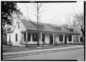
George Coulter House
.jpg)
