National Register of Historic Places listings in Mackinac County, Michigan
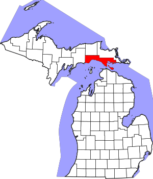
Welcome to Mackinac County, Michigan! This special place is home to many historic sites and buildings. These locations are so important that they have been added to the National Register of Historic Places. This is a list kept by the United States government to recognize places that are significant in American history, architecture, archaeology, engineering, and culture. There are 27 such places in Mackinac County, and three of them are even more special, earning the title of National Historic Landmarks! Let's explore some of these amazing spots.
Contents
- Historic Places to Discover
- John Chambers House: A Family's Legacy
- Fort Mackinac: A Fort with a Story
- Mathew Geary House: Island Architecture
- Grand Hotel: The World's Largest Porch
- Gros Cap Archaeological District: Ancient Villages
- Gros Cap Cemetery: A Place of Rest for Centuries
- Hiawatha Sportsman's Club Buildings: A Place for Fun
- Indian Dormitory: A School for Native Americans
- Juntunen Site: An Ancient Fishing Camp
- Lansing Shoals Light Station: A Lighthouse on the Lake
- Lasanen Site: An Important Burial Ground
- Mackinac Island: A Historic Landmark
- Mackinac Trail – Carp River Bridge: An Old Concrete Arch
- Manitou Lodge: A Great Depression Era Hotel
- Marquette Street Archaeological District: An Ancient Village Site
- Martin Reef Light Station: A Lighthouse on Lake Huron
- Mission Church: Michigan's Oldest Church Building
- Mission House: A School and a Hotel
- Round Island Lighthouse: A Twin Lighthouse
- Round Island Passage Light: A Modern Lighthouse
- Sacred Heart-Gros Cap Church: A Community Church
- Scott Point Site: An Ancient Village by the Lake
- St. Helena Island Light Station: An Automated Beacon
- St. Ignace Mission: A Historic Religious Site
- Robert Stuart House: Fur Trade History
- Lawrence Andrew Young Cottage: The Governor's Summer Home
Historic Places to Discover
John Chambers House: A Family's Legacy
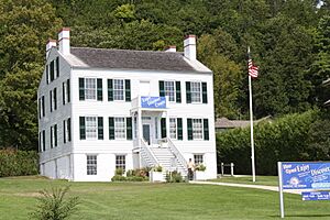
The John Chambers House in St. Ignace was built in 1870. John Chambers was an immigrant from Ireland who became successful through farming and fishing. Later, his sons, Michael and Patrick, added a beautiful Colonial Revival style front to the house in 1910. This shows how the family grew and changed over time.
Fort Mackinac: A Fort with a Story
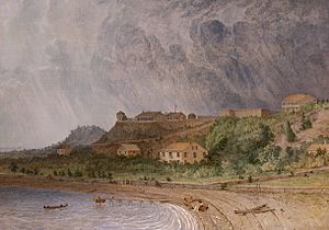
Fort Mackinac is on Mackinac Island. It was built by the British during the American Revolutionary War. Its main job was to control the important Straits of Mackinac. These straits connect Lake Michigan and Lake Huron, making them key for the fur trade. The fort was also a battleground during the War of 1812. It later served as a U.S. Army outpost until 1895. Today, Fort Mackinac is a museum within Mackinac Island State Park. You can explore 14 of its original buildings!
Mathew Geary House: Island Architecture
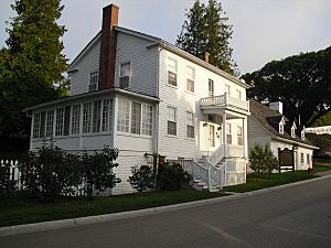
The Mathew Geary House, built around 1846, is a wooden family home on Mackinac Island. It has a raised basement, which was a common way to build houses there because of the rocky ground. The Geary family owned this house until 1968. Then, the Mackinac Island State Park bought it to preserve its history.
Grand Hotel: The World's Largest Porch
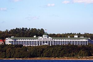
The Grand Hotel is a famous hotel built in the late 1800s. It's known for having the world's largest porch! Many important people have stayed here. These include five U.S. presidents, Russian leaders like Vladimir Putin and Dmitri Medvedev, inventor Thomas Edison, and author Mark Twain. It's a truly grand place with a rich history.
Gros Cap Archaeological District: Ancient Villages
The Gros Cap Archaeological District holds three important archaeological sites. These sites are linked to the Odawa people, who lived in this area around West Moran Bay in the late 1600s. The district covers about 13.5 acres. It includes an old village site and parts of the Gros Cap Cemetery.
Gros Cap Cemetery: A Place of Rest for Centuries
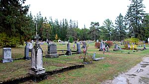
The Gros Cap Cemetery was started by the Odawa people in the late 1600s. It is one of the oldest cemeteries in the United States that has been used continuously. Both Native Americans and Europeans are buried here. You can see wooden crosses, old 19th-century headstones, and modern tombstones. It's still in use today!
Hiawatha Sportsman's Club Buildings: A Place for Fun
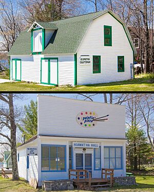
The Hiawatha Sportsman's Club was formed in 1927. Its goal was to create a place for hunting, fishing, and relaxing in nature. In 1931, they moved a store to their grounds to use as a commissary (a place to buy supplies). That same year, they built a wooden building for club maintenance.
Indian Dormitory: A School for Native Americans
The Indian Dormitory on Mackinac Island was built in 1838. It was a new idea for housing Native Americans. This building is a reminder of Henry Rowe Schoolcraft's vision. He was a U.S. government official who wanted to help Native Americans adapt to new ways of life. From 1867 to 1960, the building was a public school. Now, it is the Richard and Jane Manoogian Mackinac Art Museum.
Juntunen Site: An Ancient Fishing Camp
The Juntunen Site, also known as 20MK1, is an archaeological site on Bois Blanc Island. It was a large seasonal fishing camp used by people between 900 and 1400 AD. People often visited this site for fishing, which created many layers of archaeological remains. The site is named after Charles Juntunen, who found important artifacts there in 1959.
Lansing Shoals Light Station: A Lighthouse on the Lake
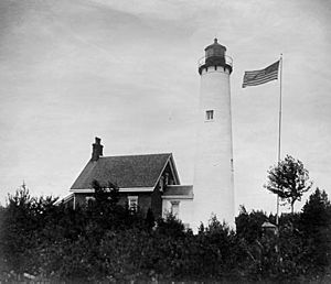
The Lansing Shoals Light Station is a lighthouse made of reinforced concrete. It sits on a stone base at the bottom of Lake Michigan. Before this lighthouse was built in 1928, lightships guided boats here since 1900. The light became automatic in 1976, meaning it no longer needed people to operate it.
Lasanen Site: An Important Burial Ground
The Lasanen Site is an ancient Indian burial ground in St. Ignace. It was found in 1966 when human remains were uncovered during construction. The site has 19 small burial pits in one area and five more nearby. The discoveries match descriptions from Antoine Laumet Cadillac in the late 1600s, suggesting it could be the same burial ground he wrote about.
Mackinac Island: A Historic Landmark
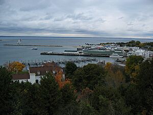
Mackinac Island became populated after Fort Mackinac was built during the American Revolutionary War. In the late 1800s, it became a popular tourist spot and a summer getaway. Much of the island has been carefully preserved and restored. This is why it earned its special National Historic Landmark status.
Mackinac Trail – Carp River Bridge: An Old Concrete Arch
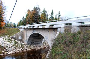
The Mackinac Trail – Carp River Bridge is a 60-foot concrete arch bridge. It was built in 1919. This bridge is special because it's one of the few remaining arch bridges built by the Michigan State Highway Department in its early days. It also has a unique guardrail design.
Manitou Lodge: A Great Depression Era Hotel
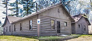
The Manitou Lodge was built for the Hiawatha Sportsman's Club. In 1930, the club planned to build a hotel. However, because of the Great Depression, they had to make the plans smaller. The log building was finished in 1931. It had 16 rooms and a lobby with a large limestone fireplace.
Marquette Street Archaeological District: An Ancient Village Site
The Marquette Street Archaeological District in St. Ignace was once a Petun village. People lived here from about 1670 to 1701, with 500 to 800 residents. This village was located near the St. Ignace Mission, which was founded by Père Jacques Marquette in 1671.
Martin Reef Light Station: A Lighthouse on Lake Huron
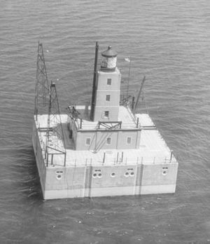
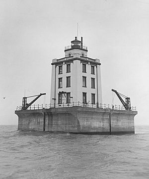
The Martin Reef Light Station was built in 1927. Before that, a lightship was used at Martin Reef for 18 years. The lighthouse is a 25-foot square, white, three-story building. It's made of a steel frame covered with concrete and iron. A 16-foot square watchroom sits on top, with an octagonal cast iron lantern. The Poe Reef Light, built in 1929, looks just like this lighthouse.
Mission Church: Michigan's Oldest Church Building
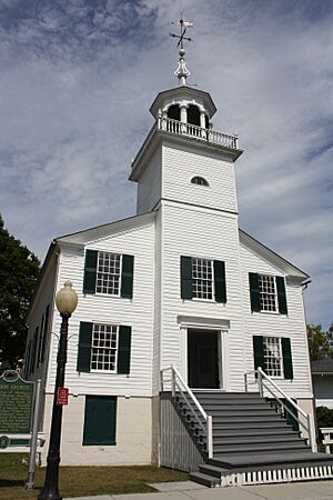
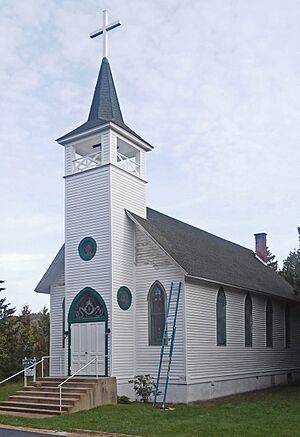
The Mission Church on Mackinac Island was built in 1829. It is the oldest church building in Michigan! It was part of William Montague Ferry's Indian mission school. Important people like Robert Stuart of the American Fur Company and Henry Schoolcraft attended services here. The mission closed in 1837, and the church was not used much until 1894. Then, summer residents restored it for services. The Mackinac Island State Park Commission bought the building in 1955.
Mission House: A School and a Hotel
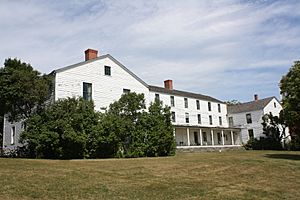
The Mission House was built in 1825 by William Montague Ferry and his wife, Amanda. It was designed to be both a school and a boardinghouse. It served this purpose until 1837. Later, it became a hotel from 1849 to 1939. It was also the headquarters for the Moral Re-Armament movement. The Mackinac Island State Park purchased it in 1977.
Round Island Lighthouse: A Twin Lighthouse
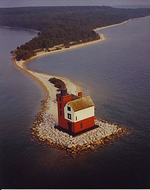
The Round Island Light was built in 1895. It's made of painted brick and looks just like the Two Harbors Light in Minnesota! This lighthouse was active from 1895 to 1947. It was abandoned in 1947 and replaced by an automatic light tower nearby. After a storm in 1972 caused part of it to collapse, emergency repairs were made. More restoration work happened in 1995 to save this historic structure.
Round Island Passage Light: A Modern Lighthouse
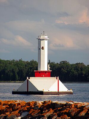
The Round Island Passage Light is an automated lighthouse built in 1948. It was constructed by the United States Coast Guard using concrete and steel. This lighthouse was one of the last ones built on the Great Lakes after World War II. It helps guide boats safely through the Round Island Passage Channel.
Sacred Heart-Gros Cap Church: A Community Church
The Sacred Heart-Gros Cap Church was finished in 1919. It served as a mission church for the St. Ignace church. The pastor from St. Ignace looked after it until 1967, when the church closed its doors.
Scott Point Site: An Ancient Village by the Lake
The Scott Point Site, also called 20MK22, is an archaeological site near Lake Michigan. It was once a Late Woodland period village. Evidence shows that people lived here seasonally, especially in the fall.
St. Helena Island Light Station: An Automated Beacon
The St. Helena Island Light began operating in 1873. In 1922, it became the first lighthouse in Michigan to be automated. This means it could operate without people living there. The light still helps guide ships today. The buildings of the St. Helena Island Light complex are the only remaining structures on St. Helena Island.
St. Ignace Mission: A Historic Religious Site
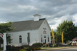
The St. Ignace Mission was founded in 1671 by Père Jacques Marquette. In 1677, Marquette's remains were buried beneath the chapel. The mission was later abandoned. A second mission was started about a mile south in 1837. The site of the first mission was rediscovered later. In 1954, the second mission chapel was moved to the original site. Today, the chapel is the Museum of Ojibwa Culture.
Robert Stuart House: Fur Trade History
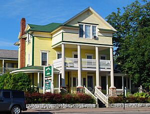
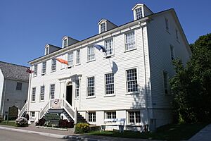
The Robert Stuart House, also known as the Agent's House, was built in 1817. It was meant to house the main agent and clerks of the American Fur Company. Ramsay Crooks was the first agent. In 1820, his assistant, Robert Stuart, took over. Stuart held the position until 1835, when the fur trade began to decline. The house later became a boardinghouse and then a hotel. Now, it is the Stuart House City Museum.
Lawrence Andrew Young Cottage: The Governor's Summer Home
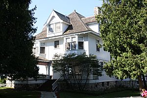
The Lawrence Andrew Young Cottage was first a private home for a lawyer from Chicago. In 1944, the Mackinac Island State Park Commission bought the house. It is now used as the Michigan governor's summer residence.


