National Register of Historic Places listings in Marion County, Kansas facts for kids
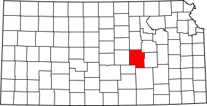
Welcome to Marion County, Kansas! This article is all about the cool and important places in Marion County that are listed on the National Register of Historic Places.
The National Register of Historic Places is like a special list kept by the United States government. It includes buildings, sites, and objects that are important to American history, architecture, archaeology, engineering, or culture. When a place is on this list, it means it's recognized as special and efforts are made to protect it for future generations.
Marion County has 31 places on this list! Let's explore some of them and find out why they are so important.
Discovering Marion County's History
Marion County, Kansas, is a place with a rich past. Many of its historic sites tell stories about how people lived, worked, and built communities long ago. From old schools to unique buildings and even parts of famous trails, these places help us understand history better.
Schools and Learning Centers
Many old school buildings in Marion County are on the National Register. These places remind us of how education has changed over time.
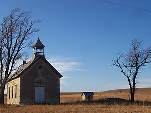
- Bethel School: Located east of Lincolnville, this old school building was added to the list in 1987. Imagine what it was like to learn here many years ago!
- Bichet School, District 34: This school, found east of Florence, became historic in 2004. It's a great example of the small, one-room schoolhouses that used to be common across the country.
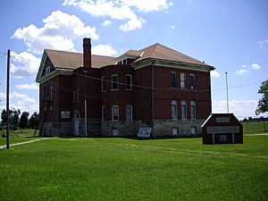
- Bown-Corby School: In Marion, this school building was added to the list in 2015. It shows how schools were designed in the past.
- Burns Union School: This building in Burns, listed in 1975, is now the Burns Community Museum. It's cool to see how an old school can be used to preserve history today.
- Hill Grade School: Another historic school in Marion, listed in 1976. These old school buildings often have unique architectural styles.
Libraries and Community Hubs
Libraries have always been important places for communities to gather and learn. Marion County has some historic libraries too.
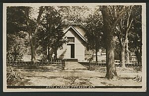
- Peabody Historical Library Museum: Also known as the Old Peabody Library, this building in Peabody was listed in 1973. Today, it serves as the Peabody Historical Museum, sharing local history.
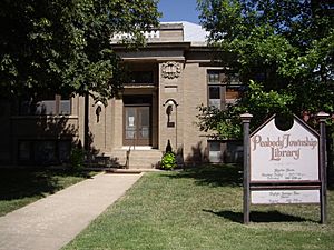
- Peabody Township Carnegie Library: This library in Peabody, listed in 1987, is a "Carnegie Library." These libraries were built with money from Andrew Carnegie, a famous businessman who believed in the power of reading and education. It's still used as the Peabody Township Library today.
Important Buildings and Structures
Many other buildings and structures in Marion County have earned a spot on the National Register because of their age, design, or the stories they hold.
- 1927 Hillsboro Water Tower: This water tower in Hillsboro, built in 1927, was listed in 2011. Water towers are important parts of a town's infrastructure and can be quite old.
- Amelia Park Bridge: This bridge near Antelope was listed in 2004. Bridges are often recognized for their engineering and how they helped people travel.
- Doyle Place: Located south of Florence, this place was added to the list in 2000. Historic homes often show us how people lived in different eras.
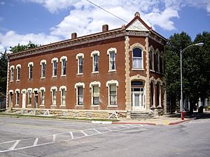
- Elgin Hotel: This hotel in Marion, listed in 1978, tells us about travel and hospitality from long ago. Hotels were central to towns when people traveled by train or horse.
- Florence Opera House: In Florence, this opera house was listed in 2011. Opera houses were important centers for entertainment and community events.
- Florence Water Tower: Another water tower, this one in Florence, was listed way back in 1973.
- Harvey House (Florence, Kansas): This building in Florence, listed in 1973, is connected to the famous Fred Harvey Company. Fred Harvey was known for creating a chain of restaurants and hotels along railroad lines, making travel across the American West more comfortable.
- Island Field Ranch House: South of Lincolnville, this ranch house was listed in 1995. Ranch houses are important for understanding the agricultural history of the area.
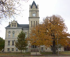
- Marion County Courthouse: The courthouse in Marion, listed in 1976, is a significant building. Courthouses are often the center of a county's government and history.
- P.H. Meehan House: This house in Tampa was listed in 2007.
- W.H. Morgan House: In Peabody, this house was listed in 1996.
- Pioneer Adobe House: This unique house in Hillsboro, listed in 1973, is made of adobe, a type of sun-dried brick. It's now known as the Peter Paul Loewen House.
- William F. and Ida G. Schaeffler House: This house in Hillsboro, listed in 2002, is now the William F. Schaeffler House Museum. It helps us learn about the lives of the people who lived there.
- J.S. Schroeder Building: In Peabody, this building was listed in 1991.
Parks and Outdoor Spaces
Even outdoor areas can be historic!
- Marion County Park and Lake: This park and lake area near Marion was listed in 2002. It's a place where people have enjoyed nature and recreation for many years.
- Peabody City Park: This park in Peabody was listed in 2012. Parks are important for community life and can have historical significance.
Historic Districts and Trails
Some listings are not just single buildings but entire areas or parts of famous trails.
- Donahue's Santa Fe Trail Segment: This is a part of the famous Santa Fe Trail near Durham, listed in 2016. The Santa Fe Trail was a very important trade route in the 19th century.
- French Frank's Santa Fe Trail Segment: Another part of the Santa Fe Trail, this segment is near Lehigh and was listed in 2013.
- Lost Springs (landmark): This landmark near Lost Springs was listed in 1976. It's a natural feature that played a role in the history of the area.
- Marion Archeological District: This district in Marion, listed in 1976, contains important archaeological sites. These sites help scientists learn about ancient cultures and how people lived thousands of years ago.
- Peabody Downtown Historic District: This area in Peabody, listed in 1998, includes many historic buildings that make up the town's downtown area. It shows what a bustling town center looked like in the past.
- Santa Fe Trail - Marion County Trail Segments: More segments of the Santa Fe Trail near Durham were listed in 1995. These trail segments are like footprints of history, showing where pioneers and traders once traveled.
These are just some of the amazing historic places you can find in Marion County, Kansas. Each one helps tell the story of this area and why it's so special!


