National Register of Historic Places listings in Mathews County, Virginia facts for kids
Welcome to Mathews County, Virginia! This special place is home to many historic buildings and sites. These aren't just old buildings; they are officially recognized by the National Register of Historic Places. This means they are important parts of American history and are protected so future generations can learn from them. Think of it like a Hall of Fame for historic places!
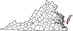
In Mathews County, there are 15 amazing properties and areas that have earned a spot on this important list. Each one tells a unique story about the past. Let's explore some of these cool historic spots!
Contents
- Discovering Mathews County's Historic Gems
- Historic Homes and Buildings
- Important Landmarks and Public Spaces
- Fort Cricket Hill: A Revolutionary War Site
- The Lane Hotel: A Place for Travelers
- Mathews County Courthouse Square: The Heart of the County
- Methodist Tabernacle: A Place of Worship
- Old Thomas James Store: A Historic Shop
- Sibley's and James Store Historic District: A Shopping Area
- B. Williams & Co. Store: Another Important Shop
- Lighthouses: Guiding Ships to Safety
- A Look at a Former Listing
Discovering Mathews County's Historic Gems
Mathews County is full of interesting places that have been around for a long time. Each one has a story to tell about how people lived, worked, and even fought for freedom in the past.
Historic Homes and Buildings
Many of the places on the list are old homes or buildings that show us what life was like centuries ago.
The Billups House: A Glimpse into the Past
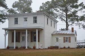
The Billups House is located east of Moon, Virginia. It was added to the National Register in 1980. This house gives us a peek into the architecture and lifestyle of earlier times in Mathews County.
Hesse: An Old Estate in Blakes
Hesse is another historic property found east of Cobbs Creek, near Blakes. It joined the list in 1974. Estates like Hesse often have unique designs and stories from their original families.
Poplar Grove Mill and House: A Working History
Southwest of the junction of Routes 14 and 613, you'll find the Poplar Grove Mill and House. This site was listed in 1969. Mills were super important in the past for grinding grain, and this one shows us how people used to get their food ready.
Riverlawn: A Riverside Beauty
Riverlawn, located at 134 Williamsdale Lane in Mathews, was added to the list in 2012. Many historic homes in Virginia are found near rivers, which were like the highways of the past.
Springdale: An Old Home with Character
At 1108 New Point Comfort Highway in Mathews, you'll find Springdale. This property became a historic listing in 2013. Old homes like Springdale often have special architectural details that tell us about the time they were built.
Important Landmarks and Public Spaces
Beyond homes, some places on the list are public buildings or important landmarks that served the whole community.
Fort Cricket Hill: A Revolutionary War Site
Near the Gwynn's Island bridge in Hudgins stands Fort Cricket Hill. This site was added to the National Register way back in 1970. It's special because it includes fortifications from the American Revolutionary War. Imagine soldiers defending their land right here!
The Lane Hotel: A Place for Travelers
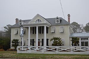
The Lane Hotel at 68 Church Street in Mathews joined the list in 2011. Hotels were vital places for travelers and visitors in the past, offering a place to rest and connect.
Mathews County Courthouse Square: The Heart of the County
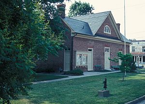
The Mathews County Courthouse Square on VA 611 in Mathews was listed in 1977. Courthouses are very important buildings where laws are made and justice is served. This square has been the center of county life for a long time.
Methodist Tabernacle: A Place of Worship
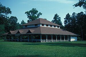
Southeast of Mathews, at the junction of VA 611 and VA 644, is the Methodist Tabernacle. It was added to the list in 1975. This building served as a gathering place for religious services and community events.
Old Thomas James Store: A Historic Shop
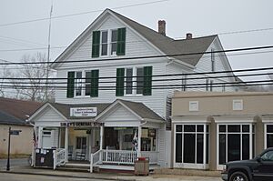
The Old Thomas James Store on Main and Maple Streets in Mathews Court House was listed in 2008. General stores like this were once the main shopping centers for communities, selling everything from food to tools.
Sibley's and James Store Historic District: A Shopping Area
The Sibley's and James Store Historic District at 239 Main Street in Mathews was recognized in 2010. This district includes several historic commercial buildings, showing us what a busy shopping area looked like long ago.
B. Williams & Co. Store: Another Important Shop
At 1030 Williams Wharf Road in Mathews, you'll find the B. Williams & Co. Store. This store was added to the list in 2009. It's another example of the important role local stores played in community life.
Lighthouses: Guiding Ships to Safety
Two lighthouses in Mathews County are also on the National Register, playing a crucial role in maritime history.
New Point Comfort Lighthouse: A Beacon of Hope
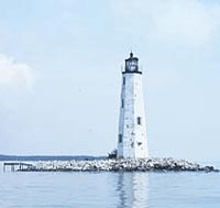
The New Point Comfort Lighthouse is located at the junction of Chesapeake Bay and Mobjack Bay. It was listed in 1973. Lighthouses are like guardians of the sea, helping ships navigate safely through the waters.
Wolf Trap Light Station: Another Guiding Light
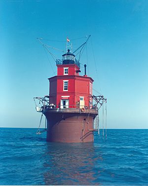
Southeast of New Point Comfort is the Wolf Trap Light Station. This lighthouse joined the list in 2002. These structures are not just pretty; they are vital for maritime safety, especially in busy waterways.
A Look at a Former Listing
Sometimes, a place might be removed from the National Register. This can happen for different reasons, like if the building is no longer there or if it changes too much.
Donk's Theatre: A Stage for Memories
Donk's Theatre in Hudgins was once on the National Register, listed in 2011. However, it was removed from the list in 2017. Even though it's no longer listed, it still holds memories for many people who enjoyed shows there.


