
National Register of Historic Places listings in Montgomery County, New York facts for kids
Montgomery County, New York, is a special place with many buildings, sites, and areas that are important to history. These places are listed on something called the National Register of Historic Places. It's like a special list kept by the United States government to recognize and protect places that tell us about the past.
When a place is on this list, it means it's considered important for its history, architecture, or what happened there. It helps make sure these places are looked after so future generations can learn from them. In Montgomery County, you can find all sorts of interesting spots on this list, from old homes and churches to parts of famous canals.

Contents
What is the National Register of Historic Places?
The National Register of Historic Places is the official list of the nation's historic places worth saving. It's part of a program to coordinate and support public and private efforts to identify, evaluate, and protect America's historic and archaeological resources. Being on the list helps people understand the importance of these places. It also means they get special consideration when big projects are planned that might affect them.
Historic Buildings and Homes
Montgomery County has many old buildings and homes that are on the National Register. These places often show us how people lived and worked long ago.
Homes with Stories
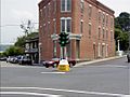
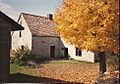
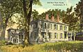
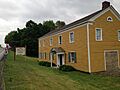
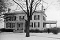
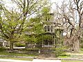
Many houses on the list are named after the families who built them or lived there for a long time. For example, the Bates-Englehardt Mansion in St. Johnsville is a beautiful old home. The Bragdon-Lipe House in Canajoharie and the Frey House in Palatine Bridge are other examples of historic homes. These houses often have unique architectural styles from different time periods.
Important Public Buildings
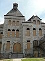
Some public buildings are also recognized for their history. The Amsterdam City Hall is one such place. It's where important decisions for the city have been made for many years. Old post offices, like the ones in Amsterdam, Canajoharie, Fort Plain, and St. Johnsville, are also on the list. They remind us of how communication and community services used to work.
Schools and Churches
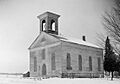
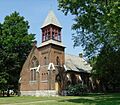
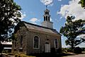
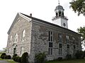
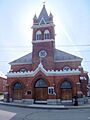
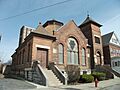
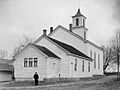
Schools and churches often play a big role in a community's history. The Ames Academy Building was once a place of learning. The First Baptist Church in Charleston and the First Methodist Episcopal Church of St. Johnsville are examples of historic churches. The Palatine Church and the Reformed Dutch Church of Stone Arabia are also very old and important. These buildings show us how communities grew and how people gathered for education and worship.
Canals and Waterways
Montgomery County is famous for its connection to the Erie Canal. This waterway changed transportation and trade in New York and the United States.
The Historic Erie Canal
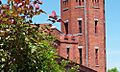
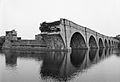
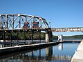
The Erie Canal itself is a National Historic Landmark. This means it's considered one of the most important historic places in the entire country! You can still see parts of the old canal, like the ruins of the aqueduct over Schoharie Creek near Fort Hunter. This aqueduct was like a bridge for the canal, carrying boats over the river.
The New York State Barge Canal
Later, a newer canal system, the New York State Barge Canal, was built. This system also runs through Montgomery County and is also a National Historic Landmark. It was designed to be bigger and better for modern boats, helping New York stay a leader in trade. These canals are a huge part of the county's history and how goods moved across the state.
Historic Districts
Sometimes, it's not just one building that's important, but a whole area or group of buildings. These are called "historic districts."
Villages with History
The Canajoharie Historic District includes many streets and buildings that show the history of this Mohawk Valley village. The Fort Plain Historic District and the Glen Historic District are other examples. These districts help preserve the look and feel of old towns, so you can imagine what life was like there long ago.
Other Notable Places
Beyond buildings and canals, other unique sites in Montgomery County are recognized for their historical value.
Ancient Village Sites
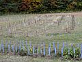
The Caughnawaga Indian Village Site near Fonda is a very important archaeological site. It tells us about the Native American communities that lived in this area long before European settlers arrived.
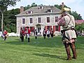
Old Forts and Farms
Fort Johnson and Fort Klock are two other National Historic Landmarks in the county. These forts played important roles in early American history. Many old farms, like the Caspar Getman Farmstead and the Samuel and Johanna Jones Farm, are also on the list. They show us the agricultural roots of the region.
Montgomery County's National Register listings offer a fascinating look into the past. Each place has a story to tell, helping us understand the rich history of this part of New York.
Images for kids
-
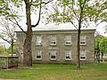
Ames Academy Building
-
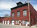
Amsterdam (46th Separate Company) Armory
-
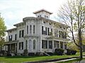
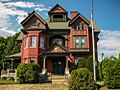
Bates-Englehardt Mansion
-
Bragdon-Lipe House
-
Canajoharie Historic District
-
Caughnawaga Indian Village Site
-
Chalmers Knitting Mills
-
Erie Canal (Schoharie Crossing State Historic Site)
-
First Baptist Church (Charleston, New York)
-
First Methodist Episcopal Church of St. Johnsville
-
Fort Johnson
-
Fort Klock
-
Fort Plain Historic District
-
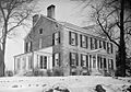
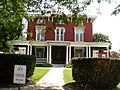
Frey House
-
Glen Historic District
-
Greene Mansion
-
Guy Park
-
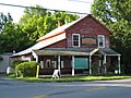
Nellis Tavern
-

Nelliston Historic District
-
New York State Barge Canal
-
Palatine Church
-
Reformed Dutch Church of Stone Arabia
-
Saint Stanislaus Roman Catholic Church Complex
-
Temple of Israel
-
Trinity Lutheran Church and Cemetery
-
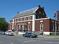
US Post Office-Amsterdam
-
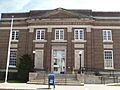
US Post Office-Fort Plain
-
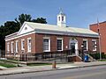
US Post Office-St. Johnsville
-
Van Alstyne House
-
Webster Wagner House
-
West Hill School


.jpg)


,_Palatine_Bridge_(Montgomery_County,_New_York).jpg)


.jpg)


.jpg)


.jpg)


