National Register of Historic Places listings in Nome Census Area, Alaska facts for kids
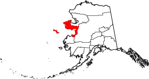
Have you ever wondered about places that are super important to history? In the Nome Census Area of Alaska, there are many such spots! These special places are listed on something called the National Register of Historic Places. It's like a hall of fame for buildings, areas, and sites that tell us a lot about the past.
This list helps us learn about the history of the Nome area, from exciting gold rushes to ancient villages and important buildings. There are 20 places on this list, and three of them are even bigger deals, called National Historic Landmarks. One place used to be on the list but isn't anymore. Let's explore some of these amazing historical treasures!
What is the National Register of Historic Places?
The National Register of Historic Places is the official list of the United States' historic places worth saving. It's managed by the National Park Service. When a place is added to this list, it means it's important for its history, architecture, archaeology, engineering, or culture.
Being on the list helps protect these places. It also makes people more aware of their value. Many different kinds of places can be listed, like old houses, schools, battlefields, or even entire neighborhoods. Each one has a unique story to tell about America's past.
Cool Historic Sites You Can Find
The Nome Census Area is full of history, especially from the exciting days of the gold rush. But there are also places that show us about earlier times and other important events.
Gold Rush Discoveries
The search for gold brought many people to Alaska. Several places on the list are connected to this exciting time.
Anvil Creek Gold Discovery Site
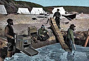
This is where the big gold rush in Nome really started! It's located about 4.25 miles north of Nome, near Anvil Creek. Imagine the excitement when gold was first found here in 1898! This discovery quickly led to thousands of people rushing to the area, hoping to strike it rich.
Cape Nome Mining District Discovery Sites
This area includes the Nome beach and other spots along Anvil Creek. It's where the first major gold discoveries were made in the Nome region. These finds kicked off the famous Nome Gold Rush. Thousands of prospectors arrived, turning Nome into a bustling boomtown almost overnight.
Cape Nome Roadhouse
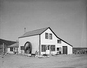
East of Nome, at mile 14 of the Nome-Council Highway, stands the Cape Nome Roadhouse. Roadhouses were like hotels and restaurants for travelers during the gold rush era. They offered a place to rest, eat, and get supplies in the harsh Alaskan wilderness. This roadhouse was a vital stop for miners and adventurers.
Council City and Solomon River Railroad
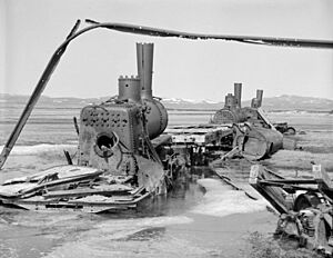
You can find parts of this old railroad at Mile 31 of the Nome-Council Highway, near Solomon. This railroad was built to help transport supplies and gold during the mining boom. Today, you can still see rusting parts of the locomotives, which are a cool reminder of how people moved things around back then.
Erik Lindblom Placer Claim
This site, north of Nome, is named after Erik Lindblom. He was one of the "Three Lucky Swedes" who made the first big gold discovery at Anvil Creek. His placer claim was an important part of the early gold mining efforts in the area.
Snow Creek Placer Claim No. 1
Located north of Nome at Snow Gulch, this was another significant gold mining claim. Placer mining involves separating gold from sand or gravel, often using water. This claim played a role in the extensive gold extraction that happened in the Nome region.
Solomon Roadhouse
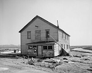
Another important stop for travelers was the Solomon Roadhouse, found along the Nome-Council Highway. Just like the Cape Nome Roadhouse, it provided essential services for people moving through the mining districts. It shows how important these rest stops were in the early 1900s.
Swanberg Dredge
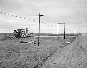
At Mile 1 of the Nome-Council Highway, you can see the Swanberg Dredge. A dredge is a large machine used to dig up riverbeds or land to find gold. This dredge is a great example of the heavy machinery used in later stages of the gold rush to extract more gold from the ground.
Important Buildings and Structures
Beyond gold, many buildings in the Nome Census Area tell stories about the communities that grew there.
Jacob Berger House
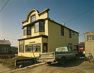
The Jacob Berger House is located on 1st Avenue in Nome. This house is a historic residence that gives us a glimpse into what life was like for people living in Nome during its early days.
Bureau of Indian Affairs Unalakleet School
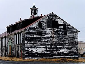
This old school is on the Unalakleet spit, at the mouth of the Unalakleet River. It was built by the Bureau of Indian Affairs. Schools like this were very important for educating children in remote Alaskan communities.
Discovery Saloon
At the corner of 1st and D Streets in Nome, you'll find the Discovery Saloon. Saloons were popular gathering places during the gold rush. They were where miners would relax, share stories, and spend their earnings. This saloon is a piece of that lively history.
Fort St. Michael
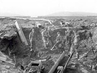
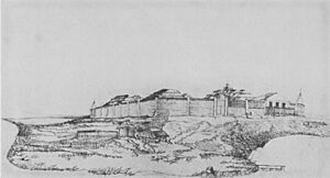
Located at St. Michael Bay, Fort St. Michael was an important military post. It played a role in the early history of Alaska, especially during the time when Russia sold Alaska to the United States. It was a key point for trade and defense.
Old St. Joseph's Catholic Church
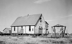
This beautiful old church is on Bering and Seppala Streets in Nome. It's a significant religious building that has served the community for many years. Its architecture and history reflect the growth and development of Nome as a town.
Teller Mission Orphanage
At the junction of Shelman Creek Road and Mission Street in Brevig Mission, you'll find the Teller Mission Orphanage. This site represents the efforts of missions to provide care and education for children in the region. It's a reminder of the social history of these communities.
Ancient Sites and Other Landmarks
Some places on the list are much older, showing us about the very first people who lived in Alaska. Others are unique landmarks.
Fairhaven Ditch
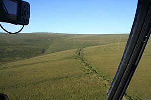
The Fairhaven Ditch is a long canal, about 38 miles long, located between Imuruk Lake and the north coast of the Seward Peninsula. It was dug to bring water to placer mining operations. This massive engineering project shows the determination of miners to get gold.
Gambell Sites
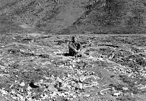
These sites are on St. Lawrence Island. They are very important archaeological locations. They contain evidence of ancient human settlements, giving scientists clues about how early people lived, hunted, and survived in this challenging environment.
Iyatayet Site
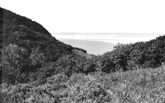
The Iyatayet Site is on the northwest shore of Cape Denbigh on Norton Bay. This is another incredibly important archaeological site. It has provided evidence of some of the earliest human presence in Alaska, showing how people migrated and lived thousands of years ago.
Norge Storage Site
On Front Street in Teller, there's a warehouse where parts of the airship Norge were stored. The Norge was a famous airship that flew over the North Pole in 1926. This site is a cool reminder of early Arctic exploration and aviation history.
Pilgrim Hot Springs
East of Teller on Kugarock Road, you'll find Pilgrim Hot Springs. Hot springs are natural pools of warm water that come from deep within the Earth. This site has been used by people for a long time, possibly for healing or relaxation.
St. Michael Redoubt Site
This site, located in St. Michael, was a redoubt, which is a type of small fort or defensive outpost. It played a role in the history of Russian America and the early American period in Alaska, helping to protect trade routes and settlements.
Wales Site
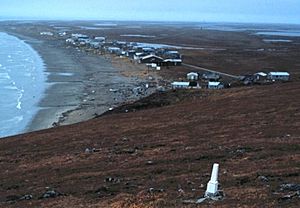
The Wales Sites are located in Wales, Alaska. These are significant archaeological sites that provide insights into the ancient cultures of the Bering Strait region. They show how people lived, hunted, and interacted with their environment in this unique part of the world.
What Happened to Some Places?
Sometimes, a place that was once on the National Register of Historic Places might be removed. This can happen if the place is destroyed, moved, or if it loses the historical qualities that made it special.
LT. C. V. DONALDSON
The ship LT. C. V. DONALDSON was once listed on the National Register. It was located at Belmont Point in Nome. However, it was removed from the list in 1990. This means it no longer met the criteria for being a protected historic place.


