
National Register of Historic Places listings in North and Northwest Baltimore facts for kids
The National Register of Historic Places is like a special list of important buildings, places, and neighborhoods across the United States. These places are chosen because they have a lot of history, beautiful architecture, or are important to how our country developed. When a place is on this list, it means it's recognized as a valuable part of our shared heritage and should be protected for future generations.
Baltimore, Maryland, is a city with a very long and interesting history. Because of this, many places in Baltimore are on the National Register. This list helps us remember and appreciate the stories and people who shaped Baltimore over the years. Even though Baltimore is a big city, it's actually separate from Baltimore County, which surrounds it. Think of it like a special independent city!
Contents
What is the National Register of Historic Places?
The National Register of Historic Places is the official list of places in the United States that are worth saving. These can be buildings, sites, objects, structures, or even whole neighborhoods. To get on the list, a place must be important because of its history, its design, or because it's connected to important people or events.
Being on the National Register doesn't mean a building can't be changed or sold. But it does encourage people to protect these special places. It also helps local groups get grants or tax benefits to help keep these historic sites in good shape. It's all about making sure we don't forget the past and can learn from it!
Exploring Baltimore's Historic Places
Baltimore has many amazing places on the National Register. These include old schools, grand homes, historic churches, and even entire neighborhoods that tell stories of different times. Let's take a look at some of them!
Historic Buildings and Homes
Many individual buildings in Baltimore are recognized for their unique history or architecture.
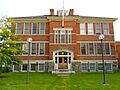
- Louisa May Alcott School: This school, named after the famous author, was listed in 1990. It's located in the Northwest part of the city.
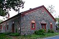
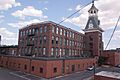
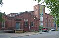
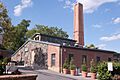
- American Ice Company Baltimore Plant No. 2: This building, listed in 2002, shows how ice was made and stored in the past, which was very important before refrigerators were common!
- Cedar Grove: Listed in 1996, this is a historic property in the North part of Baltimore.
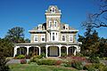
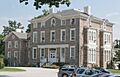
- Charlcote House: This beautiful house, listed in 1988, is another example of Baltimore's historic homes.
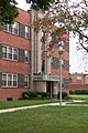
- Eastern High School: A significant school building listed in 2000, located in North Baltimore.
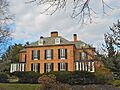
- Evergreen Museum & Library (Evergreen House): Listed in 1983, this grand estate is now a museum and library, showing what life was like in a wealthy Baltimore family's home.
- Evergreen on the Falls: Another historic "Evergreen" property, listed in 1975, located along Falls Road.
- First Church of Christ, Scientist: This church, listed in 1982, is recognized for its architectural style.
- Gallagher Mansion and Outbuilding: A historic mansion with its own smaller building, listed in 1983.
- Grace-Hampden Methodist Episcopal Church: This church, listed in 2001, is an important part of the Hampden neighborhood's history.
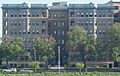
- Highfield House Condominium: A more modern building, listed in 2007, recognized for its architectural significance.
- Homewood Museum: Listed in 1971, this is a National Historic Landmark, meaning it's extra special! It's located on the Johns Hopkins University campus.
- James E. Hooper House: This historic house was listed in 1982.
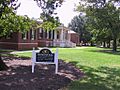
- Howard Park P.S. 218: An important school building in the Northwest area, listed in 2000.
- Lake Drive Apartments: These apartments, listed in 2001, are recognized for their design and history.
- Londontown Manufacturing Company, Inc.: This factory building, listed in 1973, tells a story about Baltimore's industrial past.
- Lovely Lane Methodist Church: Listed in 1973, this church is famous for its unique architecture and historical importance to Methodism in America.
- Elmer V. McCollum House: This house, listed in 1976, is a National Historic Landmark. Elmer V. McCollum was a famous scientist who discovered important vitamins.
- H.F. Miller & Son Tin Box and Can Manufacturing Plant: Listed in 2003, this factory shows Baltimore's history in manufacturing.
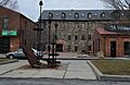
- Mount Vernon Mill No. 1: This old mill, listed in 2001, is a reminder of Baltimore's textile industry.
- Northern District Police Station: This historic police station building was listed in 2001.
- Riviera Apartments: Another apartment building recognized for its history, listed in 1999.
- Ruscombe: A historic property listed in 2007.
- St. John's Protestant Episcopal Church: This church, listed in 1974, is known for its beautiful design.
- Samester Parkway Apartments: Listed in 1998, these apartments are in the Northwest part of the city.
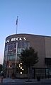
- Senator Theatre: This famous movie theater, listed in 1989, is a beloved landmark in Baltimore.
- Stieff Silver Company Factory: Listed in 2000, this factory made beautiful silver items.
- Tivoli: A historic mansion listed in 1980.
Historic Neighborhoods and Districts
Sometimes, a whole area or neighborhood is important enough to be on the National Register. These are called "historic districts."
- Auchentoroly Terrace Historic District: This neighborhood was listed in 2015.
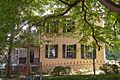
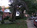
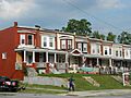
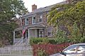
- Bellona-Gittings Historic District: Listed in 2008, this district includes several streets and avenues.
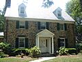
- Brick Hill: This historic district was listed in 1988.
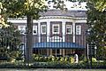
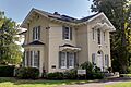
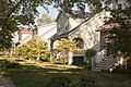
- Cedarcroft Historic District: Listed in 2003, this area is known for its historic homes.
- Charles Village-Abell Historic District: This large and well-known historic district was listed in 1983. It includes the Charles Village and Abell neighborhoods.
- Cylburn House and Park District: Listed in 1972, this district includes the beautiful Cylburn Arboretum.
- Dickeyville Historic District: This unique historic village area was listed in 1972.
- Druid Hill Park Historic District: One of Baltimore's largest and most famous parks, listed in 1973.
- Ednor Gardens Historic District: This neighborhood was listed in 2004.
- Greater Homeland Historic District: A large historic residential area listed in 2001.
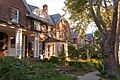
- Guilford Historic District: This elegant neighborhood, known for its grand homes, was listed in 2001.
- Hampden Historic District: This lively neighborhood, known for its unique character, was listed in 2004.
- Hochschild, Kohn Belvedere and Hess Shoes: This district, listed in 2003, includes historic commercial buildings.
- Lake-Evesham Historic District: Another historic neighborhood listed in 2003.
- Lake Roland Historic District: This park area was listed in 1992.
- Mount Washington Mill Historic District: This area, listed in 1990, includes historic mill buildings.
- Northwood Historic District: This neighborhood was listed in 1998.
- Oakenshawe Historic District: Listed in 2003, this district is known for its historic homes.
- Old Goucher College Buildings: This district, listed in 1978, includes the historic buildings of the former Goucher College campus.
- Park Circle Historic District: This neighborhood was listed in 2008.
- Poole and Hunt Company Buildings: These industrial buildings were listed in 1973.
- Radnor-Winston Historic District: This neighborhood, near the College of Notre Dame, was listed in 2003.
- Remington Historic District: This historic neighborhood was added to the list in 2017.
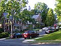
- Roland Park Historic District: One of Baltimore's earliest planned communities, listed in 1974, known for its beautiful homes and design.
- Stone Hill Historic District: This historic mill village area was listed in 2001.
- Tuscany-Canterbury Historic District: This neighborhood, near Johns Hopkins University, was listed in 2001.
- Waverly Main Street Historic District: This commercial and residential area was listed in 2013.
- Woodberry Historic District: This historic mill village was listed in 2003.
Other Notable Listings
- Lombard Street Bridge: This historic bridge was listed in 1972, though it was later taken apart and stored.
These are just some of the many amazing places in Baltimore that are recognized for their importance. Each one helps tell the story of the city and why it's such a special place!
Images for kids
-
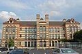
Louisa May Alcott School
-
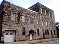
American Ice Company Baltimore Plant No. 2
-
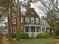
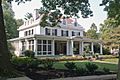
A home in the Bellona-Gittings Historic District
-
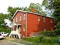
Homes in the Brick Hill Historic District
-
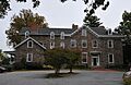
Cedar Grove
-
A home in the Cedarcroft Historic District
-
Charlcote House
-
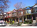
A street in the Charles Village-Abell Historic District
-
Cylburn Mansion in Cylburn Arboretum
-
An old mill in the Dickeyville Historic District
-
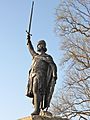
A statue in Druid Hill Park
-
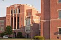
Eastern High School
-
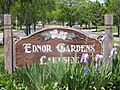
A home in the Ednor Gardens Historic District
-

Evergreen House
-
Evergreen on the Falls
-
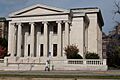
First Church of Christ, Scientist
-
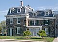
Gallagher Mansion
-
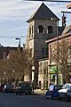
Grace-Hampden Methodist Episcopal Church
-
A house in the Greater Homeland Historic District
-
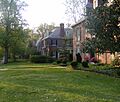
A home in the Guilford Historic District
-
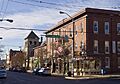
A street in the Hampden Historic District
-
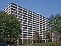
Highfield House Condominium
-
Hochschild, Kohn Belvedere and Hess Shoes
-
Homewood Museum
-
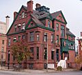
James E. Hooper House
-
Howard Park P.S. 218
-
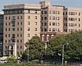
Lake Drive Apartments
-
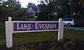
A home in the Lake-Evesham Historic District
-
Londontown Manufacturing Company, Inc.
-
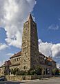
Lovely Lane Methodist Church
-

Elmer V. McCollum House
-
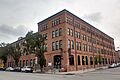
H.F. Miller & Son Tin Box and Can Manufacturing Plant
-
Mount Vernon Mill No. 1
-
Mount Washington Mill
-
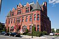
Northern District Police Station
-
A home in the Northwood Historic District
-
A building in the Oakenshawe Historic District
-
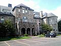
Old Goucher College Buildings
-
A street in the Park Circle Historic District
-
Poole and Hunt Company Buildings
-
A home in the Radnor-Winston Historic District
-
Riviera Apartments
-
A home in the Roland Park Historic District
-
Ruscombe
-
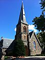
St. John's Protestant Episcopal Church
-
Samester Parkway Apartments
-
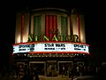
Senator Theatre
-
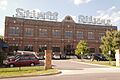
Stieff Silver Company Factory
-
A street in the Stone Hill Historic District
-
Tivoli
-
A home in the Tuscany-Canterbury Historic District
-

A street in the Waverly Main Street Historic District
-
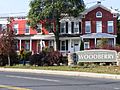
A building in the Woodberry Historic District


_1.jpg)


_01.JPG)


