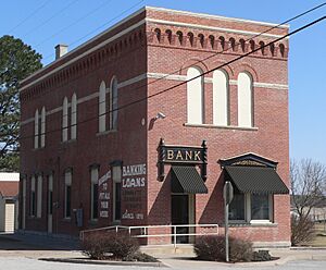
National Register of Historic Places listings in Pawnee County, Nebraska facts for kids
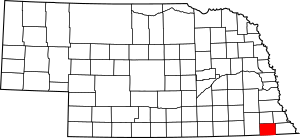
Welcome to Pawnee County, Nebraska! This page is all about the cool and historic places here that are listed on the National Register of Historic Places. Think of this register as a special list of buildings, areas, or objects that are important to American history and culture. When a place is on this list, it means it's worth protecting and remembering for future generations.
Pawnee County has 14 amazing places on this list right now. Two other places were once on the list but have since been removed. Let's explore some of these special spots!
What is the National Register of Historic Places?
The National Register of Historic Places is like a hall of fame for important historical sites in the United States. It's managed by the National Park Service. When a place gets listed, it means it has a special story to tell about our past. This could be about how people lived, what they built, or important events that happened there. Listing a place helps protect it and makes people more aware of its history.
Historic Places You Can Find in Pawnee County
Pawnee County is full of interesting history, and many of its special places are on the National Register. These sites include old houses, important business areas, and even places where people lived thousands of years ago!
Exploring Pawnee City's Historic Gems
Pawnee City, the county seat, has several places on the National Register. It's a town with a rich past!
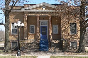
Pawnee City Carnegie Library
The Pawnee City Carnegie Library is a beautiful building located at 730 G Street. It was added to the National Register in 2010. This library is one of many "Carnegie Libraries" built across the country with money from a famous businessman named Andrew Carnegie. He believed in the power of reading and wanted everyone to have access to books.
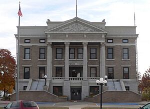
Pawnee County Courthouse
The Pawnee County Courthouse, found at 625 6th Street, became a historic site in 1990. Courthouses are often important buildings in a county. They are where local government decisions are made and where many important records are kept. This building shows the history of law and order in Pawnee County.
Pawnee City Historic Business District
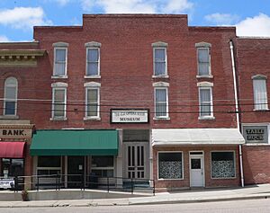
Imagine walking through an old town! The Pawnee City Historic Business District is a whole area, roughly bounded by 5th, 7th, F, and G Streets, that was listed in 1994. This district includes many buildings that show what the town looked like and how businesses operated long ago. It's a snapshot of the past!
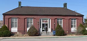
United States Post Office - Pawnee City
The US Post Office in Pawnee City, at 703 G Street, was added to the list in 1992. What makes this post office extra special is a mural inside called "The Auction." It was painted in 1942 by Kenneth Evett. Murals like this were often added to public buildings during the Great Depression to give artists work and to bring art to everyday places.
E. F. Hempstead House
The E. F. Hempstead House, located at 14th and H Street in Pawnee City, is another historic home. It was listed in 1982. Old houses like this can tell us a lot about how people lived and the styles of homes that were popular many years ago.
Rinne Farm
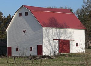
The Rinne Farm, at 71075 617 Avenue near Pawnee City, was added to the National Register in 2015. Farms are important parts of Nebraska's history, showing how people worked the land and provided food for communities. This farm helps us remember that agricultural heritage.
Historic Spots in Other Pawnee County Towns
Pawnee County has other towns with their own unique historic places.
Harold Lloyd Birthplace in Burchard
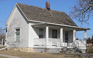
In Burchard, you can find the Harold Lloyd Birthplace, located at the corner of Pawnee and 4th Streets. This house was listed in 1993. Harold Lloyd was a very famous actor during the silent film era, known for his exciting stunts and comedies. This home marks where his amazing life story began!
Lindsley House in Table Rock
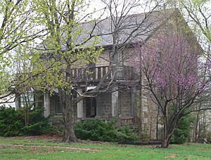
The Lindsley House, at 706 Luzerne Street in Table Rock, became a historic site in 1999. It's another example of a well-preserved home that tells a story about the town's past.
Table Rock Opera House
The Table Rock Opera House on Houston Street was listed in 1988. Opera houses weren't just for opera! They were often community centers where people gathered for plays, concerts, meetings, and other events. This building reminds us of how people entertained themselves in the past.
Table Rock Public Square Historic District
Similar to Pawnee City, Table Rock also has a historic district. The Table Rock Public Square Historic District, roughly bounded by Pennsylvania, Nebraska, Luzerne, and Houston Streets, was listed in 1994. This area shows the historic layout and buildings around the town's public square, which was often the heart of a community.
Steinauer Opera House
In Steinauer, you'll find the Steinauer Opera House at 215 Main Street. It was added to the National Register in 1988. Like the one in Table Rock, this opera house was a hub for community events and entertainment in Steinauer.
Ancient and Hidden Sites
Some historic places are not buildings you can visit easily. They might be archeological sites or places with restricted access to protect them.
Farwell Archeological District
The Farwell Archeological District near Du Bois was listed in 1997. Archeological sites are places where scientists study the remains of past human life, like tools, pottery, or old settlements. These sites help us learn about people who lived here long, long ago.
Rad Jan Kollar cis 101 Z.C.B.J.
Near Du Bois, there's also the Rad Jan Kollar cis 101 Z.C.B.J., listed in 1990. This name might sound a bit tricky! Z.C.B.J. stands for "Zapadni Cesko-Bratrska Jednota," which was a Czech-American fraternal organization. These groups helped immigrants and kept their cultural traditions alive. This site likely relates to their meeting hall or a place important to their community.
Table Rock Archeological Site
Another archeological site, the Table Rock Archeological Site, is located near Table Rock and was listed in 1974. Like the Farwell site, it holds clues about ancient cultures and how they lived in this area.
Places That Were Once Listed
Sometimes, a historic place might be removed from the National Register. This can happen if the building is changed too much, or if it is no longer standing.
Cincinnati Bridge
The Cincinnati Bridge near Du Bois was once listed in 1992 but was removed in 2015. It was an old bridge over the South Fork of the Big Nemaha River. Bridges are important for transportation and can be historic structures, but sometimes they are replaced or taken down.
Hotel Pawnee
The Hotel Pawnee in Pawnee City, located at 700 G Street, was listed in 1974 but later removed. This hotel was demolished, meaning it was torn down. When a historic building is no longer there, it cannot remain on the National Register.
Images for kids


