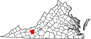
National Register of Historic Places listings in Pulaski County, Virginia facts for kids
Welcome to Pulaski County, Virginia! This area is full of interesting places that tell stories about the past. Many of these special spots are listed on the National Register of Historic Places. This means they are officially recognized as important parts of American history and culture.
This article will introduce you to some of these amazing historic buildings and areas in Pulaski County. You'll learn about places where people lived, worked, and gathered long ago. There are 23 places currently on the list, and one used to be listed but isn't anymore. Let's explore these cool historical treasures!
What is the National Register of Historic Places?
The National Register of Historic Places (often called NRHP) is the official list of places in the United States that are important for their history, architecture, archaeology, engineering, or culture. It's like a special hall of fame for buildings, sites, districts, objects, and structures that have played a big role in American history.
When a place is added to the NRHP, it means it's worth protecting and preserving for future generations. It helps people understand and appreciate the past. These places might be old homes, churches, schools, bridges, or even whole neighborhoods!
Exploring Historic Places in Pulaski County
Pulaski County has many fascinating places on the National Register. Each one has its own unique story. Here are some of them:
Historic Homes and Farms
- Back Creek Farm: This historic farm near Dublin was added to the list in 1975. It shows what farming life was like in the past.
- Belle-Hampton: Another historic spot near Dublin, listed in 1989. It's a great example of old architecture.
- John Hoge House: Located near Belspring, this house was recognized in 1988. It's named after an important person from the area's history.
- Haven B. Howe House: This house, listed in 2008, is found on State Park Road near Dublin. It's a beautiful example of older homes in the region.
- Rockwood: This historic manor house in Dublin was added to the Register in 2005. It's a grand old building with a lot of history.
- Spring Dale: North of Dublin, this historic property was listed in 2003. It gives us a glimpse into the past of the area.
Important Public Buildings and Sites
- Calfee Athletic Field: Located in Pulaski, this sports field was listed in 2000. It's a place where many community events and games have happened over the years.
- Dalton Theatre Building: This old theatre building on Washington Avenue in Pulaski was added to the list in 1979. Imagine all the shows and movies people watched there!
- Fairview District Home: Near Dublin, this site was recognized in 1997. It was an important community building.
- Ingles Ferry: This historic ferry site near Radford was listed way back in 1969. Ferries were crucial for crossing rivers before bridges were common.
- New Dublin Presbyterian Church: This church near Dublin was listed in 2004. Churches often serve as important centers for communities for many years.
- Pulaski County Courthouse: The main courthouse in Pulaski, listed in 1982, is a significant building where local laws and decisions are made.
Historic Districts (Whole Neighborhoods!)
Sometimes, not just one building, but a whole area or neighborhood is considered historic. These are called "historic districts."
- Dublin Historic District: A large part of Dublin, including Giles Avenue and Church Street, was listed in 1992. This district shows how the town grew over time.
- Newbern Historic District: The village of Newbern has its own historic district, recognized in 1979. It's like stepping back in time when you walk through it.
- Pulaski Historic Commercial District: This area in downtown Pulaski, listed in 1986, includes many old shops and businesses. It shows what the town's main street looked like.
- Pulaski Historic Residential District: A large residential area in Pulaski was added to the list in 1988. It has many old homes that tell stories about the people who lived there.
- Pulaski South Historic Residential and Industrial District: This district in Pulaski, listed in 1991, shows a mix of old homes and industrial buildings. It highlights the town's growth.
- Snowville Historic District: The small community of Snowville also has a historic district, recognized in 1987. It's a charming area with a lot of character.
- Snowville Christian Church: This church within the Snowville Historic District was separately listed in 1987.
A Look at Former Historic Sites
Sometimes, a place that was once on the National Register of Historic Places might be removed. This usually happens if the building is changed too much, or if it's unfortunately torn down.
- Nathaniel Burwell Harvey House: This house near Dublin was listed in 1986. However, it was removed from the list in 2001 because it was demolished. It's a reminder that we need to protect our historic places.
Images for kids


