
National Register of Historic Places listings in Queens, New York facts for kids

This page is about the National Register of Historic Places in Queens, New York. It lists special places in Queens, New York City, that are important because of their history, architecture, or what happened there. These places are officially recognized by the United States government. When a building or area is on this list, it means it's worth protecting and learning about for future generations.
Queens is one of the five parts, or boroughs, of New York City. It's a very diverse place with a rich history. Many buildings and areas in Queens tell stories about how people lived, worked, and built communities over many years.
Contents
What is the National Register of Historic Places?
The National Register of Historic Places is like a special list of important buildings, sites, and areas across the United States. It's managed by the National Park Service. When a place is added to this list, it means it has been carefully studied and found to be very important to American history or culture.
Being on the list helps protect these places. It can also help owners get special grants or tax breaks to help keep the buildings in good shape. Some of these places are even more special and are called National Historic Landmarks. These are the most important historic places in the entire country!
Cool Historic Places in Queens
Queens has many amazing places on the National Register. Let's explore some of them!
World's Fair Wonders
Queens was home to two famous World's Fairs, in 1939 and 1964. Some buildings from these fairs are still standing and are now historic sites.
- The New York State Pavilion from the 1964-1965 World's Fair is a huge, unique structure in Flushing Meadows–Corona Park. It looks like something from the future, with its tall towers and a giant map of New York on the ground.
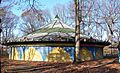
- The Flushing Meadows Carousel is another fun reminder of the 1964-1965 World's Fair. It's made from parts of two old carousels from Coney Island and is one of the few rides left from the fair.
Famous Homes and Important Buildings
Many homes of famous people or buildings that played a big role in history are on the list.
- The Louis Armstrong House in Corona was the home of the legendary jazz musician Louis Armstrong. You can visit it and see how he lived! It's a National Historic Landmark.
- The John Bowne House in Flushing is one of the oldest houses in New York City. It's important because John Bowne stood up for religious freedom way back in the 1600s.
- The Ralph Bunche House in Kew Gardens was the home of Ralph Bunche, a very important diplomat who won the Nobel Peace Prize. This is also a National Historic Landmark.
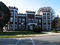
- King Manor in Jamaica was the home of Rufus King, one of the people who signed the United States Constitution. It's another National Historic Landmark in Queens.
- The Steinway Mansion in Astoria was built by the famous Steinway piano-making family. It's a beautiful old house that tells the story of this important family.
Historic Churches and Synagogues
Many places of worship in Queens are recognized for their history and beautiful architecture.
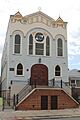
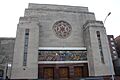
- The Astoria Center of Israel is a historic synagogue in Astoria.
- The Old Quaker Meetinghouse in Flushing is a very old building where Quakers met for worship. It's a National Historic Landmark and shows the long history of religious freedom in Queens.
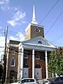
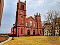
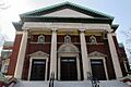
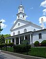
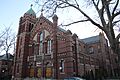
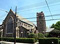
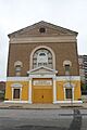
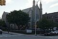
- The First Presbyterian Church of Newtown in Elmhurst is a lovely brick and stone church built in 1873.
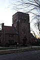
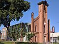
- The First Reformed Church of College Point is a rare example of an old wooden church building in Queens, built in 1872.
Old Schools and Public Buildings
Some schools and government buildings are also on the list.
- Flushing High School is an old and important school building in Flushing.
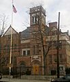
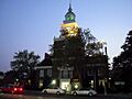
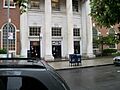
- Flushing Town Hall was built in 1862 and is now a center for arts and culture.
- The Long Island City Courthouse Complex is an impressive building where legal matters were handled.
- Many United States Post Offices across Queens, like those in Far Rockaway, Flushing, and Jamaica, are recognized for their architecture and role in the community.
Transportation History
Queens has played a big part in transportation history.
- The Queensboro Bridge connects Queens to Manhattan. It's a huge, famous bridge that was built a long time ago.
- The Marine Air Terminal at LaGuardia Airport is a beautiful old airport building. It was once used for seaplanes that flew across oceans!
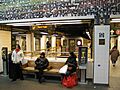
- Several subway stations, like 45th Road – Court House Square Station and Elmhurst Avenue Subway Station, are on the list because they are important parts of New York City's subway history.
- The Long Island Motor Parkway was one of the first roads built just for cars in the United States. Parts of it still exist in Queens.
Historic Districts
Sometimes, it's not just one building but a whole area that is historic. These are called "historic districts." They often have many old homes or buildings that show how a neighborhood grew over time.
- Jackson Heights Historic District is famous for its garden apartments and beautiful buildings.
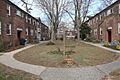
- Sunnyside Gardens Historic District is another special neighborhood known for its planned community design and green spaces.
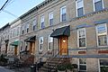
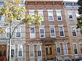
- Many historic districts in Ridgewood, like the Central Ridgewood Historic District and Cypress Avenue East Historic District, show off the unique brick rowhouses of that area.
- The Far Rockaway Beach Bungalow Historic District includes small beach houses that have survived for many years, even through big storms like Superstorm Sandy.
Cemeteries and Parks
Even cemeteries and parts of parks can be historic.
- Beth Olam Cemetery and Evergreens Cemetery are old cemeteries with beautiful monuments and art.
- Maple Grove Cemetery in Kew Gardens is another historic burial ground.
- The Old Town of Flushing Burial Ground is a 19th-century graveyard where many African-American and Native American residents were laid to rest.
- The Forest Park Carousel is a beloved ride in Forest Park.
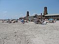
- Fort Tilden Historic District and Jacob Riis Park Historic District are parts of parks that have important military or recreational history.
This list shows just how many special places there are in Queens that tell the story of its past!
Images for kids
-
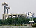
The New York State Pavilion in Flushing Meadows–Corona Park
-
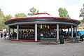
The Flushing Meadows Carousel
-
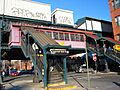
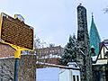
45th Road – Court House Square Subway Station
-
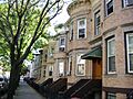
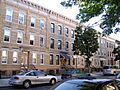
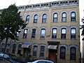
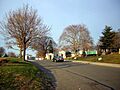
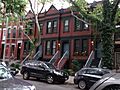
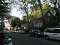
A street in the 68th Avenue-64th Place Historic District
-
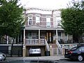
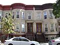
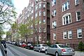
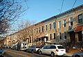
Brick rowhouses in the 75th Avenue-61st Street Historic District
-
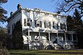
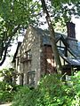
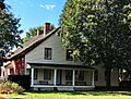
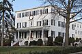
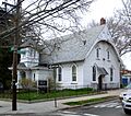
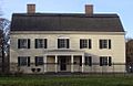
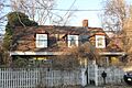
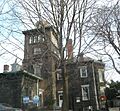
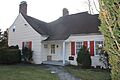
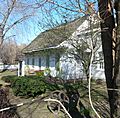
The Allen-Beville House
-
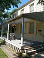
The Louis Armstrong House
-
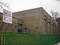
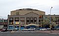
The Astoria Center of Israel
-
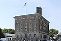
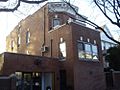
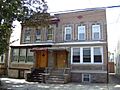
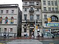
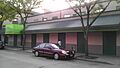
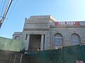
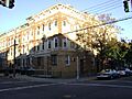
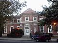
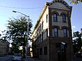
Benevolent and Protective Order of Elks, Lodge #878
-
Beth Olam Cemetery
-
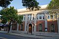
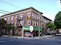
Bohemian Hall and Park
-
The John Bowne House
-
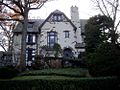
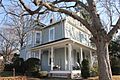
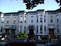
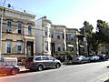
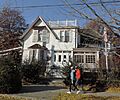
A house in the Broadway-Flushing Historic District
-
The Ralph Bunche House
-
A street in the Central Avenue Historic District
-
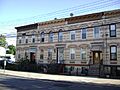
A street in the Central Ridgewood Historic District
-
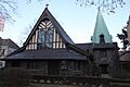
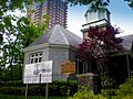
The Church-in-the-Gardens
-
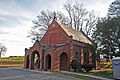
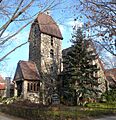
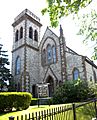
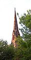
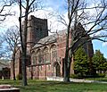
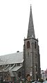
The Church of the Resurrection
-
Congregation Tifereth Israel
-
A building in the Cooper Avenue Row Historic District
-
A street in the Cornelia-Putnam Historic District
-
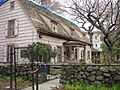
The Cornell Farmhouse
-
A street in the Cypress Avenue East Historic District
-
A street in the Cypress Avenue West Historic District
-
A building in the Douglaston Hill Historic District
-
A building in the Douglaston Historic District
-
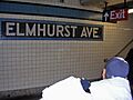
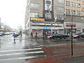
Elmhurst Avenue Subway Station
-
Evergreens Cemetery
-
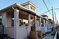
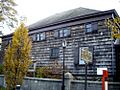
Bungalows in the Far Rockaway Beach Bungalow Historic District
-
Firemen's Hall
-
First Presbyterian Church of Newtown
-
First Reformed Church (Jamaica)
-
First Reformed Church of College Point
-
Flushing Armory
-
Flushing High School
-
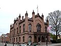
Flushing Town Hall
-
Forest Park Carousel
-
A street in the Forest-Norman Historic District
-
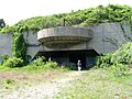
Fort Tilden Historic District
-
Fort Totten Officers' Club
-
Free Synagogue of Flushing
-
A street in the Fresh Pond-Traffic Historic District
-
Grace Episcopal Church Complex
-
A street in the Grove-Linden-St. John's Historic District
-
A street in the Hunters Point Historic District
-
A building in the Jackson Heights Historic District
-
Jacob Riis Park Historic District
-
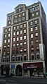
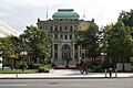
Jamaica Chamber of Commerce Building
-
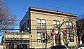
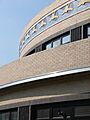
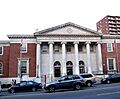
Jamaica Savings Bank
-
King Manor
-
Kingsland Homestead
-
J. Kurtz and Sons Store Building
-
La Casina
-
Lent Homestead and Cemetery
-
Long Island City Courthouse Complex
-
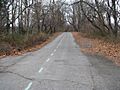
The Long Island Motor Parkway
-
A street in the Madison-Putnam-60th Place Historic District
-
Main Street Subway Station
-
Maple Grove Cemetery
-
Marine Air Terminal
-
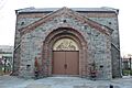
Office of the Register
-
Old Quaker Meetinghouse
-
Old Town of Flushing Burial Ground
-
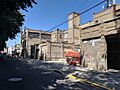
Paramount Studios Complex (now Kaufman Astoria Studios)
-
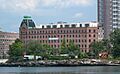
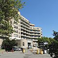
Parkway Village
-
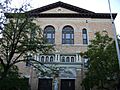
Poppenhusen Institute
-
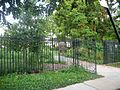
Prospect Cemetery
-
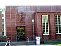
Public School 66
-
Queens County Savings Bank
-
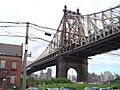
Queensboro Bridge
-
Reformed Church of Newtown Complex
-
Rego Park Jewish Center
-
A building in the Richmond Hill Historic District
-
RKO Keith's Theater
-
Rockaway Courthouse
-
Russell Sage Memorial Church
-
Saint Benedict Joseph Labre Parish
-
St. George's Church
-
St. James Church, Elmhurst
-
St. Luke's Episcopal Church
-
St. Matthew's Episcopal Church
-
St. Matthias Roman Catholic Church Complex
-
St. Monica's Church
-
A street in the Seneca Avenue East Historic District
-
A street in the Seneca-Onderdonk-Woodward Historic District
-
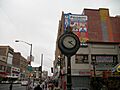
Sidewalk Clock at 161-11 Jamaica Avenue
-
Sohmer and Company Piano Factory
-
Spear and Company Factory
-
Steinway Mansion
-
A street in the Stockholm-DeKalb-Hart Historic District
-
A street in the Summerfield Street Row Historic District
-
A street in the Sunnyside Gardens Historic District
-
Temple of Israel Synagogue
-
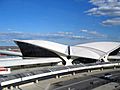
Trans World Airlines Flight Center
-
Triboro Hospital for Tuberculosis
-
Trinity Chapel
-
Trinity Lutheran Church
-
US Post Office-Far Rockaway
-
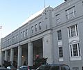
US Post Office-Flushing Main
-
US Post Office-Forest Hills Station
-
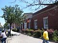
US Post Office-Jackson Heights Station
-
US Post Office-Jamaica Main
-
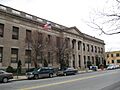
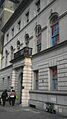
US Post Office-Long Island City
-
Cornelius Van Wyck House
-
Vander Ende-Onderdonk House Site
-
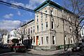
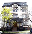
Conrad Voelcker House (Voelker Orth Museum)
-
A street in the Woodbine-Palmetto-Gates Historic District
-
Wyckoff-Snediker Family Cemetery marker


.jpg)


_1.jpg)


_20180215.jpg)


.jpg)


_1.jpg)


.jpg)
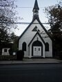
_Episcopal_Church,_Woodhaven_jeh.jpg)

_20180930_ded.1856_02.jpg)


_Street_Clock.JPG)


_08.jpg)
See also
 In Spanish: Anexo:Registro Nacional de Lugares Históricos en Queens para niños
