National Register of Historic Places listings in Rappahannock County, Virginia facts for kids
Imagine a special list of important places in America! The National Register of Historic Places (NRHP) is like a hall of fame for buildings, sites, and districts that have played a big part in history. These places are recognized for their unique stories and how they connect us to the past.
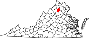
Rappahannock County, Virginia, has many such amazing places. There are 19 historic spots in the county on this list. One of these is even more special, called a National Historic Landmark. This means it's super important to the history of the entire United States!
Historic Homes and Farms
Many of the places on the National Register in Rappahannock County are old homes and farms. These buildings tell us a lot about how people lived long ago.
Ben Venue and Its Surroundings
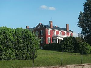
Ben Venue is a historic home located northeast of Washington, Virginia. It was added to the National Register in 1979. This beautiful house stands as a reminder of the past.
Close by is the Ben Venue Rural Historic District. This district includes not just one house, but a whole area with many historic farms and landscapes. It helps us see how the land was used and how communities grew over time. It was added to the list in 2016.
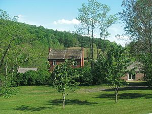
Another interesting farm is Caledonia Farm, near Flint Hill. This farm was recognized in 1990. It shows us how farming life was in earlier centuries.
Other Notable Homes
The George L. Carder House in Castleton is another important historic home. It was listed in 2004. This house, along with its other buildings, gives us a peek into daily life from long ago.
In Amissville, you can find the Locust Grove-R.E. Luttrell Farmstead. This farm was added to the list in 2013. It's a great example of a traditional farmstead.
Also in Amissville is Meadow Grove Farm, listed in 2006. This farm shows how important agriculture was to the area's history.
The John W. Miller House near Boston was added in 1991. It's another example of the historic homes that dot the Rappahannock landscape.
Montpelier, located south of Sperryville, is a historic property listed in 1973. It has a long history and is a significant part of the county's heritage.
Sunnyside in Washington, Virginia, was added to the Register in 2004. This historic property adds to the rich collection of old homes in the area.
Community Buildings and Districts
Besides homes, the National Register also includes buildings and areas that were important to the community.
Historic Mills and Churches
The Calvert Mill/Washington Mill is an old mill located east of Washington, Virginia. Mills were very important long ago for grinding grain. This one was listed in 1982.
Flint Hill Baptist Church in Flint Hill was added to the Register in 1997. Churches often served as important centers for communities.
The Mount Salem Baptist Meetinghouse, southeast of Washington, is another historic church. It was listed in 1979 and shows the religious history of the area.
Schools and Historic Districts
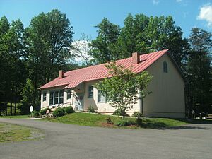
The Scrabble School in Castleton is a special place because it was once a school. It was listed in 2007. Imagine what it was like to learn here many years ago!
Several areas in Rappahannock County are recognized as Historic Districts. This means that a whole group of buildings and the way they are arranged tell a story together.
- The Flint Hill Historic District (listed 2012) includes the main parts of the town of Flint Hill.
- The Laurel Mills Historic District (listed 2004) focuses on the historic area around Laurel Mills.
- The Sperryville Historic District (listed 1983) covers the historic core of Sperryville.
- The Washington Historic District (listed 1975) includes important streets and buildings in Washington, Virginia. These districts help preserve the unique look and feel of these towns.
Skyline Drive: A National Historic Landmark
One of the most famous listings in Rappahannock County is part of the Skyline Drive Historic District. This amazing road runs through Shenandoah National Park. It's not just a road; it's a National Historic Landmark! This means it's considered extremely important to the history of the entire United States. It was listed in 1997. Skyline Drive offers incredible views and was built in a special way to blend with nature.
These historic places in Rappahannock County help us understand the past and protect important parts of our heritage for the future.
Images for kids


