
National Register of Historic Places listings in San Joaquin County, California facts for kids

Have you ever wondered about the old buildings in your town? Many of them have amazing stories! In San Joaquin County, California, there are 36 special places that are listed on the National Register of Historic Places. This means they are important parts of history that deserve to be protected. These places include old banks, theaters, schools, and homes. They help us remember what life was like long ago and how our communities grew. Let's explore some of these cool historic spots!
Contents
Historic Buildings in San Joaquin County
San Joaquin County is home to many buildings that tell tales of the past. These places were chosen for the National Register because they are important to the history, architecture, or culture of the area.
Banks and Business Buildings
Many old banks and business buildings are on the list. They show how important trade and money were to the growth of towns like Stockton and Tracy.
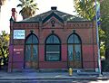
Bank of Italy (Tracy)
The Bank of Italy in Tracy was built in 1919. It's a beautiful building that shows the style of architecture from that time. Banks were very important for people to save money and for businesses to grow. This bank helped Tracy become a busy town.
Commercial and Savings Bank (Stockton)
In Stockton, the Commercial and Savings Bank is another historic financial building. It was built in 1924. Imagine people coming here to do their banking business almost 100 years ago! It shows how Stockton was a center for business in the region.
Sperry Union Flour Mill (Stockton)
The Sperry Union Flour Mill is a big building that reminds us of Stockton's industrial past. Built in 1923, this mill processed grain into flour. It was a vital part of feeding the community and beyond. It shows how important agriculture and industry were to the area.
Places for Community and Entertainment
Historic buildings weren't just for business. Many were built for people to gather, learn, and have fun.
Fox California Theater (Stockton)
The Fox California Theater in Stockton opened in 1930. It was a grand movie palace where people went to watch films and enjoy live shows. Think about how exciting it must have been to see a movie here when it was brand new! It's a great example of the fancy theaters from that era.
El Dorado Elementary School (Stockton)
The El Dorado Elementary School, built in 1926, is a historic school building in Stockton. It was a place where many generations of children learned and grew. Today, it's used as the Stockton School for Adults, continuing its role in education.
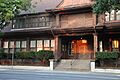
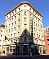
Hotel Stockton
The Hotel Stockton, built in 1910, was once a very fancy place for travelers and important events. Hotels like this were central to city life. People would stay here when visiting, and locals would hold meetings and parties. It shows the elegance of travel and social life long ago.
Lodi Arch
The Lodi Arch, built in 1907, is a famous landmark in Lodi. It's a beautiful archway that welcomes people to the city. It was originally built to celebrate the grape harvest, which is still a big part of Lodi's identity. It's a symbol of the town's history and pride.
Historic Homes and Other Unique Sites
Some historic listings are homes of important people or unique community buildings.
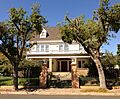
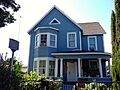
Benjamin Holt House (Stockton)
The Benjamin Holt House was built in 1904. Benjamin Holt was a very important inventor from Stockton. He invented the first successful track-type tractor, which changed farming forever! His house is a reminder of his amazing contributions.
Tracy City Hall and Jail
The Tracy City Hall and Jail building, built in 1908, housed the local government and its jail. This building shows how towns organized themselves and provided services to their citizens in the early 20th century. It's a piece of local government history.
Nippon Hospital (Stockton)
The Nippon Hospital, built in 1915, served the Japanese-American community in Stockton. It's an important reminder of the diverse groups of people who helped build San Joaquin County. It shows how communities created their own services and support systems.
Images for kids
-
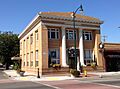
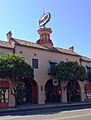
The Bank of Tracy, another historic bank building.
-
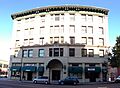
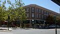
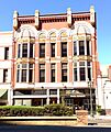
The Elks Building in Stockton.
-
The Farmer's and Merchant's Bank in Stockton.
-
The Wong K. Gew Mansion.
-
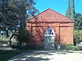
Harmony Grove Church in Lockeford.
-
Hotel Lodi, a historic hotel.
-
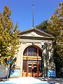
The I.O.O.F. Hall in Woodbridge.
-
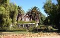
The John Ohm House.
-
The Philomathean Clubhouse.
-
The Moses Rodgers House.
-
The Sperry Office Building.
-
The Stockton Savings and Loan Society Bank.
-
The Tracy Inn.
-
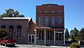
The Tretheway Block.
-
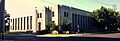
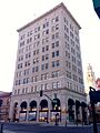
The U.S. Post Office in Stockton.
-
The West Side Bank in Tracy.
-
The Woman's Club of Lodi.
-
The Woodbridge Masonic Lodge No. 131.


.jpg)

.JPG)


.jpg)
