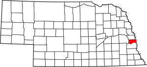
National Register of Historic Places listings in Sarpy County, Nebraska facts for kids
Sarpy County, Nebraska, is home to many important places that tell us about the past. These special spots are listed on the National Register of Historic Places. This is a list kept by the United States government to recognize buildings, sites, and objects that are important in American history, architecture, archaeology, engineering, or culture.
There are 20 places in Sarpy County that are currently on this special list. Two other places were once listed but have since been removed. Let's explore some of these amazing historic sites!
Contents
Historic Buildings and Homes
Many of the places on the National Register are old buildings and houses. They show us how people lived and worked long ago.
Important Houses
- William E. Gordon House: This house in Bellevue was added to the list in 2006. It's a great example of homes from its time.
- William Hamilton House: Also in Bellevue, this house from 1969 gives us a peek into past living styles.
- McCarty-Lilley House: Located west of Bellevue, this house was recognized in 1978.
- John Sautter Farmhouse: Found in Papillion, this farmhouse from 1980 shows us what farm life was like.
- Zweibel Farmstead: This farmstead in Papillion was added in 2000. It helps us understand farming history.
Community Buildings
- Fontenelle Bank: This old bank building in Bellevue, listed in 1969, reminds us of early businesses.
- Old Log Cabin: In Bellevue, this log cabin from 1970 is a simple but important reminder of early settlements.
- Presbyterian Church: This church in Bellevue, listed in 1970, shows the history of faith and community.
- Springfield Community Hall: This hall in Springfield, added in 1998, was a central place for town gatherings.
- Third Sarpy County Courthouse: Located in Papillion, this courthouse from 1990 is where important decisions were made for the county.
Historic Districts and Sites
Some places on the list are not just single buildings, but whole areas or special sites.
Military and Natural Areas
- Fontenelle Forest Historic District: This beautiful forest in Bellevue, listed in 1974, is important for both its nature and its history. It's a great place to explore.
- Fort Crook Historic District: This area on Offutt Air Force Base in Bellevue, recognized in 1976, has a rich military history. It played a big role in protecting the country.
Archaeological Sites
Archaeological sites are places where scientists find clues about people who lived long, long ago.
- Champe-Fremont 1 Archeological Site: Near Gretna, this site from 1975 helps us learn about ancient cultures.
- Kurz Omaha Village: This site near Papillion, listed in 1973, tells us about the Omaha people who lived here.
- Moses Merrill Mission and Oto Indian Village: Near La Platte, this site from 1972 is important for understanding early missions and Native American life.
- Patterson Site: This site near South Bend, added in 2007, also holds secrets about ancient communities.
- Peter A. Sarpy Trading Post Site: This site near Bellevue, listed in 1975, was once a busy place where people traded goods.
Other Notable Listings
- Big Papillion Creek Bridge: This bridge near La Vista, listed in 1992, is an example of historic engineering. It shows how bridges were built in the past.
- Blacksmith Shop: Located on Offutt Air Force Base in Bellevue, this shop from 1978 reminds us of the important work of blacksmiths.
- Linoma Beach: This beach near Gretna, added in 2003, was a popular spot for recreation and fun.
Former Listing
Sometimes, a place is removed from the National Register. This can happen if it is moved or changed too much.
- Burlington Depot: This old train station in Bellevue was listed in 1970 but removed in 1987. It was moved to the Sarpy County Museum Grounds.


