
National Register of Historic Places listings in Sonoma County, California facts for kids

Welcome to Sonoma County, California! This area is full of amazing places that tell stories about the past. Many of these special spots are listed on the National Register of Historic Places. This is like a special list kept by the United States government. It helps protect buildings, sites, and objects that are important to American history, architecture, archaeology, engineering, or culture.
Imagine finding a old house where a famous scientist lived, or a fort from long ago! When a place is on this list, it means it's recognized as a valuable part of our heritage. It helps make sure these places are preserved for future generations, so you and your friends can learn from them too!
Sonoma County has 72 places on this list, including 6 that are extra special and called National Historic Landmarks. These landmarks are considered important to the entire country!
Contents
Exploring Sonoma County's Historic Treasures
Let's discover some of the cool historic places you can find in Sonoma County. Each one has a unique story!
Homes of Famous People
Luther Burbank Home and Gardens

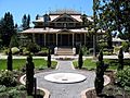
In Santa Rosa, you can visit the home and gardens of Luther Burbank. He was a super famous plant scientist who created many new kinds of fruits, vegetables, and flowers. He lived here and did much of his amazing work. It's a National Historic Landmark because his contributions changed how we grow food and plants!
Jack London Ranch

Near Glen Ellen, you'll find the Jack London Ranch, which is now part of a state park. Jack London was a very famous writer, known for adventure stories like The Call of the Wild and White Fang. This ranch was his home and inspiration. It's also a National Historic Landmark, showing how important his life and work were.
Old Buildings and Businesses
Buena Vista Winery

The Buena Vista Winery in Sonoma is one of California's oldest wineries. It was founded in 1857! This place shows the early history of winemaking in the state. It's a great example of how businesses from long ago helped shape the area.
Free Public Library of Petaluma

In Petaluma, the Free Public Library building is a historic spot. Many towns received money from Andrew Carnegie, a wealthy businessman, to build libraries. These "Carnegie Libraries" were important because they helped spread knowledge and reading to everyone. This building is a reminder of that important time.
Old Petaluma Opera House

The Old Petaluma Opera House was once a lively place for shows and performances in Petaluma. It reminds us of how people entertained themselves before movies and TV. Historic buildings like this help us imagine what life was like in the past.
Sonoma County Museum (Old Post Office)

The building that now houses the Sonoma County Museum in Santa Rosa was once the Old Post Office. Post offices were very important centers for communication in communities. This building now continues to serve the community by preserving and sharing local history.
Important Historical Sites
Fort Ross

Fort Ross is a very special place north of Fort Ross on Highway 1. It was a Russian settlement from 1812 to 1841! It was a trading post and agricultural center. This site is a National Historic Landmark because it shows a unique part of California's early history, long before it became part of the United States. You can see old buildings and learn about the people who lived there.
Rancho Petaluma Adobe

East of Petaluma, you'll find the Rancho Petaluma Adobe. This was a huge ranch house built during the Mexican period of California's history. It was part of a large land grant and shows how early settlers lived and worked. It's a National Historic Landmark, representing an important time before California became a U.S. state.
Sonoma Plaza

The Sonoma Plaza is right in the center of Sonoma. It's one of the largest town squares in California and has a rich history. It was the site of the Bear Flag Revolt in 1846, which was a key event leading to California becoming part of the U.S. Today, it's a beautiful park surrounded by historic buildings. It's a National Historic Landmark District, meaning the whole area is protected for its historical importance.
Other Interesting Places
Condominium 1

At Sea Ranch, a community along the coast, you'll find Condominium 1. This building is special because of its unique design. It's an example of modern architecture that blends with the natural landscape. It shows that historic places aren't just old buildings, but also important examples of design and art.
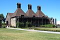
De Turk Round Barn

The De Turk Round Barn in Santa Rosa is a very cool and unusual building. Round barns were sometimes built because people thought they were stronger or more efficient. This one is a great example of this unique architectural style and the history of farming in the area.
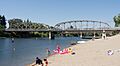
Guerneville Bridge

The Guerneville Bridge crosses the Russian River. Bridges are important for connecting communities and allowing people and goods to travel. This bridge is recognized for its engineering and its role in the local area's development.
SS POMONA (Shipwreck)

Off the coast near Fort Ross, there's a shipwreck called the SS POMONA. Shipwrecks are like underwater time capsules! They can tell us a lot about maritime history, trade, and the challenges of sea travel long ago. This site is protected as a historic place, even though it's underwater.
Watson School

The Watson School in Bodega is a historic school building. Schools are central to communities and represent the history of education. This building reminds us of how children learned in the past and the importance of schools in shaping society.
Images for kids
-
Bodega Bay, a historic district.
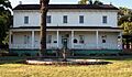
-
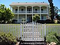
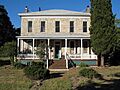
The Nicholas Carriger Estate, home of an early settler.
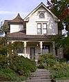
-
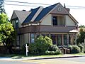
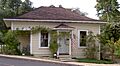
The Cnopius House in Santa Rosa.
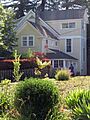
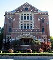
-
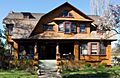
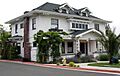
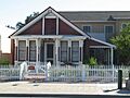
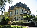
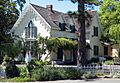
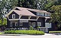
The Comstock House in Santa Rosa.
-
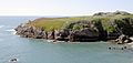
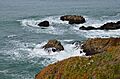
Duncan's Landing Site, an archaeological area.
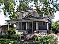
-
The Ellis-Martin House in Petaluma.
-
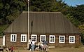
The Fort Ross Commander's House, also known as Rotchev House.
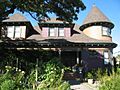
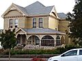
-
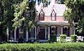
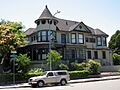
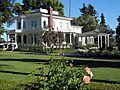
The Gables, a historic home in Santa Rosa.
-
Glen Oaks Ranch, a historic district.
-
Luther Burbank's Gold Ridge Experiment Farm.
-
The Gould-Shaw House in Cloverdale.
-
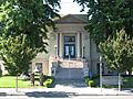
The Healdsburg Carnegie Library, now a museum.
-
The Healdsburg Memorial Bridge.
-
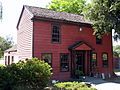
The Hicks House in Graton.
-
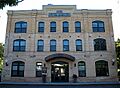
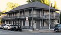
The Hinds Hotel in Freestone.
-
The William Hood House in Santa Rosa.
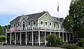
-
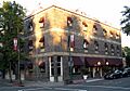
The Hotel Chauvet in Glen Ellen.
-
The Hotel La Rose in Santa Rosa.
-
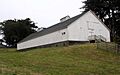
The Knipp and Stengel Ranch Barn at Sea Ranch.
-
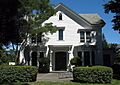
The James H. and Frances E. Laughlin House in Windsor.
-
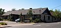
The Llano Road Roadhouse in Sebastopol.
-
The W. H. Lumsden House in Santa Rosa.
-
Madrona Manor in Healdsburg.
-
The McDonald Mansion in Santa Rosa.
-
Orange Lawn in Sonoma.
-
The Park Apartments in Santa Rosa.
-
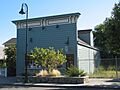
The Petaluma and Santa Rosa Railway Powerhouse.
-
The Petaluma Historic Commercial District.
-
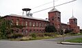
The Petaluma Silk Mill.
-
The Simon Pinschower House in Cloverdale.
-
The Railroad Square District in Santa Rosa.
-
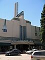
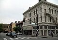
Rosenberg's Department Store in Santa Rosa.
-
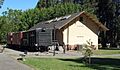
The Sebastopol Depot of the Petaluma and Santa Rosa Railway.
-
The Isaac E. Shaw Building in Cloverdale.
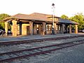
-
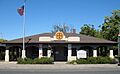
The Sonoma Depot.
-
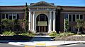
The Sonoma Grammar School.
-
The Sonoma State Home-Main Building, also known as Sonoma Developmental Center.
-
The George A. Strout House in Sebastopol.
-
The Philip Sweed House in Petaluma.
-
The Sweet House in Santa Rosa.
-
Temelec Hall in Temelec.
-
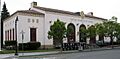
The US Post Office-Petaluma.
-
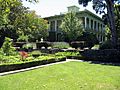
The Vallejo Estate in Sonoma.
-
Walters Ranch in Healdsburg.
-
The Wasserman House in Santa Rosa.


.jpg)


.jpg)


