Oxly, Missouri facts for kids
Quick facts for kids
Oxly, Missouri
|
|
|---|---|

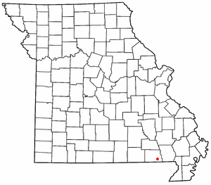
Location of Oxly in Missouri
|
|
| Country | United States |
| State | Missouri |
| County | Ripley |
| Elevation | 400 ft (100 m) |
| FIPS code | 29-55694 |
| GNIS feature ID | 2587099 |
Oxly is a small community in southeastern Ripley County, Missouri, in the United States. It is a "census-designated place," which means it's an area identified by the U.S. Census Bureau for collecting statistics. It is not an officially incorporated town.
Oxly is located on Logan Creek. You can find it along Missouri Route 142, about seven miles east of the town of Doniphan. A post office has been serving the community of Oxly since the year 1900. The community was named after F. G. Oxley, who was a businessperson involved in the local lumber industry.
Oxly's Climate and Weather
The climate in Oxly is known for its relatively high temperatures. It also has rain spread out evenly throughout the year. This type of weather is called a "Humid Subtropical Climate." This is based on the Köppen Climate Classification system, which helps scientists categorize different climates around the world.
| Climate data for Oxly, Missouri | |||||||||||||
|---|---|---|---|---|---|---|---|---|---|---|---|---|---|
| Month | Jan | Feb | Mar | Apr | May | Jun | Jul | Aug | Sep | Oct | Nov | Dec | Year |
| Mean daily maximum °C (°F) | 8 (46) |
11 (51) |
16 (61) |
22 (72) |
27 (80) |
31 (88) |
33 (92) |
33 (91) |
29 (84) |
23 (73) |
16 (60) |
9 (48) |
21 (70) |
| Mean daily minimum °C (°F) | −6 (21) |
−4 (25) |
1 (33) |
6 (42) |
11 (52) |
16 (61) |
18 (65) |
17 (63) |
13 (55) |
6 (42) |
0 (32) |
−4 (24) |
6 (43) |
| Average precipitation mm (inches) | 91 (3.6) |
86 (3.4) |
120 (4.6) |
120 (4.9) |
120 (4.9) |
99 (3.9) |
99 (3.9) |
94 (3.7) |
99 (3.9) |
84 (3.3) |
100 (4.1) |
71 (2.8) |
1,200 (48) |
| Source: Weatherbase | |||||||||||||
See also
 In Spanish: Oxly (Misuri) para niños

