Panabá facts for kids
Quick facts for kids
Panabá
|
|
|---|---|
|
Municipal Seat
|
|
| Country | |
| State | Yucatán |
| Municipality | Panabá |
| Area | |
| • Total | 1.91 km2 (0.74 sq mi) |
| Elevation | 19 m (62 ft) |
| Population
(2010)
|
|
| • Total | 5,232 |
| Time zone | UTC-6 (Central Standard Time) |
| • Summer (DST) | UTC-5 (Central Daylight Time) |
| Postal code (of seat) |
96710
|
| Area code(s) | 986 |
| INEGI code | 310570001 |
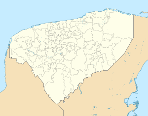
Panabá is a town located in the state of Yucatán, Mexico. It is the main town, also known as the municipal seat, of the Panabá Municipality. This means it's where the local government for the surrounding area is located.
About Panabá
Panabá is a small town in the northern part of Yucatán. It is an important center for the Panabá Municipality. The town helps manage the services and activities for the people living in the municipality.
Location and Geography
Panabá is found at coordinates 21°17′47″N 88°16′14″W. It sits about 19 meters (62 feet) above sea level. The town covers an area of about 1.91 square kilometers.
Population Details
According to information from 2010, the town of Panabá had a population of 5,232 people. This number helps us understand the size of the community.
Time Zone Information
Panabá follows the North American Central Time Zone. This means during standard time, it is UTC-6. During daylight saving time, it shifts to UTC-5.
See also
 In Spanish: Panabá para niños


