Pedregoso, Zacatecas facts for kids
Quick facts for kids
Pedregoso
|
|
|---|---|
|
Town
|
|

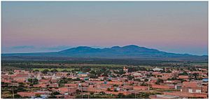
Panoramic view of Pedregoso
|
|
| Country | |
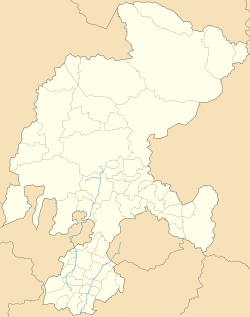
| State | Zacatecas |
| Municipality | Pinos |
| Elevation | 2,188 m (7,178 ft) |
| Population
(2010)
|
|
| • Total | 2,629 |
| Postal code |
98959
|
Pedregoso is a town located in the Pinos Municipality within the State of Zacatecas, Mexico. Its name means "Stony" in Spanish, which might describe the local landscape. This town is an important part of the Pinos area.
Pedregoso is about 135 kilometers (84 miles) southeast of Zacatecas City. It's also 86.5 kilometers (53.7 miles) from Aguascalientes City and 118 kilometers (73 miles) from San Luis Potosí City. The town is quite close to Pinos, only 25 kilometers (15.5 miles) away.
People Living in Pedregoso
According to the 2010 Mexico census, Pedregoso has a population of 2,629 people. This makes it the second-largest town in the Pinos Municipality. Pedregoso and Pinos are the only two main urban centers in the area.
Learn More
 For more information in Spanish, check out the Kiddle encyclopedia: Pedregoso (Zacatecas) para niños

All content from Kiddle encyclopedia articles (including the article images and facts) can be freely used under Attribution-ShareAlike license, unless stated otherwise. Cite this article:
Pedregoso, Zacatecas Facts for Kids. Kiddle Encyclopedia.


